- Utah State Route 269
Infobox road
state=UT
type=SR
route=269
alternate_name=500 South, 600 South
section=132
maint=UDOT 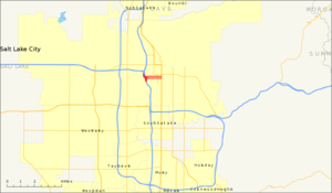
length_mi=0.904
length_round=3
length_ref=cite web | title=State Route 269 Highway reference | publisher=Utah Department of Transportation | url=http://www.dot.utah.gov/main/uconowner.gf?n=7150717025800821 ]
established=1960
direction_a=West
terminus_a=jct|state=UT|I|15|I|80 in Salt Lake City
direction_b=East
terminus_b=jct|state=UT|US|89 in Salt Lake City
previous_type=SR
previous_route=268
next_type=SR
next_route=270
commons=category
customcommons=Utah State Route 269State Route 269 (SR-269) is a
state highway in the U.S. state ofUtah that sits completely within Salt Lake City in Salt Lake County. It consists entirely of aone-way pair of 500 South and 600 South, two parallelone-way street s that connect I-15 and I-80 todowntown Salt Lake City . SR-269 was designated in 1960 and constructed later that decade, coinciding with the construction of I-15 in the area.Prior to 2000, SR-269 began and ended with
viaduct s that were longer than they are now. From the western terminus, the viaduct extended from I-15/I-80 to 200 West, two blocks east of where the viaduct ends presently. The other segment's viaduct began at 300 West (also two blocks east of where it begins now) and extended to I-15/I-80. As a part of I-15's reconstruction and then-Salt Lake City MayorDeedee Corradini 's Gateway project, the viaducts were drastically shortened.cite web | title=Utah Highway Pages, 261-280 (268 and 269) | publisher=Stober, Dan | url=http://members.aol.com/utahhwys/261-280.htm Rs|date=June 2008] cite web | title=Transportation - May 2004 | publisher=McGraw-Hill Construction | url=http://intermountain.construction.com/features/archive/0405_cover.asp | accessdate=2008-07-01] cite web | title=EPA Region 8 – Gateway/500 West Park Blocks Project, Salt Lake City, Utah | publisher=The Center For Brownfields Initiatives | url=http://www.brownfields.com/Feature/Feature-Awards2003-region8.htm | accessdate=2008-07-01]The route connects the city center with the freeway. As the settlers of Utah laid their towns with amply wide streets, one-way streets are rare in the city, SR-269 being one of two such pairs in existence. As part of I-15's construction in the 1960s, planners felt that two one-way streets with many lanes leading to and from the freeway would be better utilized. The
Salt Lake City and County Building is located at the route's junction with US-89.cite web | title=Salt Lake City Historic Sites | publisher=State of Utah| url=http://www.utah.com/saltlake/historic_salt_lake.htm ]Route description
SR-269 has two separate segments that lay a block apart, both one-way streets; the eastbound segment is known as 600 South (officially Martin Luther King Jr. Boulevard), while the westbound segment is named 500 South (officially Cesar E. Chavez Boulevard).
The highway begins its eastbound stint from two exits from eastbound I-80 and northbound I-15. The two ramps join together to form five eastbound lanes on a viaduct west of 600 West along 600 South. It reaches grade-level at 400 West and enters downtown. Past 200 West, the road loses one lane. The highway continues east three blocks before state maintenance ends at US-89 (State Street). The westbound section begins at US-89 and heads west on four lanes along 500 South. After intersecting with SR-270 (West Temple), one lane is gained; a block further east at 200 West, the road widens with one additional lane. After 500 West, the highway elevates to above grade-level with four lanes and dips southwest before two lanes default onto southbound I-15/eastbound I-80 and the two other lanes default onto westbound I-80.cite web | title=Google Maps | publisher=
Google | url=http://maps.google.com ]History
As I-15 was being constructed through the
Wasatch Front , the State Road Commission designated three routes—SR-268, SR-269, and SR-270—in 1960 as direct connections into Salt Lake City's downtown.Utah Department of Transportation , [http://www.udot.utah.gov/main/f?p=100:pg:5285268476414239680:::1:T,V:1348, Highway Resolutions] : PDFlink|1= [http://www.udot.utah.gov/main/uconowner.gf?n=200609201357501 Route 269] |2=620 KB, updated November 2007, accessed May 2008] ) in 1969.As Salt Lake City won the bid for the
2002 Winter Olympics in1995 , I-15 was reconstructed. As part of the reconstruction, SR-268 and SR-269's viaducts into the city were set to be reconstructed and shortened. Mayor Corradini wanted to revitalize an industrial portion of Salt Lake City with her Gateway project. A part of her project included demolishing the almost mile-long viaducts of SR-269, as she felt a freeway bridge passing over the area she was trying to revitalize would be a hindrance to the project. The pair of viaducts were demolished in late-1998 –early-1999 , replaced with much shorter viaducts in2000 .Major intersections
The entire route is located in Salt Lake City, Salt Lake County.cite web | title=Wasatch Front Inset Map | publisher=
Utah Department of Transportation | url=http://www.udot.utah.gov/main/f?p=100:pg:2117854713443240831::::V,T:,346 ] :"Note:milepost s are measured from west to east on the eastbound side and east to west on the westbound side. Both figures are given in the table."References

Wikimedia Foundation. 2010.