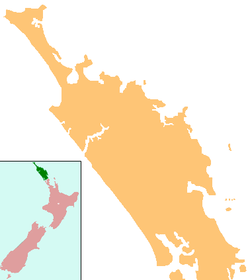
Motatau

Motatau
Motatau
Motatau is located in Northland
Motatau
Coordinates: 35°29′25″S 174°2′7″E / 35.49028°S 174.03528°E / -35.49028; 174.03528Coordinates: 35°29′25″S 174°2′7″E / 35.49028°S 174.03528°E / -35.49028; 174.03528
Country New Zealand
Region Northland Region
District Far North District

Motatau is a locality in the Northland Region of the North Island of New Zealand. Maromaku is to the east. The Taikirau Stream flows from east through Motatau and then runs northwest to join the Waiharakeke Stream..[1][2]

The name means "to speak to oneself" in Māori.[3]

Education

Motatau School is a decile 3 coeducational primary school serving years 1-8. It has a roll of 28.[4]

References

  1. ^ Peter Dowling (editor) (2004). Reed New Zealand Atlas. Reed Books. pp. map 5. ISBN 0-7900-0952-8. 
  2. ^ Roger Smith, GeographX (2005). The Geographic Atlas of New Zealand. Robbie Burton. pp. maps 24. ISBN 1-877333-20-4. 
  3. ^ "Te Arawa explorers". Te Ara Encyclopedia of New Zealand. http://www.teara.govt.nz/TheBush/UnderstandingTheNaturalWorld/NgaWaewaeTapuMaoriExploration/5/en. 
  4. ^ "Te Kete Ipurangi". Ministry of Education. http://www.tki.org.nz/e/schools/display_school_info.php?school_id=1053. 

Wikimedia Foundation. 2010.

Игры ⚽ Нужно сделать НИР?

Look at other dictionaries:

  • List of towns in New Zealand — This is a list of towns in New Zealand. The term town has no current statutory meaning in New Zealand, the few Town Districts having been abolished in 1989 or earlier. No particular size minimum has been adopted. Many would be called villages in… …   Wikipedia

  • Papatoetoe Intermediate — Infobox NZ school name = Papatoetoe Intermediate badge = motto = whaka pokai tara type = State: Not integrated Co Ed (Year 7 8) established = 1953 address = Motatau Road, Papatoetoe, Auckland principal = Dr Brian Hinchco roll = 970 decile = 3 MOE …   Wikipedia

  • North Auckland Line — Overview Type commuter rail, rail freight System New Zealand Government Railways Department Status Operational Locale …   Wikipedia

  • Northland Rugby Union — Northland Rugby Football Union Nickname(s) Taniwha, Cambridge Blues Founded 1920 Region Northland Ground(s) Okara Park, Whangar …   Wikipedia

  • Kusza Coat of Arms — Infobox PolishCoA herb=Kusza battlecry=NE CEDE ARDIUS (Yield Not Unto Difficulties) alternative=NIEZAPOMINAJKA (Forget Me Not) mention=More than 60 Golden Books families=Herb Wlasny (PERSONAL ARMS) SUBRITZKY (Polish spelling Kusza Zubrzycki)… …   Wikipedia

  • North Auckland Line — Westfield–Opua Streckenlänge: 284,13 km Spurweite: 1067 mm (Kapspur) Legende …   Deutsch Wikipedia

Share the article and excerpts

Direct link
Do a right-click on the link above
and select “Copy Link”