Monroe Point, Colonial Beach, Virginia
- Monroe Point, Colonial Beach, Virginia
-
Coordinates: 38°15′8″N 76°58′38″W / 38.25222°N 76.97722°W / 38.25222; -76.97722
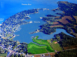
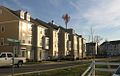
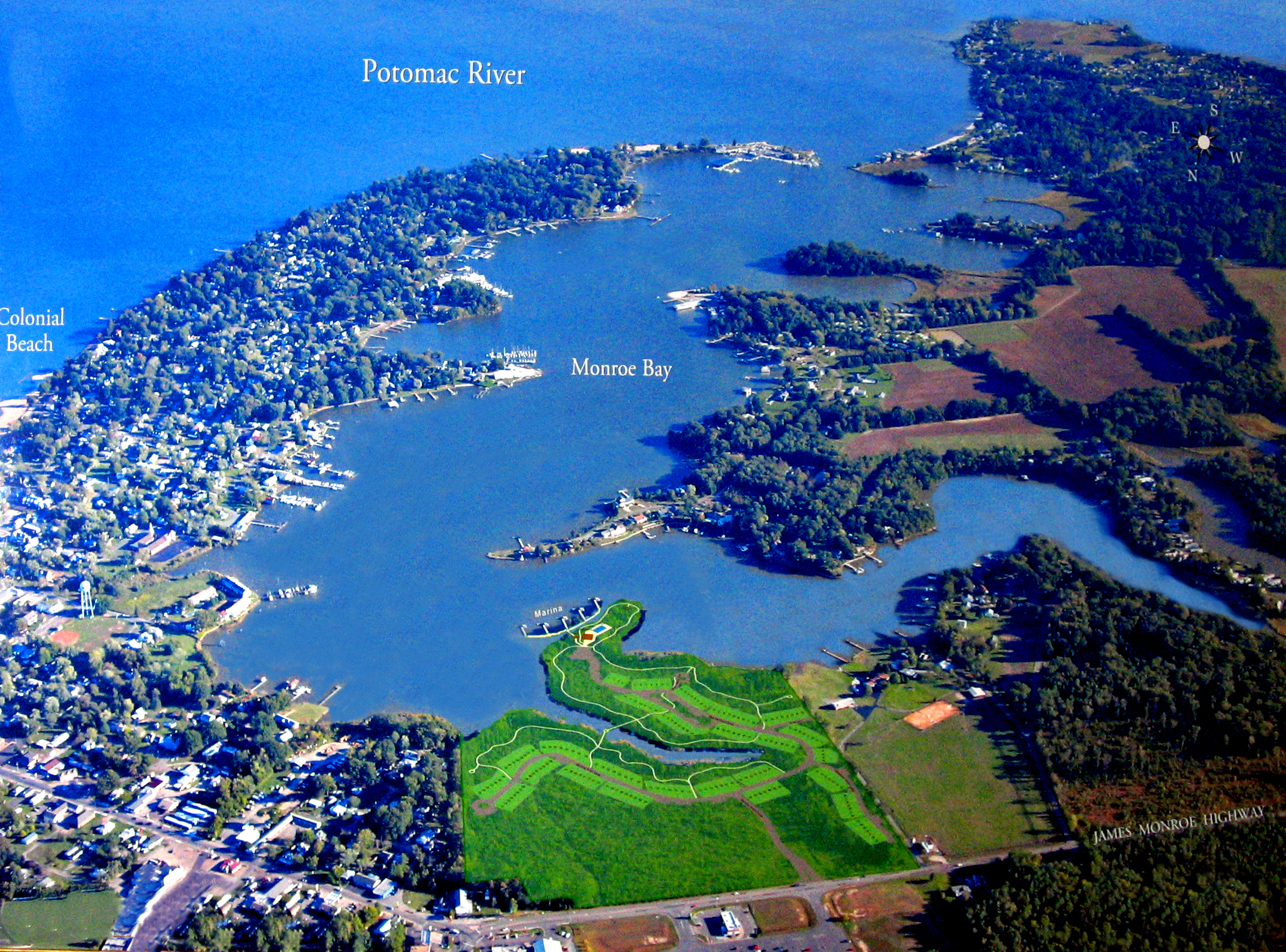
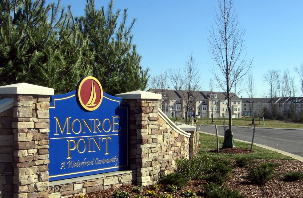
Monroe Point is an upscale waterfront community located on State Road 205 in Colonial Beach on Virginia’s historic Northern Neck. Located in a natural setting on the quiet upper portion of Monroe Bay, when complete, Monroe Point will be a mixed use community of more than 300 waterfront townhomes and waterfront condominiums. The community features a marina, a clubhouse, a pool and a one mile long nature trail.
In the town of Colonial Beach, the Potomac River is 6 miles wide, offering dramatic water views and boating opportunities comparable to the Chesapeake Bay. Monroe Point offers easy access to the river.
Monroe Point is located 60 miles south of Washington, D.C., 25 miles east of Fredericksburg, Virginia and 60 miles north of Richmond, Virginia. As of November, 2010 more than seventy townhomes had been constructed. Despite the slump in the housing market, new homes are under construction in this beautiful yet undiscovered waterfront community.
http://www.monroepoint.net Monroe Point Web Site
http://www.jlbuildersva.com JL Builders Web Site [1]
References
\
\\\\\
Categories:
- Geography of Westmoreland County, Virginia
- Buildings and structures in Westmoreland County, Virginia
- Waterfronts
- Piers in Virginia
- Marinas in the United States
- Communities
Wikimedia Foundation.
2010.
Look at other dictionaries:
Colonial Beach, Virginia — Town Pier and Riverboat Off Track Betting, Restaurant, and Lounge … Wikipedia
Monroe Point — may refer to: Monroe Point, Colonial Beach, Virginia Monroe Point, South Shetland Islands This disambiguation page lists articles about distinct geographical locations with the same name. If an internal lin … Wikipedia
Monroe Bay — is a protected body of water in Colonial Beach, Virginia that connects at its south end to the Potomac River which is more than six miles wide in Colonial Beach. The bay is approximately two miles long and one third mile wide and features… … Wikipedia
Narrow Beach, Virginia — Narrow Beach is an unincorporated community in Westmoreland County, in the U. S. state of Virginia. References GNIS entry … Wikipedia
Virginia — /veuhr jin yeuh/, n. 1. a state in the E United States, on the Atlantic coast: part of the historical South. 5,346,279; 40,815 sq. mi. (105,710 sq. km). Cap.: Richmond. Abbr.: VA (for use with zip code), Va. 2. a town in NE Minnesota. 11,056. 3.… … Universalium
Monroe Hall, Virginia — Roadside scene in Monroe Hall Highway running through Monroe Hall … Wikipedia
Colonial Williamsburg — Williamsburg Historic District U.S. National Register of Historic Places U.S. National Historic Landmark District … Wikipedia
Virginia Commonwealth University — VCU redirects here. For other uses, see VCU (disambiguation). Virginia Commonwealth University Virginia Commonwealth University Emblem Established 1838 Type … Wikipedia
Virginia Peninsula — The Virginia Peninsula is a peninsula in southeast Virginia, bounded by the York River, James River, Hampton Roads and Chesapeake Bay.Hampton Roads is the common name for the metropolitan area that surrounds the body of water of the same name.… … Wikipedia
List of museums in Virginia — This list of museums in Virginia, United States, contains museums which are defined for this context as institutions (including nonprofit organizations, government entities, and private businesses) that collect and care for objects of cultural,… … Wikipedia