- Calakmul (municipality)
Infobox Settlement
name = Calakmul
settlement_type = Municipality
subdivision_type = Country
subdivision_name =Mexico
subdivision_type1 = State
subdivision_name1 =Campeche
map_caption =
mapsize= 250px
population_as_of=2005
population_total=23814
population_note=
population_density_km2=auto
area_total_km2= 13839.11
leader_title =Municipal president
leader_name = Luis A. González Caamal (2006–09)
leader_party =
subdivision_type2 = Municipal seat
subdivision_name2 =Xpujil
subdivision_type3 =
subdivision_name3 =
blank_name = Created
blank_info =31 December 1996
blank1_name =
blank1_info =
blank2_name =
blank2_info =
timezone = CST
utc_offset = -6
timezone_DST = CDT
utc_offset_DST = -5
latd =18 | latm =00 | lats = | latNS =N
longd = 89 | longm= 45 | longs= | longEW =W
website= [http://www.calakmul.gob.mx/ www.calakmul.gob.mx]
footnotes=Calakmul is a municipality in the Mexican state of
Campeche , situated in the central part of theYucatán Peninsula .History and geography
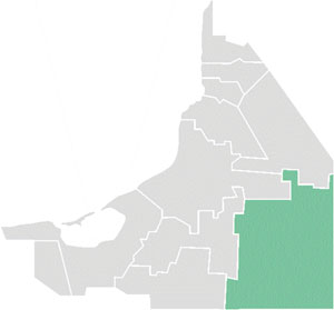
The municipality "(municipio)" of Calakmul borders to the east with
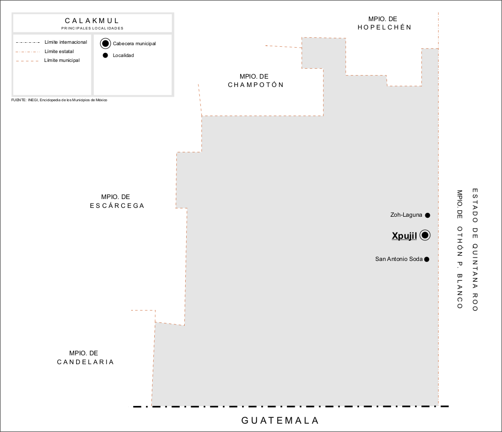
Quintana Roo (municpalities of José María Morelos and Othón P. Blanco) andBelize ; to the south withGuatemala ; and to the north and west with other municipalities in Campeche (Candelaria,Champotón ,Escárcega andHopelchén ). It covers 13,839.11 km² (5,343.31 sq mi), accounting for 24.34% of the state's total surface area, and is the 10th-largest municipality in area in the country.The municipality was created on
31 December 1996 , from part of the territory ofChampotón . On19 June 1998 , the State Congress enacted legislation creating the new municipality of Candelaria as of1 July of that year, with which Calakmul lost 24% of its population and a portion of its territory.Demographics
The 2005 census reported a population of 23,814 persons, of whom 6,566 speak an indigenous language. The languages spoken in Calakmul include
Yucatec Maya , Ch'ol,Chontal ,Tzotzil , and others. The municipal seat is the town ofXpujil , a small settlement of 3,222 inhabitants located on Federal Highway 186 as it crosses the base of the peninsula fromEscárcega, Campeche , toChetumal, Quintana Roo .Population centres in the municipality include:
*Xpujil , with 3,222 inhabitants, the municipal seat
*Zoh-Laguna (1,021)
*Constitución (1,016)Heritage
Maya archaeological sites in the municipality include:
Calakmul ,Becán ,Chicanna ,El Hormiguero ,Río Bec andXpuhil . TheCalakmul Biosphere Reserve also covers much of its southern portion.References
* [http://www.inegi.gob.mx/est/contenidos/espanol/sistemas/conteo2005/localidad/iter/ Link to tables of population data from Census of 2005] INEGI: Instituto Nacional de Estadística, Geografía e Informática
* [http://www.e-local.gob.mx/work/templates/enciclo/campeche/Mpios/04010a.htm Calakmul] Enciclopedia de los Municipios de MéxicoExternal links
* [http://www.calakmul.gob.mx/ Ayuntamiento de Calakmul] Official website es icon
* [http://www.campeche.gob.mx/Campeche/Municipios/Calakmul.php Municipio de Calakmul] from official Campeche state government website es icon
Wikimedia Foundation. 2010.