- Euripus Strait
-
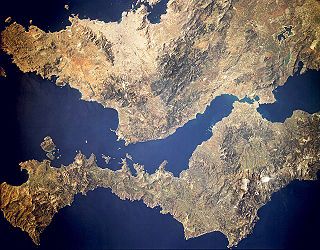
The Euripus Strait (Greek: Εύριπος, pronounced [ˈevripos]), is a narrow channel of water separating the Greek island of Euboea in the Aegean Sea from Boeotia in mainland Greece. The strait's principal port is Chalcis on Euboea, located at the strait's narrowest point.
The strait is subject to strong tidal currents which reverse direction approximately four times a day. Tidal flows are very weak in the Eastern Mediterranean, and the strait is a remarkable exception. Water flow peaks at about 12 km/hour, either northwards or southwards, and lesser vessels are often incapable of sailing against it. When nearing flow reversal, sailing is even more precarious because of vortex formation.
The Swiss scholar Francois-Alphonse Forel helped to solve this enigma owing to his study of limnology and the discovery of the seiche phenomenon. But the complete solving of the problem is due to the Greek D. Eginitis, director of the Athens Observatory, who published his conclusions in 1929.[1]
Contents
Bridges
There are two road bridges across the strait, both at Chalcis. One is a two-pylon, cable-suspended bridge built south of town in 1992, and commonly called the "New" or "High" bridge, with a span of about 215 m (705 ft). The strait is 160 m (525 ft) wide at this point. The bridge is accessible via a fork on the main road at Aulis.
The "Old" or "Low" or "Sliding" Bridge lies across midtown, and can slide away to allow shipping traffic. It is located at the narrowest point of the strait, where it is only 38 m (125 ft) wide. It accommodates two lanes of vehicular traffic. It was originally built as a retractable bridge in 1858, replaced by a rotating one in 1896. The existing, originally wooden bridge was built in 1962 and was extensively refurbished in 1998.
History
The first bridge across Euripus is often said to have been built in 411 BC, i.e. during the Peloponnesian War. In fact, there is no track of this, neither in Thucydides nor in Xenophon who count the story of that conflict (resp. in History of the Peloponnesian War and in Hellenica). Probably that date has been proposed because such a bridge was preventing the Athenian fleet to control the strait, control which was a reality until the Athenians' defeat in front of Eretria (a few kilometres South of Chalkis) in 411. What is sure is that :
- there was no bridge in 480 (Second Persian War), because many ships passed there at the time of the Artemisio battle (see Herodotus, e.a. VII.173 and VIII.66);
- there was a bridge before 334 B.C. because, as per Strabo, on the one side Ephorus wrote that the strait is so narrow that it was spanned by a bridge only two plethra long (IX.2.2), and on the other side the people of Chalkis built towers, doors and high walls at the bridge head the year Alexander the Great passed in Asia (X.1.8).
The bridge was apparently rebuilt by the Emperor Justinian I in 540 AD. Another was built by the Venetians in the late Middle Ages; it was called the "Black Bridge" (Italian: Negroponte) and it temporarily gave its name to the town and island.
In his Phaedo, Plato has Socrates use the Euripus tide as a simile for things that "go up and down" in describing the thinking of those who hold that nothing is sound or stable (Phaedo, 90c).
Aulis, the strait's port on the mainland, mentioned by Homer as the launching point of the combined Greek fleets in the Trojan War, is now a major cement shipping terminal.See also
- List of traditional Greek place names
References
Notes
Coordinates: 38°27′46″N 23°35′22″E / 38.46278°N 23.58944°ECategories:- Greece geography stubs
- Straits of Greece
- Central Greece
Wikimedia Foundation. 2010.

