Chateaubelair

Chateaubelair
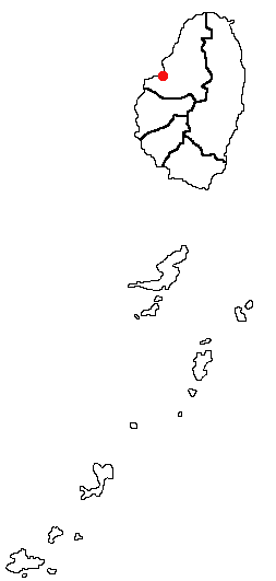
Chateaubelair, Saint Vincent and the Grenadines Location Map

Chateaubelair is a large fishing village on the Leeward (west) coast of the Caribbean island of Saint Vincent, the main island of Saint Vincent and the Grenadines. It is located just south of the volcano of Soufrière. Commonly referred to as just "Chateau", it is the focus and largest community in the North Leeward constituency of St. Vincent, and the fourth largest town in the country.

Local attractions include trinity falls, darkview falls, and rock carvings which are an archaeological find and are believed to have been left by Carib Indians.

Many activities are available year round, including spearfishing; and more common to the caribbean as a whole, dominoes, basketball, soccer and cricket.

The local economy is mainly supported by farming.

Chateaubelair is not a developed area, and though it has much appeal for tourists, it does not have much support. However, anyone looking to experience true Caribbean culture instead of a manufactured offering, should consider the natural environmental beauty and friendly, genuine people of Chateaubelair.

See also

Coordinates: 13°17′N 61°15′W / 13.283°N 61.25°W / 13.283; -61.25


Wikimedia Foundation. 2010.

Игры ⚽ Поможем написать курсовую

Look at other dictionaries:

  • Chateaubelair — Administration Pays  Saint Vincent et les Grenadines …   Wikipédia en Français

  • Chateaubelair — Este artículo está huérfano, pues pocos o ningún artículo enlazan aquí. Por favor, introduce enlaces hacia esta página desde otros artículos relacionados …   Wikipedia Español

  • Chateaubelair — Original name in latin Chateaubelair Name in other language Chateaubelair, Richmond, Richmond Town State code VC Continent/City America/St Vincent longitude 13.28333 latitude 61.25 altitude 142 Population 735 Date 2012 02 17 …   Cities with a population over 1000 database

  • Saint-David (Saint-Vincent-et-les Grenadines) — Pour les articles homonymes, voir Saint David (homonymie) et David. Saint David …   Wikipédia en Français

  • Saint-david (saint-vincent-et-les grenadines) — Pour les articles homonymes, voir Saint David (homonymie) et David. Saint David …   Wikipédia en Français

  • San David (San Vicente y las Granadinas) — Saltar a navegación, búsqueda San David (inglés: Saint David Parish) junto con otras cinco parroquias mas forman las seis divisiones administrativas de San Vicente y las Granadinas. Posee una superficie de ochenta kilómetros cuadrados y una… …   Wikipedia Español

  • Saint Vincent And The Grenadines — Introduction Saint Vincent and the Grenadines Background: Disputed between France and the United Kingdom in the 18th century, Saint Vincent was ceded to the latter in 1783. Autonomy was granted in 1969, and independence in 1979. Geography Saint… …   Universalium

  • Saint-David (Saint-Vincent-et-les-Grenadines) — 13°17′03″N 61°14′29″O / 13.28417, 61.24139 …   Wikipédia en Français

  • Saint Vincent (island) — You may be looking for St. Vincent Island, FloridaInfobox Islands name = Saint Vincent image caption = Villa, St. Vincent, 1890s image size = locator map custom = yes native name = native name link = nickname = location = Caribbean Sea… …   Wikipedia

  • List of cities, towns and villages in Saint Vincent and the Grenadines — This is a list of cities, towns and villages in Saint Vincent and the Grenadines:* Barrouallie * Chateaubelair * Georgetown * Kingstown 15,670 (capital) * Layou * Port Elizabeth * Ashton, Union Island * Clifton, Union Island * Arnos Vale *… …   Wikipedia

Share the article and excerpts

Direct link
Do a right-click on the link above
and select “Copy Link”