- White Rock, South Dakota
Infobox Settlement
official_name = White Rock, South Dakota
other_name =
native_name =
nickname =
settlement_type =Town
motto =
imagesize =
image_caption =
flag_size =
image_
seal_size =
image_shield =
shield_size =
image_blank_emblem =
blank_emblem_type =
blank_emblem_size =
imagesize =
image_caption =
flag_size =
image_
seal_size =
image_shield =
shield_size =
image_blank_emblem =
blank_emblem_type =
blank_emblem_size =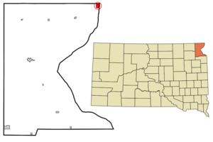
mapsize = 250px
map_caption = Location in Roberts County and the state ofSouth Dakota
mapsize1 =
map_caption1 =
image_dot_
dot_mapsize =
dot_map_caption =
dot_x =
dot_y =
pushpin_
pushpin_label_position =
pushpin_map_caption =
pushpin_mapsize =
subdivision_type = Country
subdivision_name =United States
subdivision_type1 = State
subdivision_name1 =South Dakota
subdivision_type2 = County
subdivision_name2 = Roberts
subdivision_type3 =
subdivision_name3 =
subdivision_type4 =
subdivision_name4 =
government_footnotes =
government_type =
leader_title =
leader_name =
leader_title1 =
leader_name1 =
leader_title2 =
leader_name2 =
leader_title3 =
leader_name3 =
leader_title4 =
leader_name4 =
established_title =
established_date =
established_title2 =
established_date2 =
established_title3 =
established_date3 =
area_magnitude =
unit_pref = Imperial
area_footnotes =
area_total_km2 = 4.1
area_land_km2 = 4.1
area_water_km2 = 0
area_total_sq_mi = 1.6
area_land_sq_mi = 1.6
area_water_sq_mi = 0
area_water_percent =
area_urban_km2 =
area_urban_sq_mi =
area_metro_km2 =
area_metro_sq_mi =
area_blank1_title =
area_blank1_km2 =
area_blank1_sq_mi =
population_as_of = 2000
population_footnotes =
population_note =
population_total = 18
population_density_km2 = 4.4
population_density_sq_mi = 11.3
population_metro =
population_density_metro_km2 =
population_density_metro_sq_mi =
population_urban =
population_density_urban_km2 =
population_density_urban_sq_mi =
population_blank1_title =
population_blank1 =
population_density_blank1_km2 =
population_density_blank1_sq_mi =
timezone = Central (CST)
utc_offset = -6
timezone_DST = CDT
utc_offset_DST = -5
latd = 45 |latm = 55 |lats = 9 |latNS = N
longd = 96 |longm = 34 |longs = 22 |longEW = W
elevation_footnotes =
elevation_m = 297
elevation_ft = 974
postal_code_type =
postal_code =
area_code = 605
blank_name = FIPS code
blank_info = 46-71380GR|2
blank1_name = GNIS feature ID
blank1_info = 1258972GR|3
website =
footnotes =White Rock is a town in Roberts County,
South Dakota ,United States , along theBois de Sioux River . The population was 18 at the 2000 census. White Rock is the most northeastern community in South Dakota, being along theMinnesota border and one mile south ofNorth Dakota .Geography
White Rock is located at coor dms|45|55|9|N|96|34|22|W|city (45.919046, -96.572776)GR|1.
According to the
United States Census Bureau , the town has a total area of 1.6square mile s (4.1km² ), all of it land.Demographics
As of the
census GR|2 of 2000, there were 18 people, 2 households, and 0 families residing in the town. Thepopulation density was 11.4 people per square mile (4.4/km²). There were 6 housing units at an average density of 3.8/sq mi (1.5/km²). The racial makeup of the town was 100.00% White.There were 2 households out of which none had children under the age of 18 living with them, none were married couples living together, and 100.0% were non-families. 100.0% of all households were made up of individuals and none had someone living alone who was 65 years of age or older. The average household size was 1.00 and the average family size was 0.00.
In the town the population was spread out with 5.6% from 25 to 44, 5.6% from 45 to 64, and 88.9% who were 65 years of age or older. The median age was 90 years. For every 100 females there were 38.5 males. For every 100 females age 18 and over, there were 38.5 males.
The median income for a household in the town was $3,750, and the median income for a family was $0. Males had a median income of $0 versus $0 for females. The
per capita income for the town was $22,883. There were no families and 100.0% of the population living below thepoverty line , including no under eighteens and none of those over 64.References
External links
Wikimedia Foundation. 2010.