- Ipswich, South Dakota
Infobox Settlement
official_name = Ipswich, South Dakota
other_name =
native_name =
nickname =
settlement_type =City
motto =
imagesize =
image_caption =
flag_size =
image_
seal_size =
image_shield =
shield_size =
image_blank_emblem =
blank_emblem_type =
blank_emblem_size =
imagesize =
image_caption =
flag_size =
image_
seal_size =
image_shield =
shield_size =
image_blank_emblem =
blank_emblem_type =
blank_emblem_size =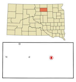
mapsize = 250px
map_caption = Location in Edmunds County and the state ofSouth Dakota
mapsize1 =
map_caption1 =
image_dot_
dot_mapsize =
dot_map_caption =
dot_x =
dot_y =
pushpin_
pushpin_label_position =
pushpin_map_caption =
pushpin_mapsize =
subdivision_type = Country
subdivision_name =United States
subdivision_type1 = State
subdivision_name1 =South Dakota
subdivision_type2 = County
subdivision_name2 = Edmunds
subdivision_type3 =
subdivision_name3 =
subdivision_type4 =
subdivision_name4 =
government_footnotes =
government_type =
leader_title =
leader_name =
leader_title1 =
leader_name1 =
leader_title2 =
leader_name2 =
leader_title3 =
leader_name3 =
leader_title4 =
leader_name4 =
established_title =
established_date =
established_title2 =
established_date2 =
established_title3 =
established_date3 =
area_magnitude =
unit_pref = Imperial
area_footnotes =
area_total_km2 = 3.4
area_land_km2 = 3.4
area_water_km2 = 0
area_total_sq_mi = 1.3
area_land_sq_mi = 1.3
area_water_sq_mi = 0
area_water_percent =
area_urban_km2 =
area_urban_sq_mi =
area_metro_km2 =
area_metro_sq_mi =
area_blank1_title =
area_blank1_km2 =
area_blank1_sq_mi =
population_as_of = 2000
population_footnotes =
population_note =
population_total = 943
population_density_km2 = 277.4
population_density_sq_mi = 725.4
population_metro =
population_density_metro_km2 =
population_density_metro_sq_mi =
population_urban =
population_density_urban_km2 =
population_density_urban_sq_mi =
population_blank1_title =
population_blank1 =
population_density_blank1_km2 =
population_density_blank1_sq_mi =
timezone = Central (CST)
utc_offset = -6
timezone_DST = CDT
utc_offset_DST = -5
latd = 45 |latm = 26 |lats = 42 |latNS = N
longd = 99 |longm = 1 |longs = 49 |longEW = W
elevation_footnotes =
elevation_m = 468
elevation_ft = 1535
postal_code_type =ZIP code
postal_code = 57451
area_code = 605
blank_name = FIPS code
blank_info = 46-31860GR|2
blank1_name = GNIS feature ID
blank1_info = 1255770GR|3
website = http://www.ipswich-sd.com
footnotes =Ipswich is a city in Edmunds County,
South Dakota ,United States . The population was 943 at the 2000 census. It is thecounty seat of Edmunds CountyGR|6.Geography
Ipswich is located at coor dms|45|26|42|N|99|1|49|W|city (45.445009, -99.030239)GR|1.
According to the
United States Census Bureau , the city has a total area of 1.3square mile s (3.4km² ), all of it land.The land the city is located on is all flat with no hills or mountains. It is largely surrounded by corn, wheat, beans, or sunflower fields. There are also a small amount of land left to grow naturally for pheasant hunting in the fall and winter.
Demographics
As of the
census GR|2 of 2000, there were 943 people, 404 households, and 254 families residing in the city. Thepopulation density was 719.3 people per square mile (277.9/km²). There were 440 housing units at an average density of 335.6/sq mi (129.7/km²). The racial makeup of the city was 98.52% White, 0.21% African American, 0.42% Native American, 0.11% Asian, 0.11% Pacific Islander, 0.21% from other races, and 0.42% from two or more races. Hispanic or Latino of any race were 0.64% of the population.There were 404 households out of which 29.7% had children under the age of 18 living with them, 54.0% were married couples living together, 7.7% had a female householder with no husband present, and 37.1% were non-families. 34.2% of all households were made up of individuals and 20.8% had someone living alone who was 65 years of age or older. The average household size was 2.32 and the average family size was 3.01.
In the city the population was spread out with 27.4% under the age of 18, 5.3% from 18 to 24, 23.4% from 25 to 44, 19.3% from 45 to 64, and 24.6% who were 65 years of age or older. The median age was 41 years. For every 100 females there were 92.1 males. For every 100 females age 18 and over, there were 84.1 males.
The median income for a household in the city was $33,073, and the median income for a family was $40,598. Males had a median income of $30,268 versus $16,413 for females. The
per capita income for the city was $19,890. About 6.7% of families and 8.7% of the population were below thepoverty line , including 6.2% of those under age 18 and 19.2% of those age 65 or over.References
External links
Wikimedia Foundation. 2010.