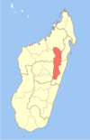
- Manakambahiny Est
-
Manakambahiny Est Location in Madagascar Coordinates: 17°51′S 48°46′E / 17.85°S 48.767°E Country  Madagascar
Region Alaotra-Mangoro District Ambatondrazaka Elevation[1] 1,106 m (3,629 ft) Population (2001)[2] - Total 8,000 Time zone EAT (UTC3) Manakambahiny Est is a town and commune (Malagasy: kaominina) in Madagascar. It belongs to the district of Ambatondrazaka, which is a part of Alaotra-Mangoro Region. The population of the commune was estimated to be approximately 8,000 in 2001 commune census.[2]
Primary and junior level secondary education are available in town. The majority 80% of the population of the commune are farmers, while an additional 18% receives their livelihood from raising livestock. The most important crop is rice, while other important products are bananas, sugarcane, cassava and sweet potatos. Services provide employment for 2% of the population.[2]
References and notes
- ^ Estimated based on DEM data from Shuttle Radar Topography Mission
- ^ a b c "ILO census data". Cornell University. 2002. http://www.ilo.cornell.edu/ilo/data.html. Retrieved 2008-03-06.
Ambatondrazaka Ambandrika · Ambatondrazaka Suburbaine · Ambatondrazaka · Ambatosoratra · Ambohitsilaozana · Amparihitsokatra · Ampitatsimo · Andilanatoby · Andromba · Antanandava · Antsangasanga · Bejofo · Didy · Feramanga Nord · Ilafy · Imerimandroso · Manakambahiny Est · Manakambahiny Ouest · Soalazaina · Tanambao Besakay
Amparafaravola Ambatomainty · Amboavory · Ambohijanahary · Ambohitrarivo · Amparafaravola · Andrebakely Est · Beanana · Bedidy · Morarano Chrome · Ranomainty · Tanambe · Vohimena · VohitsaraAndilamena Anosibe An'ala Ambalaomby · Ambatoharanana · Ampandoantraka · Ampasimaneva · Anosibe An'ala · Antandrokomby · Longozabe · Niarovana Marosampanana · TratramarinaMoramanga Ambatovola · Amboasary · Ambohidronono · Ampasipotsy Gare · Ampasipotsy Mandialaza · Andaingo · Andasibe · Anosibe Ifody · Antanandava · Antaniditra · Beforona · Belavabary · Beparasy · Fierenana · Lakato · Mandialaza · Moramanga · Moramanga Suburbaine · Morarano Gare · Sabotsy Anjiro · VodirianaCoordinates: 17°51′S 48°46′E / 17.85°S 48.767°E

This Alaotra-Mangoro location article is a stub. You can help Wikipedia by expanding it.

