Moetoetoetabriki

Moetoetoetabriki
Moetoetoetabriki
Moetoetoetabriki is located in Suriname
Moetoetoetabriki
Location in Suriname
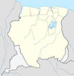
Coordinates: 4°50′N 55°34′W / 4.833°N 55.567°W / 4.833; -55.567Coordinates: 4°50′N 55°34′W / 4.833°N 55.567°W / 4.833; -55.567
Country Flag of Suriname.svg Suriname
District Sipaliwini District
Resort (municipality) Bven Saramacca
Elevation 197 ft (60 m)
Time zone UTC -3

Moetoetoetabriki is a village in Bven Saramacca municipality (resort) in Sipaliwini District in Suriname.

Nearby towns and villages include Heidoti (2.0 nm), Kwattahede (1.4 nm), Pakka-Pakka (13.9 nm), Makajapingo (7.0 nm) and Tabrikiekondre (4.1 nm).

External links


Wikimedia Foundation. 2010.

Игры ⚽ Поможем написать реферат

Look at other dictionaries:

  • Tabrikiekondre — Infobox Settlement official name = pagename other name = native name = nickname = settlement type = motto = imagesize = image caption = flag size = image seal size = image shield = shield size = image blank emblem = blank emblem type = blank… …   Wikipedia

  • Kwattahede — Infobox Settlement official name = pagename other name = native name = nickname = settlement type = motto = imagesize = image caption = flag size = image seal size = image shield = shield size = image blank emblem = blank emblem type = blank… …   Wikipedia

  • Makajapingo — Makajapingo …   Wikipedia

  • Pakka-Pakka — Infobox Settlement official name = PAGENAME other name = native name = nickname = settlement type = motto = imagesize = image caption = flag size = image seal size = image shield = shield size = image blank emblem = blank emblem type = blank… …   Wikipedia

Share the article and excerpts

Direct link
Do a right-click on the link above
and select “Copy Link”