Mescul

Mescul
Mescul
Mescul is located in Eritrea
Mescul
Location in Eritrea
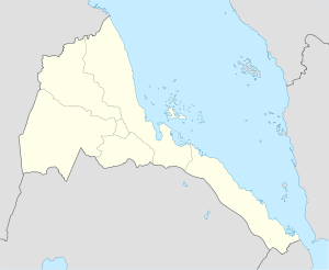
Coordinates: 15°18′N 37°30′E / 15.3°N 37.5°E / 15.3; 37.5Coordinates: 15°18′N 37°30′E / 15.3°N 37.5°E / 15.3; 37.5
Country Flag of Eritrea.svg Eritrea
Region Gash-Barka
District Mogolo District
Elevation 1,047 m (3,435 ft)

Mescul is a town in western Eritrea.

Location

It is located in Mogolo District in the Gash-Barka region.

Nearby towns and villages include Markaughe (8.3 nm), Hambok (6.3 nm), Dedda (6.3 nm), Attai (5.7 nm), Aredda (6.1 nm) and Tauda (8.2 nm).

External links


Wikimedia Foundation. 2010.

Игры ⚽ Поможем написать реферат

Look at other dictionaries:

  • Attai — Infobox Settlement official name = PAGENAME native name = imagesize = image caption = image map caption = pushpin pushpin label position =bottom pushpin mapsize = 300 pushpin map caption =Location in Eritrea subdivision type = Country subdivision …   Wikipedia

  • Hambok — Infobox Settlement official name = PAGENAME native name = imagesize = image caption = image map caption = pushpin pushpin label position =bottom pushpin mapsize = 300 pushpin map caption =Location in Eritrea subdivision type = Country subdivision …   Wikipedia

  • Mogolo District — Mogolo   District   Country  Eritrea Region Gash Barka …   Wikipedia

  • Markaughe — Markaughe …   Wikipedia

  • Tauda — Infobox Settlement official name = PAGENAME native name = imagesize = image caption = image map caption = pushpin pushpin label position =bottom pushpin mapsize = 300 pushpin map caption =Location in Eritrea subdivision type = Country subdivision …   Wikipedia

Share the article and excerpts

Direct link
Do a right-click on the link above
and select “Copy Link”