- Mrgashat
-
Mrgashat
Մրգաշատ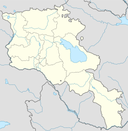
 Mrgashat
Coordinates: 40°07′47″N 44°04′14″E / 40.12972°N 44.07056°E Country Armenia Province Armavir Population (2008) - Total 5,388 Coordinates: 40°07′47″N 44°04′14″E / 40.12972°N 44.07056°E Mrgashat (Armenian: Մրգաշատ; formerly, Gechrlu, Gechrli, and Gecherlau) is a town in the Armavir Province of Armenia. The Bronze Age site of Gharatapa is nearby.
References
- Mrgashat at GEOnet Names Server
- World Gazeteer: Armenia – World-Gazetteer.com
- Report of the results of the 2001 Armenian Census, National Statistical Service of the Republic of Armenia
- Brady Kiesling, Rediscovering Armenia, p. 39; original archived at Archive.org, and current version online on Armeniapedia.org.
Categories:- Populated places in Armavir
- Armavir (province) geography stubs

Wikimedia Foundation. 2010.