- Matakohe
-
- For the island in Whangarei Harbour see Motu Matakohe
Matakohe 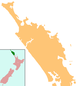
 Matakohe
Coordinates: 36°7′46″S 174°11′6″E / 36.12944°S 174.185°ECoordinates: 36°7′46″S 174°11′6″E / 36.12944°S 174.185°E Country New Zealand Region Northland Region District Kaipara District Population (2006) - Total 400 Matakohe is a settlement in Northland, New Zealand. The Matakohe River is a short river which runs from the north into the Arapaoa River, which is part of the Kaipara Harbour. State Highway 12 passes through Matakohe. Ruawai is 16 km to the west, and Paparoa is 6 km north east. The Hukatere Peninsula extends south into the Kaipara Harbour.[1][2]
The Kauri Museum at Matakohe shows the area's heritage in the kauri timber industry.[3]
The current population is approximately 400.[4]
Contents
History
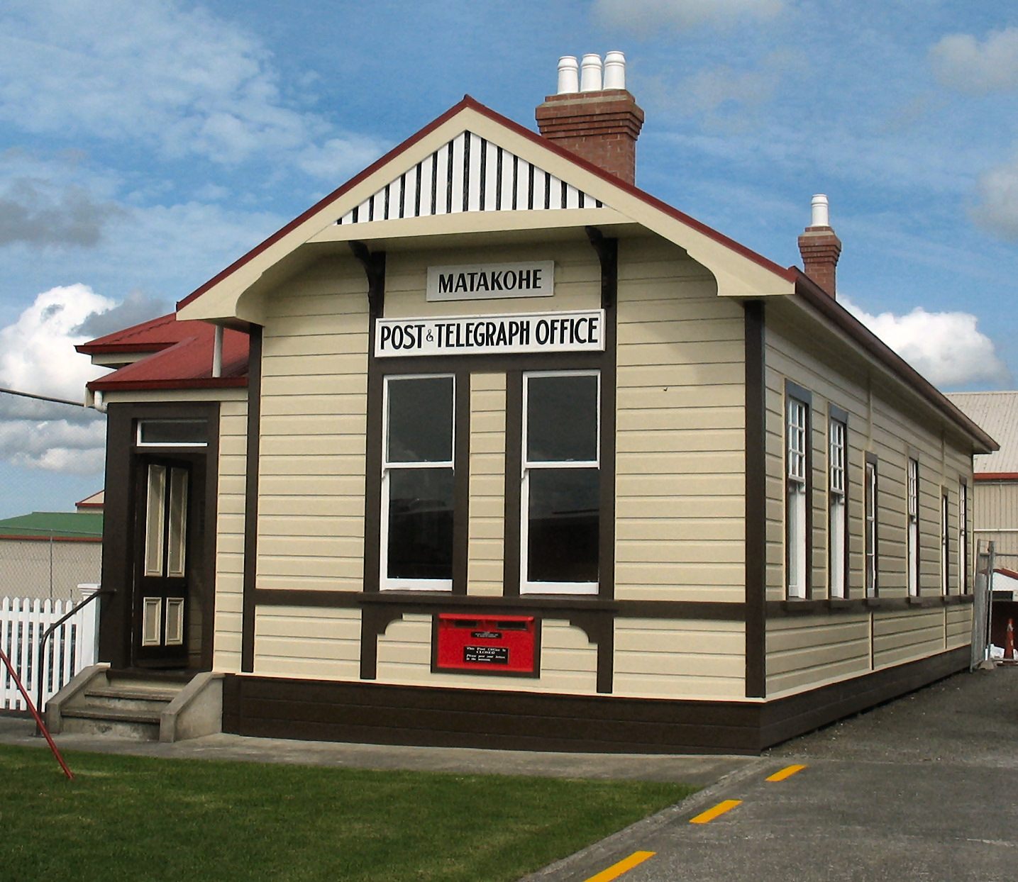
 Post and telegraph office, now a museum
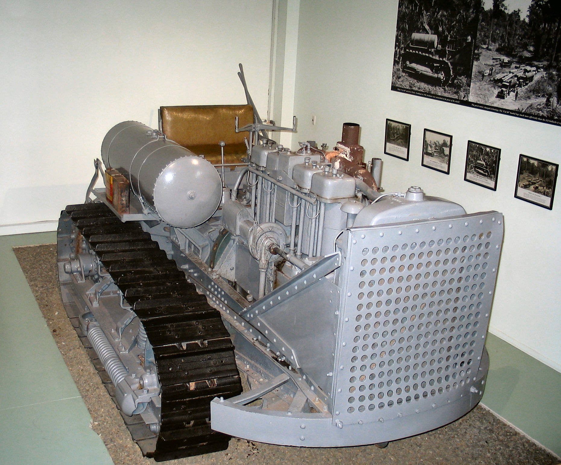
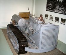 This 60 horsepower machine is one of five imported into New Zealand in 1930 for hauling logs. It replaced eight bullock teams (112 animals). Presently in the Kauri Museum in Matakohe
The Matakohe block was first settled by Pakeha in 1863, when members of the Albertland religious group arrived in New Zealand.[5] The land was initially burnt off to allow for the planting of crops and grass. A weekly (initially monthly) ferry service brought mail, and a road was constructed to Paparoa.[6] In 1881, the longest wharf in the Kaipara—1,450 feet (440 m) long—was built at Matakohe to accommodate the steamers. Minnie Casey served Matakohe in the 1880s, and the S.S. Ethel, then the S.S. Tangihua in the 1890s.[7]
The kauri gum industry became established around Matakohe in 1867-70, possibly the first place in the Kaipara District that the industry developed amongst settlers. A flax mill was built in 1870, but it was not profitable and was soon converted to a timber mill. This was replaced by a larger timber mill in the 1880s.[8] The mill was destroyed by fire in 1906.[9] Matakohe held a race-day each February, in which were entries from as far as Kaiwaka and Waipu.[10]
In the 1890s, the population of Matakohe increased from 93 to 231, and the town was described as "the principal place in the Otamatea County". By 1902 the town had two boarding houses, a library, stores and a goods shed, as well as the older church and school.[11] The population reached 264 in 1906, but declined to 141 in 1921.[12]
Focus shifted to dairy farming in the early 20th century. Apple growing was also successful at first, but ceased by 1935 due to the Great Depression and poor management.[13] The roads improved, and by 1920 all 53 miles (85 km) of roads in the area were metalled, using the abundant local supplies of limestone. The route to Dargaville was improved by the opening of a road through Ruawai in 1927, replacing the inland road.[14]
Notable people
- Gordon Coates, Prime Minister 1925-28, born on the Hukatere Peninsula, and attended Matakohe School.[15]
Education
Matakohe School is a coeducational full primary (years 1-8) school with a decile rating of 5 and a roll of 84.[16] The school celebrated its 125th reunion in 2003.[17] When it was founded, the school shared a half day with Omaru School.[18] Over the years, it has amalgamated with Ararua, Hukatere, Oparakau and Parahi schools.[17]
There was a Matakohe School established in 1870. It used a church ante-room at first, then moved to the main church building while the school building was being constructed.[19][20]
Notes
- ^ Peter Dowling (editor) (2004). Reed New Zealand Atlas. Reed Books. pp. map 7. ISBN 0-7900-0952-8.
- ^ Roger Smith, GeographX (2005). The Geographic Atlas of New Zealand. Robbie Burton. pp. map 30. ISBN 1-877333-20-4.
- ^ "Sustainable forest management". Te Ara Encyclopedia of New Zealand. http://www.teara.govt.nz/TheBush/UsesOfTheBush/LoggingNativeForests/7/en.
- ^ Bain, Carolyn (2006). New Zealand. Lonely Planet. p. 169. ISBN 1741045355. http://books.google.com/?id=FHxJ4zuemtcC&pg=PA169&dq=Matakohe.
- ^ Sir Henry Brett and Henry Hook (1927). The Albertlanders: Brave Pioneers of the 'Sixties. pp. p 234.
- ^ Ryburn, Wayne (1999). Tall Spars, Steamers & Gum. Auckland, N.Z.: Kaipara Publications. pp. pp 19–20, 27, 30, 36. ISBN 0-473-06176-7.
- ^ Ryburn, pp 75-76, 79-80
- ^ Ryburn, pp 40, 42, 55
- ^ Ryburn, pp 108-110
- ^ Ryburn, p 72
- ^ Ryburn, p 62, 64, 69
- ^ Ryburn, p 165
- ^ Ryburn, pp 156-7, 161
- ^ Ryburn, pp 188, 190, 192
- ^ Bassett, Michael. "Coates, Joseph Gordon 1878 - 1943". Dictionary of New Zealand Biography. Ministry for Culture and Heritage. http://www.teara.govt.nz/en/biographies/3c24. Retrieved 4 April 2011.
- ^ "Te Kete Ipurangi - Matakohe School". Ministry of Education. http://www.tki.org.nz/e/schools/display_school_info.php?school_id=1042.
- ^ a b "Matakohe School 125th Reunion" ([dead link] – Scholar search). Education Gazette New Zealand 82 (16). 1 September 2003. http://www.edgazette.govt.nz/notices.php/notices.php?action=view&id=59475.
- ^ Ryburn, p 222
- ^ Ryburn, pp 45-46
- ^ "Matakohe: School Fete". Daily Southern Cross XXVII (4330): p 2. 1 July 1871. http://paperspast.natlib.govt.nz/cgi-bin/paperspast?a=d&d=DSC18710701.2.16&e=-------en--1----0-all.
External links
Categories:- Kaipara District
- Populated places in New Zealand

Wikimedia Foundation. 2010.