- Paparoa
Infobox Settlement
name = Paparoa
subdivision_type = Country
subdivision_name =New Zealand
subdivision_type1= Region
subdivision_name1=Northland Region
subdivision_type2= District
subdivision_name2=Kaipara District
pushpin_
latd = 36
latm = 5
lats = 54
latNS = S
longd = 174
longm = 14
longs = 22
longEW = E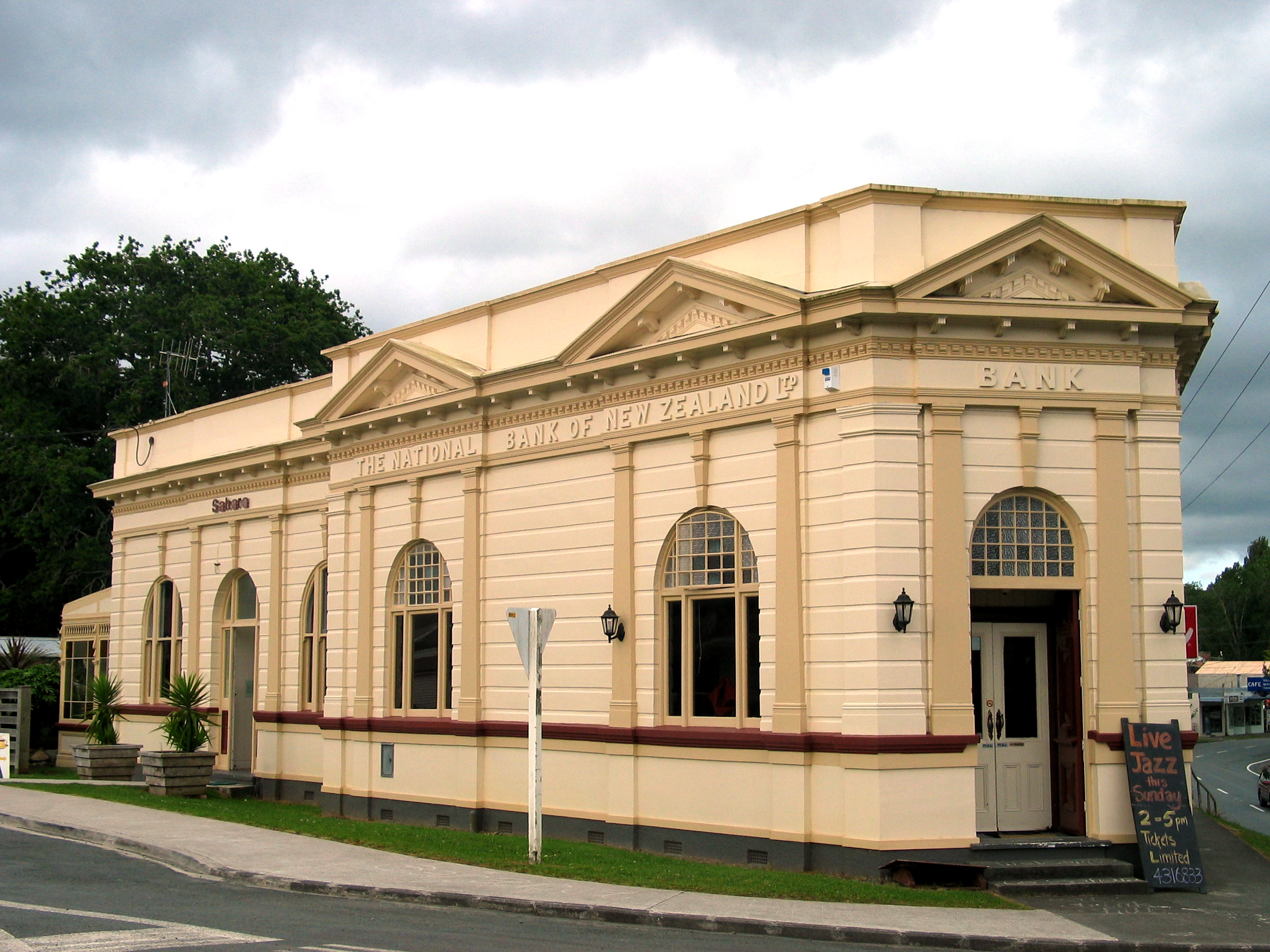
image_caption = Former National Bank of New Zealand, Paparoa, Northland (now a restaurant)Paparoa is a settlement in Northland,
New Zealand . The Paparoa Stream flows from the east, through the settlement, and into the Paparoa Creek to the south, which joins theArapaoa River which is part of theKaipara Harbour . State Highway 12 passes through Paparoa.Matakohe is 6 km to the south west, andMaungaturoto is 12 km east. [cite book|title=Reed New Zealand Atlas|year=2004|id=ISBN 0-7900-0952-8|author=Peter Dowling (editor)|publisher=Reed Books|pages=map 7] [cite book|title=The Geographic Atlas of New Zealand|year=2005|id=ISBN 1-877333-20-4|author=Roger Smith, GeographX|publisher=Robbie Burton|pages=map 30]History
Paparoa was one of several Kaipara settlements established by a religious group known as
Albertland ers. Port Albert nearWellsford was the main settlement, andMatakohe was another. [cite book|title=The Albertlanders: Brave Pioneers of the 'Sixties|author=Sir Henry Brett and Henry Hook|year=1927|pages=p 234] They settled at the Paparoa Block in 1863. The land was burnt off so that corn and grass could be planted. [cite book|title=Tall Spars, Steamers & Gum|last=Ryburn|first=Wayne|year=1999|isbn=0-473-06176-7|pages=pp 19, 20] A road was constructed to the port atPahi in 1865, and one to Matakohe shortly afterwards. [Ryburn, pp 35-36] A pottery using local clay and a factory making rope and matting from flax operated in the 1870s, and brick and tile yards were established, but their business suffered from the poor roads and high freight charges. The nearest stores were in Pahi, convert|6|mi to the south. [Ryburn, pp 48-49, 60]The steamer "Minnie Casey" connected Paparoa with
Helensville on the south side of the Kaipara with a weekly service from 1882, and the S.S. "Ethel" took over from 1891-95, after which services went only to Matakohe and Pahi. [Ryburn, p 75, 79] The network of roads in the area were improved in the 1880s and 1890s. [Ryburn, pp 89-92]In the 1890s, Paparoa had 35 families and about 200 people, mostly living along the banks of the Paparoa River. Including Pahi, there were 400 people in the area. By 1906, the population of Paparoa had doubled. [Ryburn, pp 54, 62, 64, 69] Pastoral farming became established in the area, and a dairy factory was opened in Paparoa in January 1895. [Ryburn, p 64] A branch of a Helensville-based department store was operating in the town in the 1900s. [Ryburn, p 70] The North Auckland railway line reached Huarau, to the east of Paparoa, in the early 1920s. A route through Paparoa was planned at one stage but this did not eventuate. The road to Maungatoroto, which passes through Huarua, was metalled in 1922. [Ryburn, pp 184-185, 190]
Notable people
*Alex Tait, cricketer, born in Paparoa. [cite web|url=http://www.cricket-online.com/player.php?player_id=8433|title=Alex Tait|publisher=Cricket Online]
*James Wright, potter, worked in Paparoa in the mid 1870s. [cite encyclopedia|url=http://www.dnzb.govt.nz/dnzb/default.asp?Find_Quick.asp?PersonEssay=2W35|title=Wright, James 1819 - 1887|encyclopedia=Dictionary of New Zealand Biography ]Education
Paparoa School is a coeducational contributing primary (years 1-6) school with a decile rating of 4 and a roll of 72. [cite web|url=http://www.tki.org.nz/e/schools/display_school_info.php?school_id=1077|title=Te Kete Ipurangi - Paparoa School|publisher=Ministry of Education] The school was established in 1870, [cite book|title=Paparoa School Centennial 1870-1970|author=Constance Rose Rountree, Ruth Smellie|publisher=Paparoa School Centennial Committee|year=1970] and had a roll ranging from 27 to 42 students up to 1899. [Ryburn, pp 45, 222]Notes

Wikimedia Foundation. 2010.