- Genesee Township, Pennsylvania
Infobox Settlement
official_name = Genesee Township, Pennsylvania
other_name =
native_name =
nickname =
settlement_type = Township
motto =
imagesize =
image_caption =
flag_size =
image_
seal_size =
image_shield =
shield_size =
city_logo =
citylogo_size =
mapsize = 250x200px
map_caption = Map of Potter County, Pennsylvania highlighting Genesee Township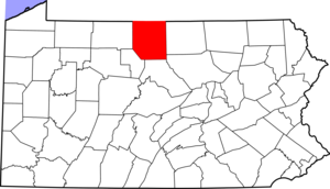
mapsize1 = 250x200px
map_caption1 = Map of Potter County, Pennsylvania
subdivision_type = Country
subdivision_name =United States
subdivision_type1 = State
subdivision_name1 =Pennsylvania
subdivision_type2 = County
subdivision_name2 = Potter
subdivision_type3 =
subdivision_name3 =
subdivision_type4 =
subdivision_name4 =
government_footnotes =
government_type =
leader_title =
leader_name =
leader_title1 =
leader_name1 =
leader_title2 =
leader_name2 =
leader_title3 =
leader_name3 =
leader_title4 =
leader_name4 =
established_title = Settled
established_date = 1816
established_title1 = Incorporated
established_date1 = 1828
area_magnitude =
unit_pref = Imperial
area_footnotes =
area_total_km2 = 93.3
area_land_km2 =
area_water_km2 =
area_total_sq_mi = 36.0
area_land_sq_mi =
area_water_sq_mi =
area_water_percent =
population_as_of = 2000
population_footnotes =
population_note =
population_total = 789
population_density_km2 = 8.5
population_density_sq_mi = 21.9
timezone = EST
utc_offset = -5
timezone_DST = EDT
utc_offset_DST = -4
elevation_m =
elevation_ft =
postal_code_type =
postal_code =
area_code =
website =
footnotes =Genesee Township is a township in Potter County,
Pennsylvania ,United States and lies near the source of theGenesee River . The population was 789 at the 2000 census. The name Genesee derives from Indian term for "beautiful valley".Geography
According to the
United States Census Bureau , the township has a total area of 36.0square mile s (93.3km² ), of which, 36.0 square miles (93.3 km²) of it is land and 0.03% is water.Genesee Township is bordered by
New York to the north, Bingham Township to the east, Allegany Township to the south and Oswayo Township to the west.The beginning of the
Genesee River (that eventually flows through downtown Rochester,New York and empties intoLake Ontario ) is located on what was or continues to be the Melvin Easton dairy farm. You can visit it by driving along RT 19 South from NY state into Genesee PA where it becomes RT 49 on the road to Gold. It begins with a spring located there.Demographics
As of the
census GR|2 of 2000, there were 789 people, 310 households, and 217 families residing in the township. Thepopulation density was 21.9 people per square mile (8.5/km²). There were 438 housing units at an average density of 12.2/sq mi (4.7/km²). The racial makeup of the township was 97.72% White, 1.01% African American, 0.51% Native American, and 0.76% from two or more races. Hispanic or Latino of any race were 0.25% of the population.There were 310 households out of which 31.6% had children under the age of 18 living with them, 56.8% were married couples living together, 10.3% had a female householder with no husband present, and 30.0% were non-families. 26.1% of all households were made up of individuals and 14.2% had someone living alone who was 65 years of age or older. The average household size was 2.55 and the average family size was 3.04.
In the township the population was spread out with 26.5% under the age of 18, 7.0% from 18 to 24, 26.5% from 25 to 44, 24.6% from 45 to 64, and 15.5% who were 65 years of age or older. The median age was 39 years. For every 100 females there were 99.7 males. For every 100 females age 18 and over, there were 96.6 males.
The median income for a household in the township was $31,667, and the median income for a family was $35,268. Males had a median income of $27,625 versus $18,125 for females. The
per capita income for the township was $17,285. About 13.6% of families and 16.2% of the population were below thepoverty line , including 22.9% of those under age 18 and 5.1% of those age 65 or over.References

Wikimedia Foundation. 2010.