- Fossil Springs Wilderness
Infobox_protected_area | name = Fossil Springs Wilderness
iucn_category = Ib
caption =
locator_x =
locator_y =
location =Arizona , USA
nearest_city =Strawberry, Arizona
lat_degrees = 34
lat_minutes = 26
lat_seconds = 56
lat_direction = N
long_degrees = 111
long_minutes = 32
long_seconds = 35
long_direction = W
area = convert|11550|acre|km2|0|sing=off
established =1984
visitation_num =
visitation_year =
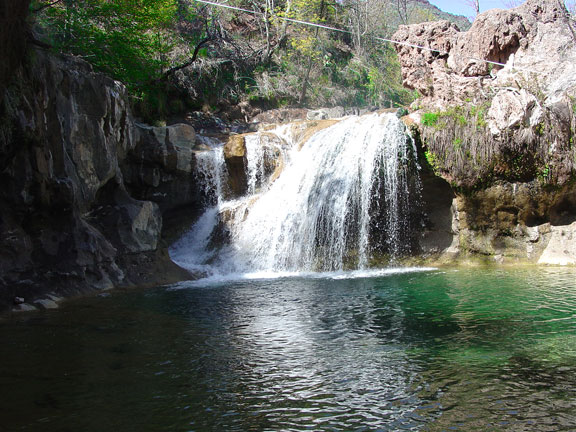
governing_body =U.S. Bureau of Land Management Fossil Springs Wilderness is a convert|11550|acre|km2|0|sing=on
wilderness area within theCoconino National Forest inArizona ,USA . It is located at the bottom of a steep canyon at the edge of theColorado Plateau , just south of theMogollon Rim . Here, water is pumped to the surface at the rate of about 20,000 gallons per minute. The perennial water supply supports one of the most diverse riparian ecosystems in the state, with more than 30 species of trees set among native desert shrub. It also creates a haven for abundant wildlife, including elk, deer, javelina, coyote, skunk, ring-tailed cat, fox, and more than 100 species of birds. [http://www.wilderness.net/index.cfm?fuse=NWPS&sec=wildView&wname=Fossil%20Springs Fossil Springs Wilderness] - Wilderness.net]References
ee also
*
List of U.S. Wilderness Areas
*List of Arizona Wilderness Areas
*Wilderness Act External links
* [http://www.fs.fed.us/r3/coconino/recreation/red_rock/fossil-spgs-wild.shtml Fossil Springs Wilderness] - Coconino National Forest
Wikimedia Foundation. 2010.