Curtis Island (Tasmania)

Curtis Island (Tasmania)
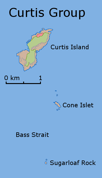
Map of the Curtis Group

Curtis Island is a granite island, with an area of 150 ha, in south-eastern Australia. It is part of Tasmania’s Curtis Group, lying in northern Bass Strait between the Furneaux Group and Wilsons Promontory in Victoria. It is a nature reserve and has been identified as an Important Bird Area because it supports up to 390,000 breeding pairs of Short-tailed Shearwaters or Tasmanian Muttonbirds.[1]

It was named by lieutenant James Grant, sailing on the Lady Nelson, after Sir Roger Curtis, British governor of the Cape of Good Hope, in 1800. [2] [3] [4]

Fauna

As well as the shearwaters, recorded breeding seabird and wader species include Little Penguin, Fairy Prion, Pacific Gull and Sooty Oystercatcher. Reptiles present include White-lipped Snake, Bougainville's Skink, White's Skink and Metallic Skink.[5]

References

  1. ^ "IBA: Curtis Island". Birdata. Birds Australia. http://www.birdata.com.au/iba.vm. Retrieved 2011-06-16. 
  2. ^ Grant, James (1803), The narrative of a voyage of discovery, performed in His Majesty's vessel the Lady Nelson, London: Roworth, pp. 195 , cited in Bird (2006)
  3. ^ Lee, Ida (1915), The Logbooks of the Lady Nelson, London: Grafton, pp. 328, http://openlibrary.org/books/OL6580132M/, retrieved 2011-02-11 , cited in Bird (2006)
  4. ^ Bird, Eric (2006-10-12). "Place Names on the Coast of Victoria" (PDF). The Australian National Placename Survey (ANPS). Archived from the original on 2011-02-09. http://www.webcitation.org/5wNhWF4B7. 
  5. ^ Brothers, Nigel; Pemberton, David; Pryor, Helen; & Halley, Vanessa. (2001). Tasmania’s Offshore Islands: seabirds and other natural features. Tasmanian Museum and Art Gallery: Hobart. ISBN 0-7246-4816-X

Coordinates: 39°28′S 146°38′E / 39.467°S 146.633°E / -39.467; 146.633


Wikimedia Foundation. 2010.

Игры ⚽ Нужно решить контрольную?

Look at other dictionaries:

  • Curtis Island — may refer to: Curtis Island (Queensland), Australia Curtis Island National Park, Queensland Curtis Island (Tasmania), Australia Curtis Island, New Zealand, in the Kermadec Islands Curtis Island (Maine), in the United States Curtis Island Light,… …   Wikipedia

  • Geology of Tasmania — Tasmania has a varied geological history, with the world s biggest exposure of diabase, or dolerite. Rocks from the Neoproterozoic, Paleozoic and Mesozoic time periods appear. It is one of the few southern hemisphere areas glaciated during the… …   Wikipedia

  • Tasmania — Tasmanian, adj., n. /taz may nee euh, mayn yeuh/, n. an island S of Australia: a state of the commonwealth of Australia. 418,957; 26,382 sq. mi. (68,330 sq. km). Cap.: Hobart. Formerly, Van Diemen s Land. * * * formerly Van Diemen s Land Island… …   Universalium

  • Protected areas of Tasmania — Tasmania is the smallest state in Australia, and has a high amount of protected areas. Contents 1 Conservation areas 2 Forest reserves 3 Game reserves 4 Historic sites …   Wikipedia

  • Fraser Island — Infobox Islands name = Fraser Island image caption = View from Indian Head, Fraser Island locator native name = native name link = location = Australia coordinates= coord|25|13|S|153|08|E|display=inline,title area = 1,840 km sup2; highest mount …   Wikipedia

  • Hydro Tasmania — Infobox Company company name = Hydro Tasmania company company type = Electricity generation foundation = 1929 (as HEC); 1998 location = Hobart key people = D.M.Crean (Chairman) V.J.Hawksworth (CEO) industry = Utilities products = Electricity… …   Wikipedia

  • Mount Wellington (Tasmania) — Mount Wellington Mount Wellington Elevation 1,271 m (4,170 ft) AHD  …   Wikipedia

  • Sugarloaf Rock (Curtis Group) — Sugarloaf Rock is a small granite island, with an area of 1.07 ha, in south eastern Australia. It is part of Tasmania’s Curtis Group, lying in northern Bass Strait between the Furneaux Group and Wilsons Promontory in Victoria.FaunaRecorded… …   Wikipedia

  • Liste australischer Leuchttürme und Feuerschiffe — Diese Liste enthält Leuchttürme und Feuerschiffe in Australien. An der 25.760 km langen Küstenlinie Australiens[1] befinden sich über 350 Leuchttürme und Navigationshilfen[2] und im Inland gibt es den Point Malcolm Leuchtturm, den einzigen… …   Deutsch Wikipedia

  • Bass Strait — (IPAEng|bæs) is a sea strait separating Tasmania from the south of the Australian mainland (Victoria in particular). Discovery and explorationThe first European to discover Bass Strait was George Bass in 1797. Governor Hunter subsequently named… …   Wikipedia

Share the article and excerpts

Direct link
Do a right-click on the link above
and select “Copy Link”