- Clay Township, Huntingdon County, Pennsylvania
-
For other Pennsylvania townships of the same name, see Clay Township, Pennsylvania (disambiguation).
Clay Township,
Huntingdon County,
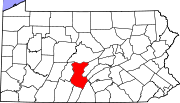
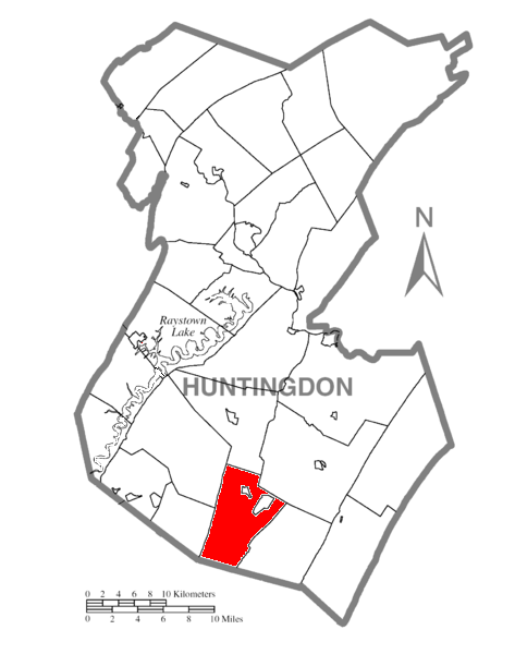
Pennsylvania— Township — Map of Huntingdon County, Pennsylvania Highlighting Clay Township Map of Huntingdon County, Pennsylvania
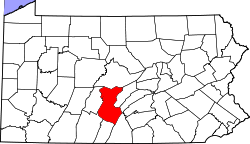
Country United States State Pennsylvania County Huntingdon Settled Incorporated Area – Total 28.2 sq mi (73 km2) Population (2000) – Total 920 – Density 32.6/sq mi (12.6/km2) Time zone Eastern (EST) (UTC-5) – Summer (DST) EDT (UTC-4) Clay Township is a township in Huntingdon County, Pennsylvania, United States. The population was 920 at the 2000 census.
Contents
General information
- ZIP Codes: 17253, 17264
- Area Code: 814
- Local Phone Exchanges: 447, 448
- School District: Southern Huntingdon County School District
Geography
According to the United States Census Bureau, the township has a total area of 28.2 square miles (73 km2), all of it land.
Demographics
As of the census[1] of 2000, there were 920 people, 370 households, and 283 families residing in the township. The population density was 32.6 people per square mile (12.6/km²). There were 494 housing units at an average density of 17.5/sq mi (6.8/km²). The racial makeup of the township was 99.02% White, 0.11% African American, 0.11% Asian, 0.11% from other races, and 0.65% from two or more races.
There were 370 households out of which 31.6% had children under the age of 18 living with them, 66.5% were married couples living together, 5.7% had a female householder with no husband present, and 23.5% were non-families. 20.0% of all households were made up of individuals and 10.3% had someone living alone who was 65 years of age or older. The average household size was 2.49 and the average family size was 2.85.
In the township the population was spread out with 23.3% under the age of 18, 6.5% from 18 to 24, 26.5% from 25 to 44, 27.2% from 45 to 64, and 16.5% who were 65 years of age or older. The median age was 40 years. For every 100 females there were 99.1 males. For every 100 females age 18 and over, there were 101.7 males.
The median income for a household in the township was $30,966, and the median income for a family was $34,250. Males had a median income of $31,992 versus $18,750 for females. The per capita income for the township was $15,282. About 5.6% of families and 9.2% of the population were below the poverty line, including 11.5% of those under age 18 and 9.1% of those age 65 or over.
References
- ^ "American FactFinder". United States Census Bureau. http://factfinder.census.gov. Retrieved 2008-01-31.
Municipalities and communities of Huntingdon County, Pennsylvania Boroughs Alexandria | Birmingham | Broad Top City | Cassville | Coalmont | Dudley | Huntingdon | Mapleton | Marklesburg | Mill Creek | Mount Union | Orbisonia | Petersburg | Rockhill | Saltillo | Shade Gap | Shirleysburg | Three Springs
Townships Unincorporated
communitiesAllenport | Ardenheim | Hesston | McConnellstown | Robertsdale | Spruce Creek
Coordinates: 40°11′00″N 77°58′59″W / 40.1833333°N 77.98306°W
Categories:- Townships in Huntingdon County, Pennsylvania

Wikimedia Foundation. 2010.