- Montbouy
-
Montbouy

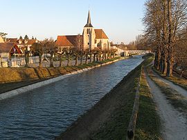
The canal du Loing near Montbouy church Administration Country France Region Centre Department Loiret Arrondissement Montargis Canton Châtillon-Coligny Intercommunality Communauté de communes de Châtillon-Coligny Mayor Yves Boscardin
(2008–2014)Statistics Elevation 102–154 m (335–505 ft) Land area1 26.73 km2 (10.32 sq mi) Population2 732 (2006) - Density 27 /km2 (70 /sq mi) INSEE/Postal code 45210/ 45230 Website montbouy.fr 1 French Land Register data, which excludes lakes, ponds, glaciers > 1 km² (0.386 sq mi or 247 acres) and river estuaries. 2 Population without double counting: residents of multiple communes (e.g., students and military personnel) only counted once. Coordinates: 47°51′43″N 2°49′12″E / 47.862°N 2.82°E
Montbouy is a commune in the Loiret department in north-central France.
Geography
The Aveyron river flows into the Loing in the commune.
See also
Categories:- Communes of Loiret
- Loiret geography stubs
Wikimedia Foundation. 2010.

