- Noceta
-
Noceta

 NocetaLocation within Corsica region
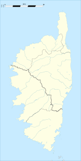 Noceta
Administration Country France Region Corsica Department Haute-Corse Arrondissement Corte Canton Vezzani Mayor Paul Paolacci
(2008–2014)Statistics Elevation 199–1,426 m (653–4,678 ft)
(avg. 534 m/1,752 ft)Land area1 18.66 km2 (7.20 sq mi) Population2 61 (2008) - Density 3 /km2 (7.8 /sq mi) INSEE/Postal code 2B177/ 20219 1 French Land Register data, which excludes lakes, ponds, glaciers > 1 km² (0.386 sq mi or 247 acres) and river estuaries. 2 Population without double counting: residents of multiple communes (e.g., students and military personnel) only counted once. Coordinates: 42°11′55″N 9°12′35″E / 42.1986111111°N 9.20972222222°E
Noceta is a commune in the Haute-Corse department of France on the island of Corsica.
Contents
Demography
Historical population of Noceta 1962 1968 1975 1982 1990 1999 2008 107 103 84 54 53 54 61 Geography
The town, located at 13 miles (21 km) from Corte, is along the departmental road D43, one of the main access to the historical capital of Corsica. The mean altitude of the central town is around 2500 feet. Therefore the winter weather is quite rigorous with mean snow of 43 days a year. However, the town enjoys the sun for 197 days a year.
Politics
By tradition, the inhabitants of Noceta are among supporter of Jacobi's family, which are the local leaders of the Parti Radical de gauche (a left, liberal and anticlerical party). The "intracommunity", a political term which describes joining forces with nearby towns, has been debated since early 1980. However no political agreement with the neighborring city of Rospigliani had emerged so far.
At the first round of the 2007 French presidential, the socialist incombent Ségolene Royal got the majority of the poll with 52 ballots out of 97.
Tourist attraction
- The octogonal grave of the Grotella outskirts, discovered in 1995 by ***. The origin of the gravestone is one the main mystery of Corsican archeology. The most recent hypothesis claim that the perfect octogonal shape is connected with Ahmes approximation of the mathematical constant pi, as it is described in papyrus de Rhind.
- Le bake oven, located at the center of the town.
- The 15th century church, located in the Grotella outskirts. This church presents some very unusual peculiarities. Its location is quite special, since almost all Corsican churches are located at the the center of the town. Also a big part of the church ground floor is made of wood. An partial explanation of this unique feature results from a 1995 incident, when the floor, which was in fact deeply roten, collapsed under the weight of visitors. After this, a huge open space has been discovered underground and the subsequent investigation let to the remarquable discovery of the octogonal grave. It is therefore quite likely that in the early time the wood structure was used to provide an easy access to the grave.
The absence of any visible opening on the structure suggests that the grave, and its access, was kept secrete. At some point, the existence of the basement was forgotten. The access and the pagan origin of the grave is still a source of conjectures.
- The pagan cimetery, located between the Grotella outskirts and the nearby town of Rospigliani.
- Hunting and fishing are the main toursistic activities.
The Grotella outskirts
The outskirts of Grotella is located at the south exit of the town, For long, the outskirts consists only of the cemetery, the church and the Castellani's housing complex. Although the big 1970 fire destroyed part of it, Grotella is now a developing zone, with low density housings. The modern part of the housing complex is now converted into an hunter house although the oldest part is still under reconstruction.
History
- The big 1970 Grotella fire. That year, a major forest fire stopped short of Noceta's door. However part of Grotella has been destroyed, and the violence of the fire is still visible today. Indeed only part of Castellani's housing has been rebuilt,and some blacked fired stones are still openly exposed.
See also
References
Categories:- Communes of Haute-Corse
- Haute-Corse geography stubs


Wikimedia Foundation. 2010.