- Méréglise
-
Méréglise

 Méréglise
Administration Country France Region Centre Department Eure-et-Loir Arrondissement Chartres Canton Illiers-Combray Intercommunality Pays de Combray Mayor Gérard Huet
(2008–2014)Statistics Elevation 155–183 m (509–600 ft)
(avg. 120 m/390 ft)Land area1 4 km2 (1.5 sq mi) Population2 90 (2008) - Density 23 /km2 (60 /sq mi) INSEE/Postal code 28242/ 28120 1 French Land Register data, which excludes lakes, ponds, glaciers > 1 km² (0.386 sq mi or 247 acres) and river estuaries. 2 Population without double counting: residents of multiple communes (e.g., students and military personnel) only counted once. Coordinates: 48°17′27″N 1°11′10″E / 48.2908333333°N 1.18611111111°E
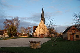
Méréglise is a commune in the Eure-et-Loir department in northern France.
Population
Historical population of Méréglise 1793 1800 1806 1821 1831 1836 1841 1846 1851 1856 130 134 146 115 137 152 163 176 191 190 1861 1866 1872 1876 1881 1886 1891 1896 1901 1906 191 157 144 146 128 141 137 136 144 146 1911 1921 1926 1931 1936 1946 1954 1962 1968 1975 123 118 123 108 106 120 114 72 85 67 1982 1990 1999 2008 65 74 70 90 See also
References
Categories:- Communes of Eure-et-Loir
- Eure-et-Loir geography stubs


Wikimedia Foundation. 2010.