- Benner Township, Pennsylvania
Infobox Settlement
official_name = Benner Township,
Pennsylvania
other_name =
native_name =
nickname =
settlement_type = Township
motto =
imagesize =
image_caption =
flag_size =
image_
seal_size =
image_shield =
shield_size =
city_logo =
citylogo_size =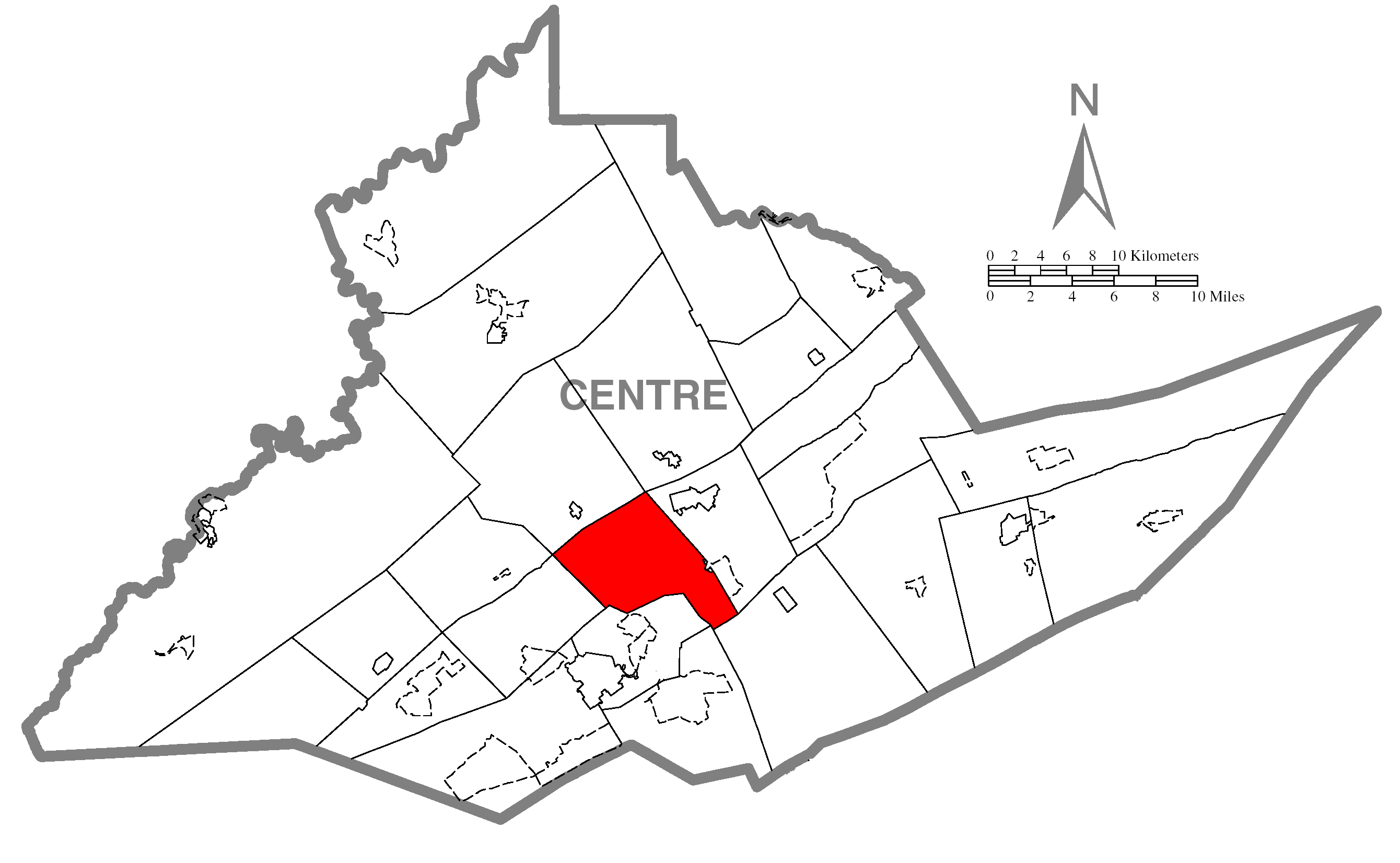
mapsize = 250x200px
map_caption = Map of Centre County, Pennsylvania highlighting Benner Township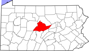
mapsize1 = 250x200px
map_caption1 = Map of Centre County, Pennsylvania
subdivision_type = Country
subdivision_name =United States
subdivision_type1 = State
subdivision_name1 =Pennsylvania
subdivision_type2 = County
subdivision_name2 = Centre
subdivision_type3 =
subdivision_name3 =
subdivision_type4 =
subdivision_name4 =
government_footnotes =
government_type = Board of Supervisors
leader_title = Chair
leader_name = David C. Breon
leader_title1 = Vice-chair
leader_name1 = James Swartzell
leader_title2 = Supervisor
leader_name2 = John Elnitski, Jr.
leader_title3 =
leader_name3 =
leader_title4 =
leader_name4 =
established_title = Settled
established_date = 1793
established_title1 = Incorporated
established_date1 = 1853
area_magnitude =
unit_pref = Imperial
area_footnotes =
area_total_km2 = 73.8
area_land_km2 =
area_water_km2 =
area_total_sq_mi = 28.5
area_land_sq_mi =
area_water_sq_mi =
area_water_percent =
population_as_of = 2000
population_footnotes =
population_note =
population_total = 5217
population_density_km2 = 70.7
population_density_sq_mi = 183.0
timezone = EST
utc_offset = -5
timezone_DST = EDT
utc_offset_DST = -4
elevation_m =
elevation_ft =
postal_code_type =
postal_code =
area_code =
website = [http://benner.centreconnect.org/benner.htm Benner Township]
footnotes =Benner Township is a township in Centre County,
Pennsylvania ,United States . It is part of the State College,Pennsylvania Metropolitan Statistical Area . It is located approximately at coor dms|40|54|48|N|77|45|53|W|city (40.9134, -77.7648)GR|1 along Buffalo Run Road (Pennsylvania Route 550 ), near Bellefonte.The population was 5,217 at the 2000 census.
Geography
According to the
United States Census Bureau , the township has a total area of 28.5square mile s (73.8km² ), all of it land.Benner Township is bordered by Spring Township to the northeast, College Township to the south, Patton Township to the southwest and Union Township to the northwest.
Demographics
As of the
census GR|2 of 2000, there were 5,217 people, 1,324 households, and 932 families residing in the township. Thepopulation density was 183.0 people per square mile (70.7/km²). There were 1,386 housing units at an average density of 48.6/sq mi (18.8/km²). The racial makeup of the township was 76.10% White, 19.84% African American, 0.23% Native American, 0.46% Asian, 0.06% Pacific Islander, 2.86% from other races, and 0.46% from two or more races. Hispanic or Latino of any race were 3.51% of the population.There were 1,324 households out of which 28.2% had children under the age of 18 living with them, 60.9% were married couples living together, 6.3% had a female householder with no husband present, and 29.6% were non-families. 23.9% of all households were made up of individuals and 7.2% had someone living alone who was 65 years of age or older. The average household size was 2.42 and the average family size was 2.89.
In the township the population was spread out with 13.5% under the age of 18, 9.7% from 18 to 24, 44.7% from 25 to 44, 24.3% from 45 to 64, and 7.9% who were 65 years of age or older. The median age was 38 years. For every 100 females there were 222.0 males. For every 100 females age 18 and over, there were 252.2 males.
The median income for a household in the township was $42,083, and the median income for a family was $47,800. Males had a median income of $30,033 versus $23,979 for females. The
per capita income for the township was $17,665. About 0.9% of families and 2.2% of the population were below thepoverty line , including 1.3% of those under age 18 and none of those age 65 or over.Government
Board of Supervisors: David C. Breon (Chairman); James Swartzell (Vice Chairman); John Elnitski, Jr.
Board of Auditors: Thomas Strouse (Chairman); Rory Spangler (Vice Chairman)
Tax Collector: Janet Houser (real estate taxes)
Constable: James Millander
References

Wikimedia Foundation. 2010.