- Upper Makefield Township, Pennsylvania
Geobox Township
name = Upper Makefield Township
native_name =
other_name =
other_name1 =
category = Township
image_size =
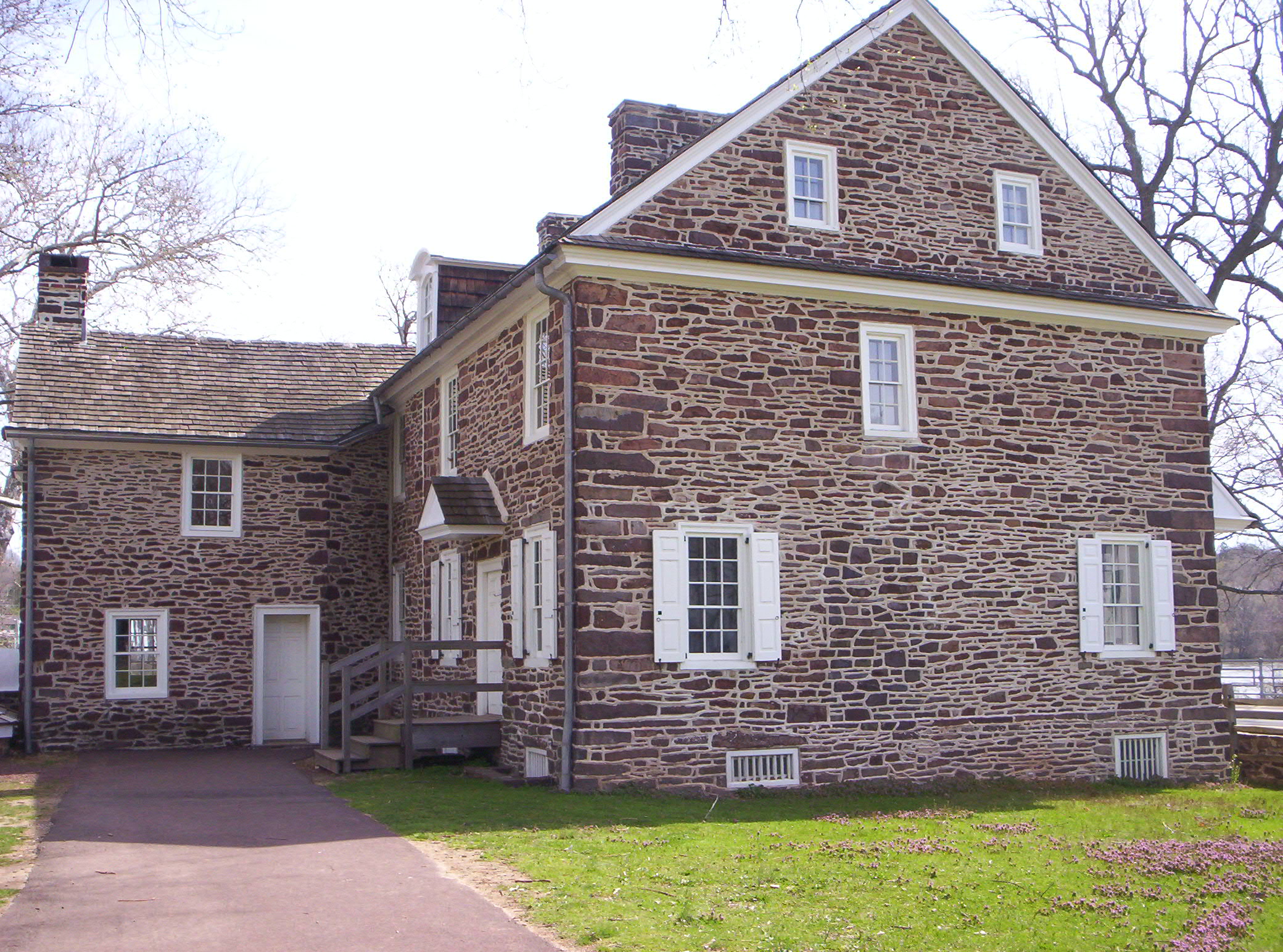
image_caption = McConkey's Ferry Inn atWashington Crossing Historic Park
flag_size =
symbol =
symbol_size =
nickname =
motto =
country = United States
state = Pennsylvania
region = Bucks
region_type = County
district =
area_imperial = 21.5
area_land_imperial = 20.9
area_water_imperial = 0.6
area_water_percentage = auto
area_percentage_round = 2
area_round = 1
location =
lat_d = 40
lat_m = 17
lat_s = 31
lat_NS = N
long_d = 74
long_m = 55
long_s = 27
long_EW = W
elevation_imperial = 161
elevation_round = 1
population_as_of = 2000
population = 7180
population_density_imperial = 343.1
population_density_round = 1
government_type =
government =
established_type =
established =
mayor =
timezone = EST
utc_offset = -5
timezone_DST = EDT
utc_offset_DST = -4
postal_code =
postal_code_type =
area_code = 215
area_code_type =
code2_type =
code2 =
free_type =
free =
free1_type =
free1 =
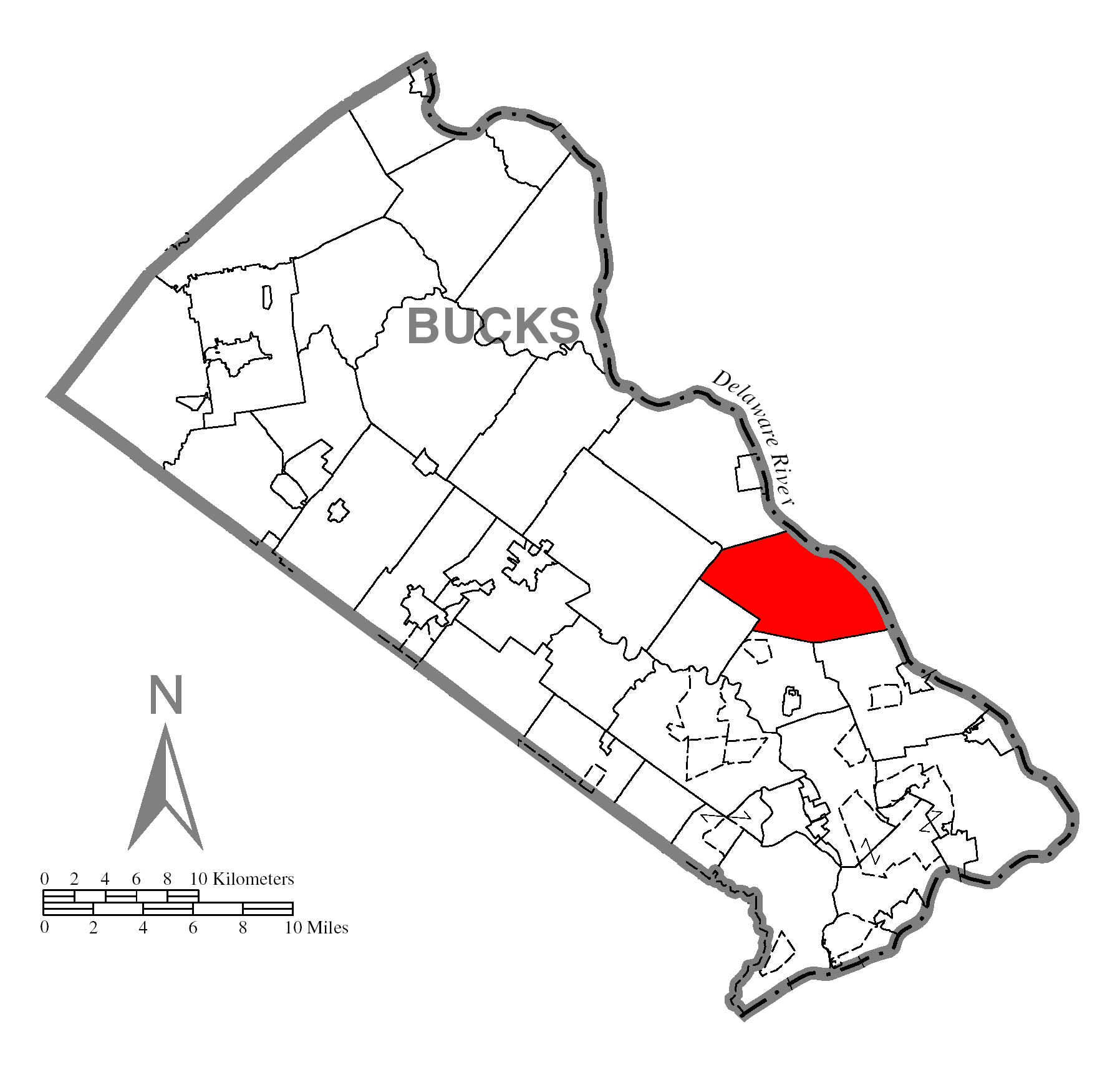
map_caption = Location of Upper Makefield Township in Bucks County
map1 = Pennsylvania Locator Map.png
map1_locator = Pennsylvania
map2 = Map of USA PA.svg
map2_caption = Location of Pennsylvania in the United States
website = http://www.upper-makefield.comUpper Makefield Township is a township in Bucks County,
Pennsylvania ,United States . The population was 7,180 at the 2000 census.Geography
According to the
United States Census Bureau , the township has a total area of 21.5square mile s (55.8km² ), of which, 20.9 square miles (54.2 km²) of it is land and 0.6 square miles (1.6 km²) of it (2.88%) is water.Demographics
As of the
census GR|2 of 2000, there were 7,180 people, 2,512 households, and 2,105 families residing in the township. Thepopulation density was 343.1 people per square mile (132.5/km²). There were 2,598 housing units at an average density of 124.1/sq mi (47.9/km²). The racial makeup of the township was 97.12% White, 0.81% African American, 0.07% Native American, 1.27% Asian, 0.24% from other races, and 0.50% from two or more races. Hispanic or Latino of any race were 1.13% of the population.There were 2,512 households out of which 37.9% had children under the age of 18 living with them, 77.3% were married couples living together, 4.6% had a female householder with no husband present, and 16.2% were non-families. 12.3% of all households were made up of individuals and 3.6% had someone living alone who was 65 years of age or older. The average household size was 2.86 and the average family size was 3.13.
In the township the population was spread out with 26.7% under the age of 18, 5.1% from 18 to 24, 23.3% from 25 to 44, 34.7% from 45 to 64, and 10.2% who were 65 years of age or older. The median age was 42 years. For every 100 females there were 96.7 males. For every 100 females age 18 and over, there were 99.6 males.
The median income for a household in the township was $102,759, and the median income for a family was $114,064. Males had a median income of $90,000 versus $42,365 for females. The
per capita income for the township was $56,288. About 1.6% of families and 2.1% of the population were below thepoverty line , including none of those under age 18 and 1.5% of those age 65 or over.History
George Washington crossed theDelaware River here during theAmerican Revolutionary War .References
External links
* [http://www.upper-makefield.com/ Upper Makefield Township]
* [http://umfc.org/ Upper Makefield Fire Company Home Page]
Wikimedia Foundation. 2010.