- Roaring Spring, Pennsylvania
Infobox Settlement
official_name = Pagename
other_name =
native_name =
nickname =
settlement_type = Borough
motto =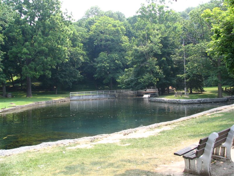
imagesize =
image_caption = The pond in Roaring Spring
flag_size =
image_
seal_size =
image_shield =
shield_size =
image_blank_emblem =
blank_emblem_size =
pushpin_
pushpin_label_position = right
pushpin_map_caption =
pushpin_mapsize =
subdivision_type = Country
subdivision_name =United States
subdivision_type1 = State
subdivision_name1 =Pennsylvania
subdivision_type2 = County
subdivision_name2 = Blair
government_footnotes =
government_type = Borough Council
leader_title = President
leader_name = Ronald Glunt
leader_title1 = Vice-president
leader_name1 = Sue Ann Feather
leader_title2 =
leader_name2 =
leader_title3 =
leader_name3 =
leader_title4 =
leader_name4 =
established_title = Settled
established_date = 1865
established_title1 = Incorporated
established_date1 = 1888
area_magnitude =
unit_pref =
unit_pref = Imperial
area_footnotes =
area_total_km2 = 2.1
area_land_km2 =
area_water_km2 =
area_total_sq_mi = 0.8
area_land_sq_mi =
area_water_sq_mi =
area_water_percent =
population_as_of = 2000
population_footnotes =
population_note =
population_total = 2418
population_density_km2 = 1167.0
population_density_sq_mi = 3020.5
timezone = Eastern (EST)
utc_offset = -5
timezone_DST = EDT
utc_offset_DST = -4
latd = 40
latm = 20
lats = 04
latNS = N
longd = 78
longm = 23
longs = 55
longEW = W
elevation_footnotes =
elevation_m =
elevation_ft =
postal_code_type =Zip code
postal_code = 16673
area_code = 814
website = [http://www.roaringspring.net/ Roaring Spring]
footnotes =Roaring Spring in
Morrison Cove , is aborough Blair County,Pennsylvania ,United States . The population was 2,418 at the 2000 census. It is part of theAltoona, PA Metropolitan Statistical Area .History
Roaring Spring originated as a settlement called Spang Mills, after a grist mill operated by the Spang family. In 1863 the land was sold to Daniel Bare; in 1865 he and others decided to build a paper mill there, which began to operate in 1866 (and is operated there today by Appleton). A foundry and a railroad connection followed, and in 1886 the factory of the Blank Book Company. The borough was incorporated in 1887.
General Information
*ZIP Code: 16673
*Area Code: 814
*Local Phone Exchange: 224Geography
Roaring Spring is located at coor dms|40|20|4|N|78|23|55|W|city (40.334494, -78.398512)GR|1.
According to the
United States Census Bureau , the borough has a total area of 0.8square mile s (2.1km² ), all of it land.The town features a natural spring, which empties out into a pond, which is known to locals as the Spring Dam. The Spring Dam also contains many large fish. The water is very clear, allowing visitors to see all the way to the bottom of the pond.
Education
Roaring Spring is home to the Spring Cove School District Admin. Offices. The school district consists of 3 Elementary Schools (Roaring Spring Elementary, Martinsburg Elementary, and East Freedom Elementary), the Spring Cove Middle School (Roaring Spring), and Central High School (Martinsburg). The district, which serves Taylor, Freedom, Huston, and N. Woodbury Townships as well as the towns or Roaring Spring and Martinsburg, has 1,911 total students with; 636 students at Central High School, 491 students at Spring Cove Middle School, 328 students at Martinsburg Elementary, 264 students at Roaring Spring Elementary, and 192 at East Freedom Elementary.
Demographics
As of the
census GR|2 of 2000, there were 2,418 people, 1,019 households, and 706 families residing in the borough. Thepopulation density was 3,020.5 people per square mile (1,167.0/km²). There were 1,087 housing units at an average density of 1,357.8/sq mi (524.6/km²). The racial makeup of the borough was 98.92% White, 0.17% African American, 0.04% Native American, 0.37% Asian, 0.21% Pacific Islander, 0.04% from other races, and 0.25% from two or more races. Hispanic or Latino of any race were 0.04% of the population. In the 2005 population estimate, Roaring Spring had a total population of 2,309, a 4.5% decrease from the 2000 census.There were 1,019 households out of which 30.3% had children under the age of 18 living with them, 54.1% were married couples living together, 11.3% had a female householder with no husband present, and 30.7% were non-families. 27.2% of all households were made up of individuals and 14.5% had someone living alone who was 65 years of age or older. The average household size was 2.37 and the average family size was 2.88.
In the borough the population was spread out with 22.5% under the age of 18, 9.3% from 18 to 24, 28.0% from 25 to 44, 23.3% from 45 to 64, and 16.8% who were 65 years of age or older. The median age was 38 years. For every 100 females there were 91.9 males. For every 100 females age 18 and over, there were 83.9 males.
The median income for a household in the borough was $35,329, and the median income for a family was $42,370. Males had a median income of $31,643 versus $24,352 for females. The
per capita income for the borough was $17,972. About 8.0% of families and 10.2% of the population were below thepoverty line , including 17.0% of those under age 18 and 9.5% of those age 65 or over.Notable Residents
*
Erika Sifrit (convicted murderer)
*Ronald Mallett (physics professor and time-travel theorist)References
External links
* [http://www.roaringspring.net/ Roaring Spring official website]

Wikimedia Foundation. 2010.