- Logan Township, Blair County, Pennsylvania
Infobox Settlement
official_name = Logan Township, Blair County, Pennsylvania
settlement_type = Township
nickname =
motto =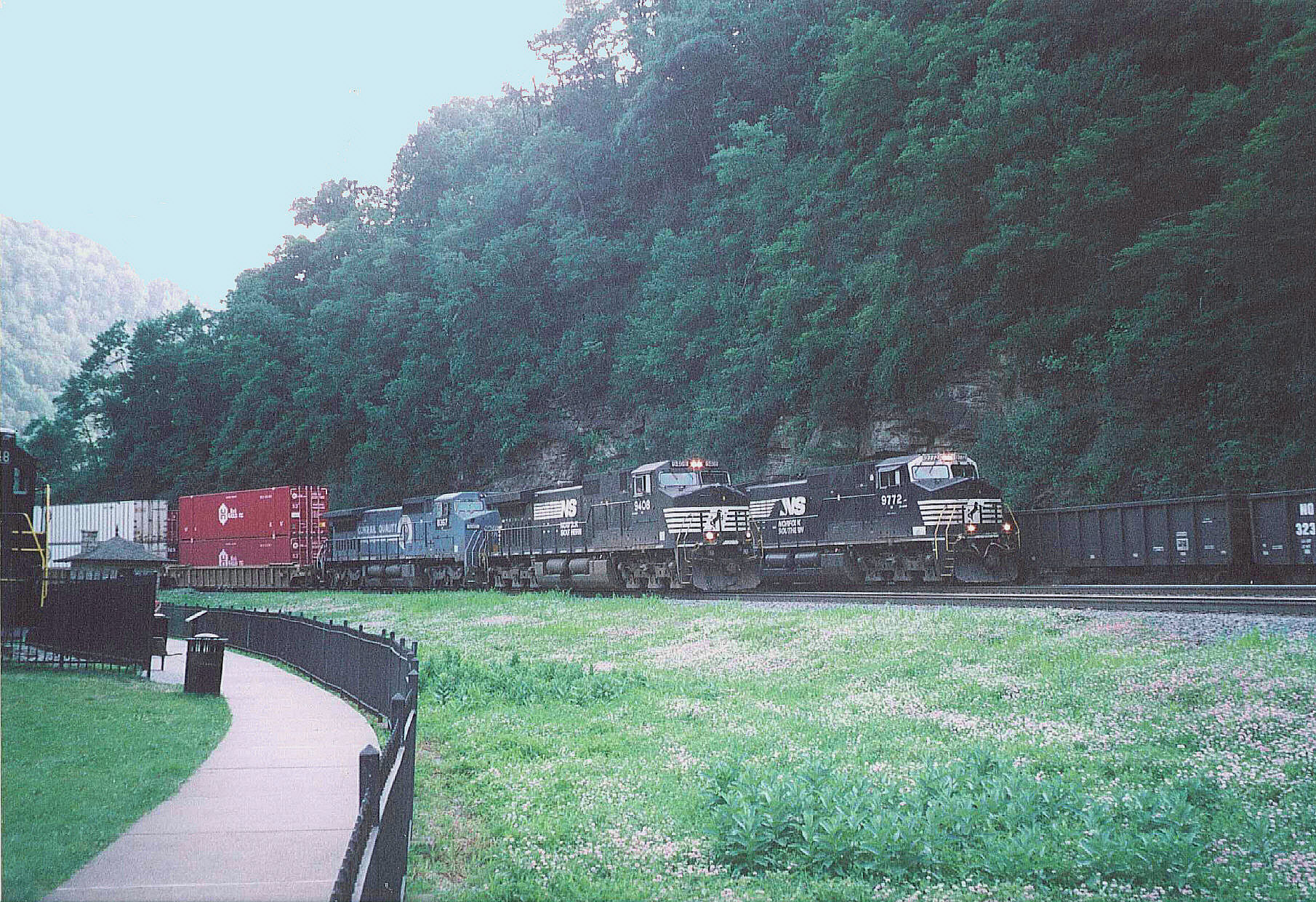
imagesize =
image_caption = Three trains passing on triple-track mainline ofNorfolk Southern Railway at Horseshoe Curve in Logan Township
image_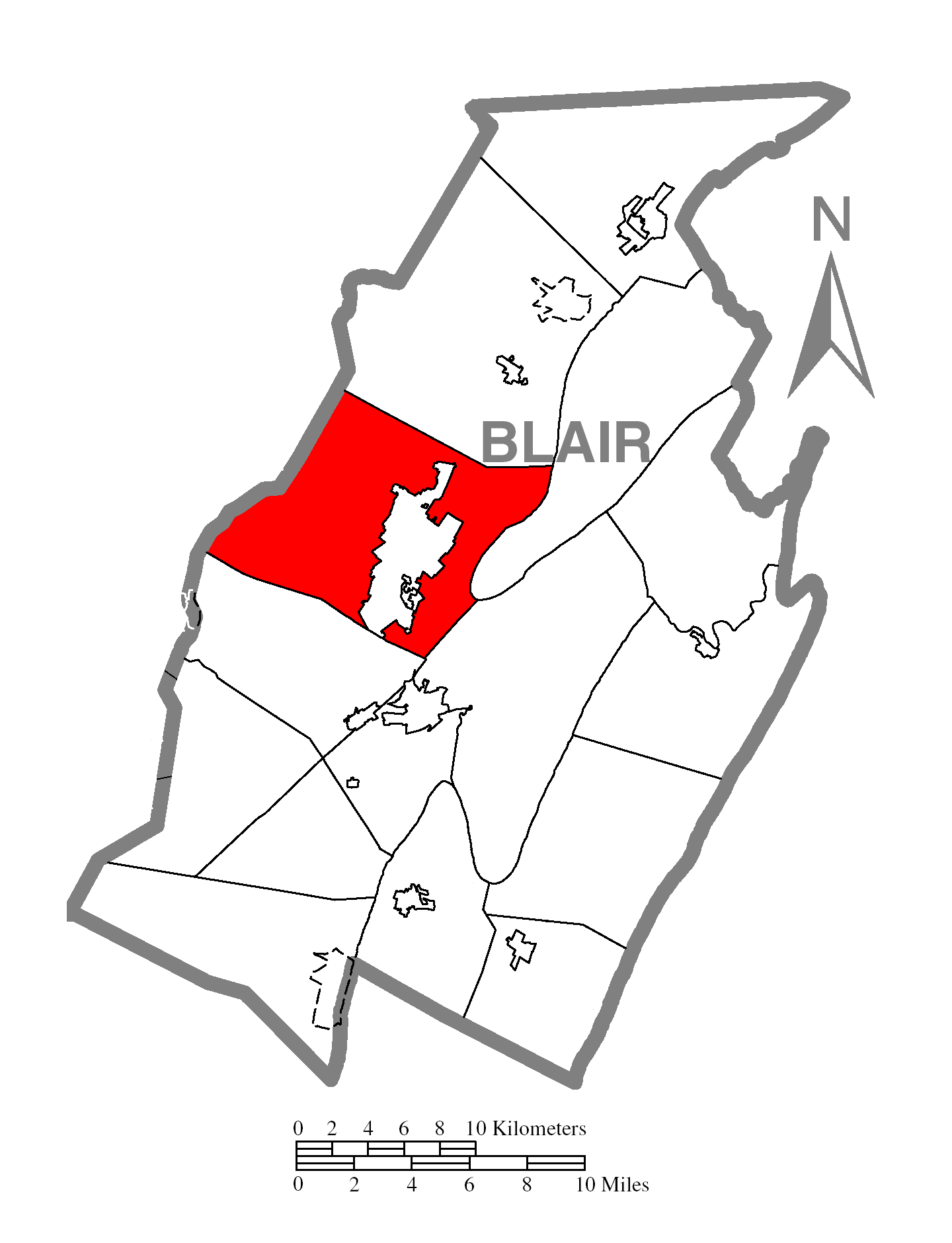
mapsize = 250x200px
map_caption = Map of Blair County, Pennsylvania highlighting Logan Township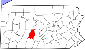
mapsize1 = 250x200px
map_caption1 = Map of Blair County, Pennsylvania
subdivision_type = Country
subdivision_name =United States
subdivision_type1 = State
subdivision_name1 =Pennsylvania
subdivision_type2 = County
subdivision_name2 = Blair
government_footnotes =
government_type = Board of Supervisors
leader_title =
leader_name =
leader_title1 =
leader_name1 =
leader_title2 =
leader_name2 =
established_title = Settled
established_date = 1770
established_title1 = Incorporated
established_date1 = 1850
unit_pref = Imperial
area_footnotes =
area_magnitude =
area_total_km2 = 121.6
area_land_km2 = 120.7
area_water_km2 = 0.9
area_total_sq_mi = 47.0
area_land_sq_mi = 46.6
area_water_sq_mi = 0.4
population_as_of = 2000
population_footnotes =
population_total = 11925
population_density_km2 = 98.8
population_density_sq_mi = 255.8
timezone = Eastern (EST)
utc_offset = -5
timezone_DST = EDT
utc_offset_DST = -4
postal_code_type =
postal_code =
area_code = 814
website =
footnotes =Logan Township is a
Township (United States) in Blair County,
townshipPennsylvania ,United States . It is part of theAltoona, PA Metropolitan Statistical Area . The population was 11,925 at the 2000 census. Logan Township is home to Horseshoe Curve aNational Historic Landmark . [cite map |scale = 1:65,000| publisher= Pennsylvania Department of Transportation, Bureau of Planning and Research, Geographic Information Division
url= ftp://ftp.dot.state.pa.us/public/pdf/BPR_pdf_files/Maps/GHS/Roadnames/blair_GHSN.PDF
title= 2007 General Highway Map Blair County Pennsylvania
accessdate= 2008-04-02 "Note: shows Horseshoe Curve"]General Information
*ZIP Codes: 16601, 16602, 16603
*Area Code: 814
*Local Phone Exchanges: 940, 941, 942, 943, 944, 946, 947, 949Geography
According to the
United States Census Bureau , the township has a total area of 47.0square mile s (121.6km² ), of which, 46.6 square miles (120.7 km²) of it is land and 0.3 square miles (0.9 km²) of it (0.72%) is water.Demographics
As of the
census GR|2 of 2000, there were 11,925 people, 4,728 households, and 3,337 families residing in the township. Thepopulation density was 255.8 people per square mile (98.8/km²). There were 4,975 housing units at an average density of 106.7/sq mi (41.2/km²). The racial makeup of the township was 98.42% White, 0.59% African American, 0.07% Native American, 0.42% Asian, 0.01% Pacific Islander, 0.06% from other races, and 0.44% from two or more races. Hispanic or Latino of any race were 0.40% of the population.There were 4,728 households out of which 27.2% had children under the age of 18 living with them, 57.8% were married couples living together, 9.2% had a female householder with no husband present, and 29.4% were non-families. 24.3% of all households were made up of individuals and 11.1% had someone living alone who was 65 years of age or older. The average household size was 2.48 and the average family size was 2.91.
In the township the population was spread out with 20.5% under the age of 18, 9.5% from 18 to 24, 25.3% from 25 to 44, 27.3% from 45 to 64, and 17.4% who were 65 years of age or older. The median age was 42 years. For every 100 females there were 94.4 males. For every 100 females age 18 and over, there were 91.1 males.
The median income for a household in the township was $36,993, and the median income for a family was $44,772. Males had a median income of $35,000 versus $21,717 for females. The
per capita income for the township was $18,439. About 3.3% of families and 7.3% of the population were below thepoverty line , including 7.1% of those under age 18 and 5.5% of those age 65 or over.References

Wikimedia Foundation. 2010.