Doughboy Island West

Doughboy Island West
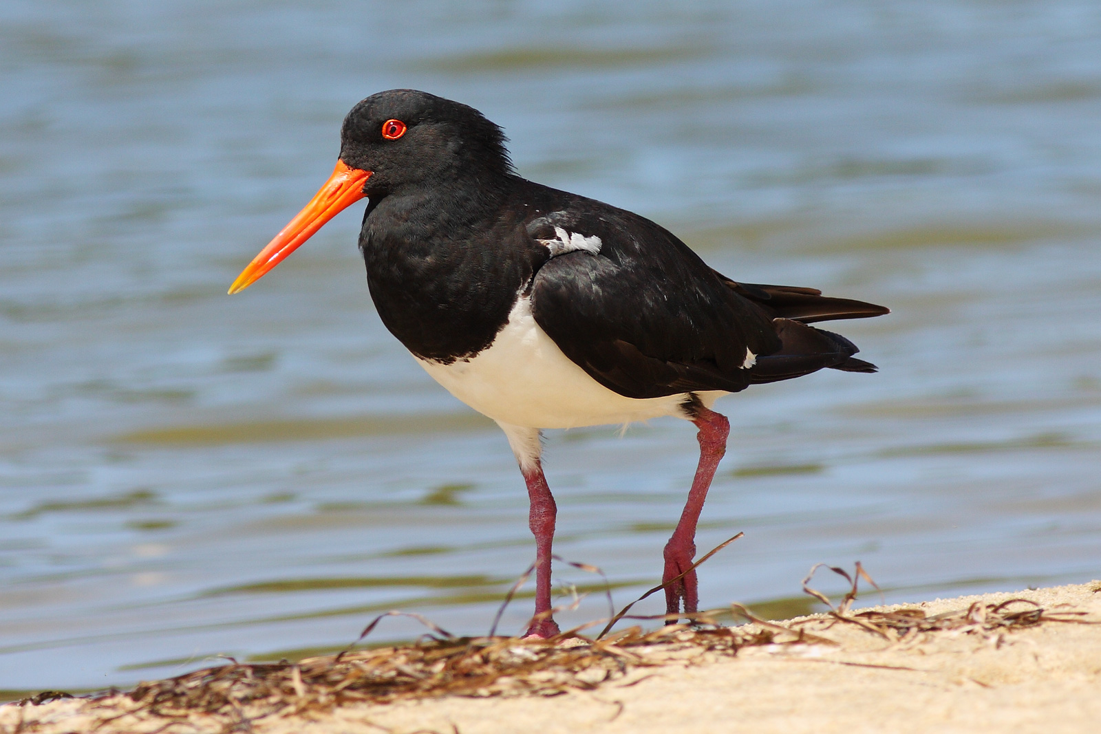
The island is a breeding site for Pied Oystercatchers

Doughboy Island West is an island nature reserve, with an area of 5.4 ha, in south-eastern Australia. It is part of Tasmania’s Trefoil Island Group, lying close to Cape Grim, Tasmania’s most north-westerly point, in Bass Strait.[1]

Fauna

The island forms part of the Hunter Island Group Important Bird Area.[2] Breeding seabird and shorebird species include Short-tailed Shearwater, Fairy Prion, Common Diving-Petrel, Pacific Gull, Silver Gull, Sooty Oystercatcher and Pied Oystercatcher. Reptiles include Metallic Skink.[1]

References

  1. ^ a b Brothers, Nigel; Pemberton, David; Pryor, Helen; & Halley, Vanessa. (2001). Tasmania’s Offshore Islands: seabirds and other natural features. Tasmanian Museum and Art Gallery: Hobart. ISBN 0-7246-4816-X
  2. ^ BirdLife International. (2011). Important Bird Areas factsheet: Hunter Island Group. Downloaded from http://www.birdlife.org on 2011-07-09.

Coordinates: 40°40′S 144°40′E / 40.667°S 144.667°E / -40.667; 144.667


Wikimedia Foundation. 2010.

Игры ⚽ Нужно решить контрольную?

Look at other dictionaries:

  • Doughboy Island — may refer to: Doughboy Island (Tasmania) Doughboy Island East Doughboy Island West This disambiguation page lists articles about distinct geographical locations with the same name. If an …   Wikipedia

  • Doughboy Island East — The island is a breeding site for Fairy Prions Doughboy Island East is an island nature reserve, with an area of 7.01 ha, in south eastern Australia. It is part of Tasmania’s Trefoil Island Group, lying close to Cape Grim, Tasmania’s most north… …   Wikipedia

  • Stewart Island/Rakiura — Stewart Island/RakiuraTerritorial AuthorityNameStewart Island/RakiuraPopulation402 (2006)Land area1,746 km²Regional CouncilNameSouthland Stewart Island / Rakiura is the third largest island of New Zealand. It lies convert|30|km south of South… …   Wikipedia

  • Stewart Island — one of the islands of New Zealand, S of South Island. 329; 670 sq. mi. (1735 sq. km). * * * ▪ island, New Zealand       third largest island of New Zealand, in the southwest Pacific Ocean off the southern tip of South Island. Roughly triangular… …   Universalium

  • List of dual place names in New Zealand — The agreed dual name of Te Koko o Kupe / Cloudy Bay remembers both the Māori and British explorations of New Zealand. Many official place names in New Zealand are dual names, incorporating both the original Māori place names and the English names …   Wikipedia

  • Cape Grim massacre — Das Cape Grim Massaker fand am 10. Februar 1828 im Nordwesten von Van Diemen’s Land (heute bekannt als Tasmanien) statt. Vier Schäfer mit Musketen töteten aus dem Hinterhalt 30 Aborigines vom Clan der Pennemukeer aus Cape Grim und warfen die… …   Deutsch Wikipedia

  • Cape-Grim-Massaker — Das Cape Grim Massaker fand am 10. Februar 1828 im Nordwesten von Van Diemen’s Land (heute bekannt als Tasmanien) statt. Vier Schäfer mit Musketen töteten aus dem Hinterhalt 30 Aborigines vom Clan der Pennemukeer aus Cape Grim und warfen die… …   Deutsch Wikipedia

  • Overton Park — may also refer to the U.S. Supreme Court case, Citizens to Preserve Overton Park v. Volpe Overton Park Historic District U.S. National Register of Historic Places …   Wikipedia

  • Ice Cube — For cubes of ice, see Ice cube. For other uses, see Ice cube (disambiguation). Ice Cube Ice Cube performing in Toronto, 2006. Background information Birth name …   Wikipedia

  • Woodside, Queens — Woodside is a neighborhood in the New York City borough of Queens. It is bordered on the south by Maspeth, on the north by Astoria, on the west by Sunnyside and on the east by Elmhurst and Jackson Heights. Its ZIP code is 11377. Some areas are… …   Wikipedia

Share the article and excerpts

Direct link
Do a right-click on the link above
and select “Copy Link”