- Alexander Creek (Susitna River)
Infobox_River
river_name = Alexander Creek (Susitna River)
image_size =
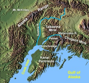
caption = Alexander Creek (Susitna River) inMatanuska-Susitna Borough, Alaska
origin = coord|61|43|53|N|150|52|17|W|region:US-AK_type:river_source:GNIS|name=Alexander Creek (Susitna River) sourceCite gnis|1398098|Alexander Creek (Susitna River)]Alexander Lake (Alaska) , Matanuska-Susitna Borough,Alaska
mouth = coord|61|24|46|N|150|35|51|W|region:US-AK_type:river_source:GNIS|name=Alexander Creek (Susitna River) mouth|display=inline,titleCook Inlet ofPacific Ocean
basin_countries =United States of America
length = convert|35|mi|km
elevation = Unit ft|138|0Cite gnis|1398100|Alexander Lake (Alaska)]
mouth_elevation = Unit ft|26|0
discharge = convert|0|cuft|m3 per second at mouth
watershed = convert|0|sqmi|km2 Alexander Creek, also known as Taguntna Creek, is a stream fromAlexander Lake (Alaska) which merges with the bigSusitna River near the village ofAlexander Creek, Alaska also known as Alexander, Alaska, anAlaska Native andAlaska Bush community, in Matanuska-Susitna Borough,Alaska .Watershed
Alexander Creek is considered a (Wild; and Scenic, Recreation, Fish, Wildlife, and Cultural) river by the
National Park Service cite web
title=Rivers and Trails - Alaska
publisher=Rivers, Trails, and Conservation Assistance Program,National Park Service ,United States Department of the Interior
url=http://www.nps.gov/ncrc/programs/rtca/nri/states/ak.html | format=HTML ] Cref|ACourse
Alexander Creek is convert|35|mi|km long, heads in
Alexander Lake (Alaska) , flows South-East to its confluence withSusitna River atAlexander Creek, Alaska convert|27|mi|km North-West ofAnchorage, Alaska Cook Inlet Low.Natural History
Geology
History
Alexander Creek reported in 1898 by
Eldridge (1900, p. 10),United States Geological Survey .Name
Alexander Creek was also known as Taguntna Creek,and Tuqentnu ("Clearwater Creek") [Cite web
title=Original Alaska Names by the Original People By James Kari and James Fall
publisher=Alaska Fish and Wildlife News,Alaska Department of Fish and Game
url=http://www.wildlifenews.alaska.gov/index.cfm?adfg=wildlife_news.view_article&issue_id=19&articles_id=83
format=HTML ]Economy
Popular river for anglers, particularly for
King Salmon andCoho Salmon . The upper reaches are scenic, with views of theAlaska Range . Class I water encourages high use by beginning floaters. The lower reaches contain native archaeological sites, historic roadhouses, and theIditarod Trail .Lists
Tributaties
From mouth going upstream to the source:
*
*Lower Sucker Creek Coord|61|36|18|N|150|39|35|W|region:US-AK_type:river_source:GNIS|name=Lower Sucker Creek, elevation: convert|112|ft|m [Cite gnis|1405774|Lower Sucker Creek] :*Sucker Lake Coord|61|39|20|N|150|54|14|W|region:US-AK_type:waterbody_source:GNIS|name=Sucker Lake (Alaska), elevation: convert|203|ft|m [Cite gnis|1410296|Sucker Lake (Alaska)] ::*Upper Sucker Creek Coord|61|39|15|N|150|54|26|W|region:US-AK_type:river_source:GNIS|name=Upper Sucker Creek, elevation: convert|203|ft|mCite gnis|1411577|Upper Sucker Creek] :::*Lake Coord|61|34|44|N|151|1|22|W|region:US-AK_type:waterbody_source:GNIS|name=Lake
*
*Alexander Lake (Alaska) Communities
From mouth going upstream to the source:
*Alexander Creek, Alaska also known as Alexander, Alaska
*Dinglishna Hills, Alaska
*Points of Interest
Images and Media
See also
*
List of rivers of Alaska Notes
Cnote|A
Outstandingly Remarkable Values (ORVs)
* Scenery (S): The landscape elements of landform, vegetation, water, color, and related factors result in notable or exemplary visual features and/or attractions. When analyzing scenic values, additional factors -- such as seasonal variations in vegetation, scale of cultural modifications, and the length of time negative intrusions are viewed -- may be considered. Scenery and visual attractions may be highly diverse over the majority of the river or river segment.
* Recreation (R): Recreational opportunities are, or have the potential to be, popular enough to attract visitors from throughout or beyond the region of comparison or are unique or rare within the region. Visitors are willing to travel long distances to use the river resources for recreational purposes. River-related opportunities could include, but are not limited to, sightseeing, wildlife observation, camping, photography, hiking, fishing and boating.:* Interpretive opportunities may be exceptional and attract, or have the potential to attract, visitors from outside the region of comparison.:* The river may provide, or have the potential to provide, settings for national or regional usage or competitive events.
* Geology (G): The river, or the area within the river corridor, contains one or more example of a geologic feature, process or phenomenon that is unique or rare within the region of comparison. The feature(s) may be in an unusually active stage of development, represent a "textbook" example, and/or represent a unique or rare combination of geologic features (erosional, volcanic, glacial, or other geologic structures).
* Fish (F): Fish values may be judged on the relative merits of either fish populations, habitat, or a combination of these river-related conditions.:* Populations: The river is nationally or regionally an important producer of resident and/or anadromous fish species. Of particular significance is the presence of wild stocks and/or federal or state listed (or candidate) threatened, endangered or sensitive species. Diversity of species is an important consideration and could, in itself, lead to a determination of "outstandingly remarkable.":* Habitat: The river provides exceptionally high quality habitat for fish species indigenous to the region of comparison. Of particular significance is habitat for wild stocks and/or federal or state listed (or candidate) threatened, endangered or sensitive species. Diversity of habitats is an important consideration and could, in itself, lead to a determination of "outstandingly remarkable."
* Wildlife (W): Wildlife values may be judged on the relative merits of either terrestrial or aquatic wildlife populations or habitat or a combination of these conditions.:* Populations: The river, or area within the river corridor, contains nationally or regionally important populations of indigenous wildlife species. Of particular significance are species considered to be unique, and/or populations of federal or state listed (or candidate) threatened, endangered or sensitive species. Diversity of species is an important consideration and could, in itself, lead to a determination of "outstandingly remarkable.":* Habitat: The river, or area within the river corridor, provides exceptionally high quality habitat for wildlife of national or regional significance, and/or may provide unique habitat or a critical link in habitat conditions for federal or state listed (or candidate) threatened, endangered or sensitive species. Contiguous habitat conditions are such that the biological needs of the species are met. Diversity of habitats is an important consideration and could, in itself, lead to a determination of "outstandingly remarkable."
* Prehistory (P): The river, or area within the river corridor, contains a site(s) where there is evidence of occupation or use by Native Americans. Sites must have unique or rare characteristics or exceptional human interest value(s). Sites may have national or regional importance for interpreting prehistory; may be rare and represent an area where a culture or cultural period was first identified and described; may have been used concurrently by two or more cultural groups; and/or may have been used by cultural groups for rare sacred purposes. Many such sites are listed on the National Register of Historic Places, which is administered by the NPS.
* History (H): The river or area within the river corridor contains a site(s) or feature(s) associated with a significant event, an important person, or a cultural activity of the past that was rare or one-of-a-kind in the region. Many such sites are listed on the National Register of Historic Places. A historic site(s) and/or features(s) is 50 years old or older in most cases.
* Cultural (C): The river or area within the river corridor contains archaelogical sites or areas significant to traditional cultures. Examples might be American Indian burial grounds, petroglyphs, the oldest known human use site in a region, or streams that support traditional agriculture, subsistence fishing, or religious ceremonies.
* Other Values (O): While no specific national evaluation guidelines have been developed for the "other similar values" category, assessments of additional river-related values consistent with the foregoing guidance may be developed -- including, but not limited to, hydrology, paleontology and botany resources.Cite web
title=National Rivers Inventory - Eligibility - Outstandingly Remarkable Values (ORVs) and Potential Classification
publisher=National Center for Recreation and Conservation,National Park Service ,United States Department of the Interior
url=http://www.nps.gov/ncrc/programs/rtca/nri/eligb.html | format=HTML ]Potential Classification
* Wild rivers (W): Those rivers or sections of rivers that are free of impoundments and generally inaccessible except by trail,with watersheds or shorelines essentially primitive and waters unpolluted. These represent vestiges of primitive America.
* Scenic rivers (S): Those rivers or sections of rivers that are free of impoundments,with shorelines or watersheds still largely primitive and shorelines largely undeveloped, but accessible in places by roads.
* Recreational rivers (R): Those rivers or sections of rivers that are readily accessible by road or railroad,that may have some development along their shorelines, and that may have undergone some impoundment or diversion in the past.References
General references
*cite web
title=Alexander Creek area management plan
publisher=Alaska Department of Natural Resources
url=http://www.dnr.state.ak.us/mlw/planning/areaplans/susitna/pdf/susitna_lowlands_unit_6.pdf
format=PDF External links
*
Wikimedia Foundation. 2010.