- Cedar Hills, Oregon
Infobox Settlement
official_name = Cedar Hills, Oregon
settlement_type = CDP
nickname =
motto =
imagesize =
image_caption =
image_
imagesize =
image_caption =
image_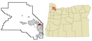
mapsize = 250px
map_caption = Location of Cedar Hills, Oregon
mapsize1 =
map_caption1 =subdivision_type = Country
subdivision_name =United States
subdivision_type1 = State
subdivision_name1 =Oregon
subdivision_type2 = County
subdivision_name2 = Washingtongovernment_footnotes =
government_type =
leader_title =
leader_name =
leader_title1 =
leader_name1 =
established_title =
established_date =unit_pref = Imperial
area_footnotes =area_magnitude =
area_total_km2 = 6.0
area_land_km2 = 6.0
area_water_km2 = 0.0
area_total_sq_mi = 2.3
area_land_sq_mi = 2.3
area_water_sq_mi = 0.0population_as_of = 2000
population_footnotes =
population_total = 8949
population_density_km2 = 1498.4
population_density_sq_mi = 3880.9timezone = Pacific (PST)
utc_offset = -8
timezone_DST = PDT
utc_offset_DST = -7
elevation_footnotes =
elevation_m = 84
elevation_ft = 276
latd = 45 |latm = 30 |lats = 15 |latNS = N
longd = 122 |longm = 48 |longs = 25 |longEW = Wpostal_code_type =
postal_code =
area_code =
blank_name = FIPS code
blank_info = 41-12050GR|2
blank1_name = GNIS feature ID
blank1_info = 1136130GR|3
website =
footnotes =Cedar Hills is a
census-designated place and neighborhood inWashington County, Oregon , near the intersection of highwaysOregon Route 217 and U.S. 26. Cedar Hills was the largest single housing tract development in the western United States at the time of its creation in1961 .Originally located in unincorporated Washington County, part of the neighborhood has since been annexed by the city of Beaverton, and in a plan agreed to by the county and Beaverton the remainder is scheduled for annexation by 2010. This plan is widely opposed by residents of the Cedar Hills neighborhood.
Some of the property within the Cedar Hills neighborhood is subject to the rules and covenants enforced by the [http://www.cedarhillshoa.org/index.htm Homes Association of Cedar Hills] .
The population was 8,949 at the 2000 census.
Geography
Cedar Hills is located at coor dms|45|30|15|N|122|48|25|W|city (45.504272, -122.806926)GR|1.
According to the
United States Census Bureau , the neighborhood has a total area of 2.3square mile s (6.0km² ), of which, 2.3 square miles (6.0 km²) of it is land and 0.43% is water.Demographics
As of the
census GR|2 of 2000, there were 8,949 people, 3,749 households, and 2,361 families residing in the neighborhood. Thepopulation density was 3,880.9 people per square mile (1,495.8/km²). There were 3,926 housing units at an average density of 1,702.6/sq mi (656.2/km²). The racial makeup of the CDP was 83.28% White, 1.32% African American, 0.57% Native American, 4.78% Asian, 0.35% Pacific Islander, 6.05% from other races, and 3.65% from two or more races. Hispanic or Latino of any race were 11.21% of the population.There were 3,749 households out of which 28.9% had children under the age of 18 living with them, 49.4% were married couples living together, 9.8% had a female householder with no husband present, and 37.0% were non-families. 29.0% of all households were made up of individuals and 9.0% had someone living alone who was 65 years of age or older. The average household size was 2.39 and the average family size was 2.94.
In the neighborhood the population was spread out with 23.0% under the age of 18, 7.7% from 18 to 24, 33.4% from 25 to 44, 23.4% from 45 to 64, and 12.5% who were 65 years of age or older. The median age was 36 years. For every 100 females there were 98.4 males. For every 100 females age 18 and over, there were 96.8 males.
The median income for a household in the neighborhood was $48,200, and the median income for a family was $56,401. Males had a median income of $42,293 versus $29,922 for females. The
per capita income for the CDP was $26,812. About 3.9% of families and 6.5% of the population were below thepoverty line , including 7.8% of those under age 18 and 3.0% of those age 65 or over.References
External links
Wikimedia Foundation. 2010.