- Dormans railway station
-
Dormans 
Location Place Dormansland and Dormans Park Local authority Tandridge Operations Station code DMS Managed by Southern Number of platforms 2 Live arrivals/departures and station information
from National Rail EnquiriesAnnual rail passenger usage 2004/05 * 91,825 2005/06 *  92,448
2006/07 * 0.108 million2007/08 * 0.123 million2008/09 *  0.108 million
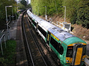
History Opened 10 March 1884 National Rail - UK railway stations A B C D E F G H I J K L M N O P Q R S T U V W X Y Z * Annual passenger usage based on sales of tickets in stated financial year(s) which end or originate at Dormans from Office of Rail Regulation statistics. Please note: methodology may vary year on year. Dormans railway station serves Dormansland and Dormans Park in Surrey, England. Train services from the station are provided by Southern, and the station is on the East Grinstead branch of the Oxted Line.
Service
The typical off-peak service is:
- 2tph (trains per hour) to London Victoria via Oxted
- 2tph to East Grinstead
External links
- Train times and station information for Dormans railway station from National Rail
Preceding station  National Rail
Following station Lingfield Southern
Oxted Line
East Grinstead branchEast Grinstead
TerminusCategories:- Railway stations in Surrey
- Former London, Brighton and South Coast Railway stations
- Railway stations opened in 1884
- Railway stations served by Southern
- DfT Category E stations
- Surrey building and structure stubs
- South East England railway station stubs

Wikimedia Foundation. 2010.