- Hjerkinn Station
Infobox Norwegian station
name = Hjerkinn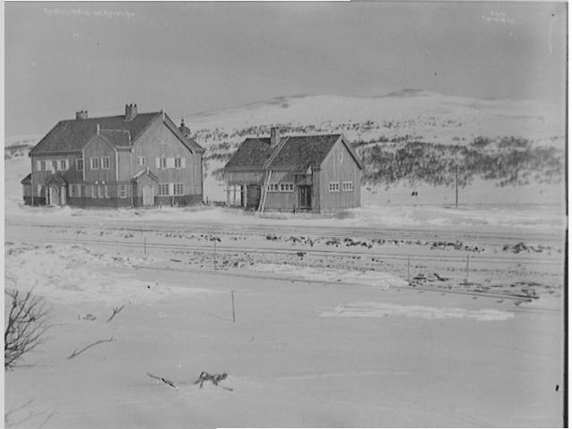
caption =March 8 ,1921
locale =Hjerkinn
municipality =Dovre
line =Dovrebanen
distance = 381.74 km
elevation = 1017.0 m asl
coordinates = coord|63|13|12|N|9|32|27|E|type:railwaystation_region:NO|display=title,inline
start = 1921
architect =
platforms = 2
owner =Jernbaneverket
operator =Norges Statsbaner
t-bane =
line1 =
line2 =
line3 =
line4 =
line5 =
line6 =
airport =
tram =
bus = |Hjerkinn Station is a
railway station located atHjerkinn inDovre ,Norway . The station is located onDovrebanen and served by four daily express trains each direction toOslo andTrondheim . There is no settlement at Hjerkinn, though there is aarmy base as well as the nearbyDovre National Park .The station was opened in 1921 as part of Dovrebanen when it was extended from Dombås to Trondheim. The building has been preserved as a cultural heritage site, but the buildings receive a lot of wear due to the weather. The highest point of Dovrebanen, at 1024 meters, is about one kilometer north of the station.
External links
* [http://www.jernbaneverket.no/jernbanenettet/stasjonssok/stasjonsoversikt/article.jhtml?articleID=1488794 Jernbaneverket page on Berkåk]
Nsb next line
line =Dovrebanen
prestation = Dombås
poststation = KongsvollNsb next express
trondheim = yes
pretrondheim = Dombås
posttrondheim = Kongsvoll
Wikimedia Foundation. 2010.