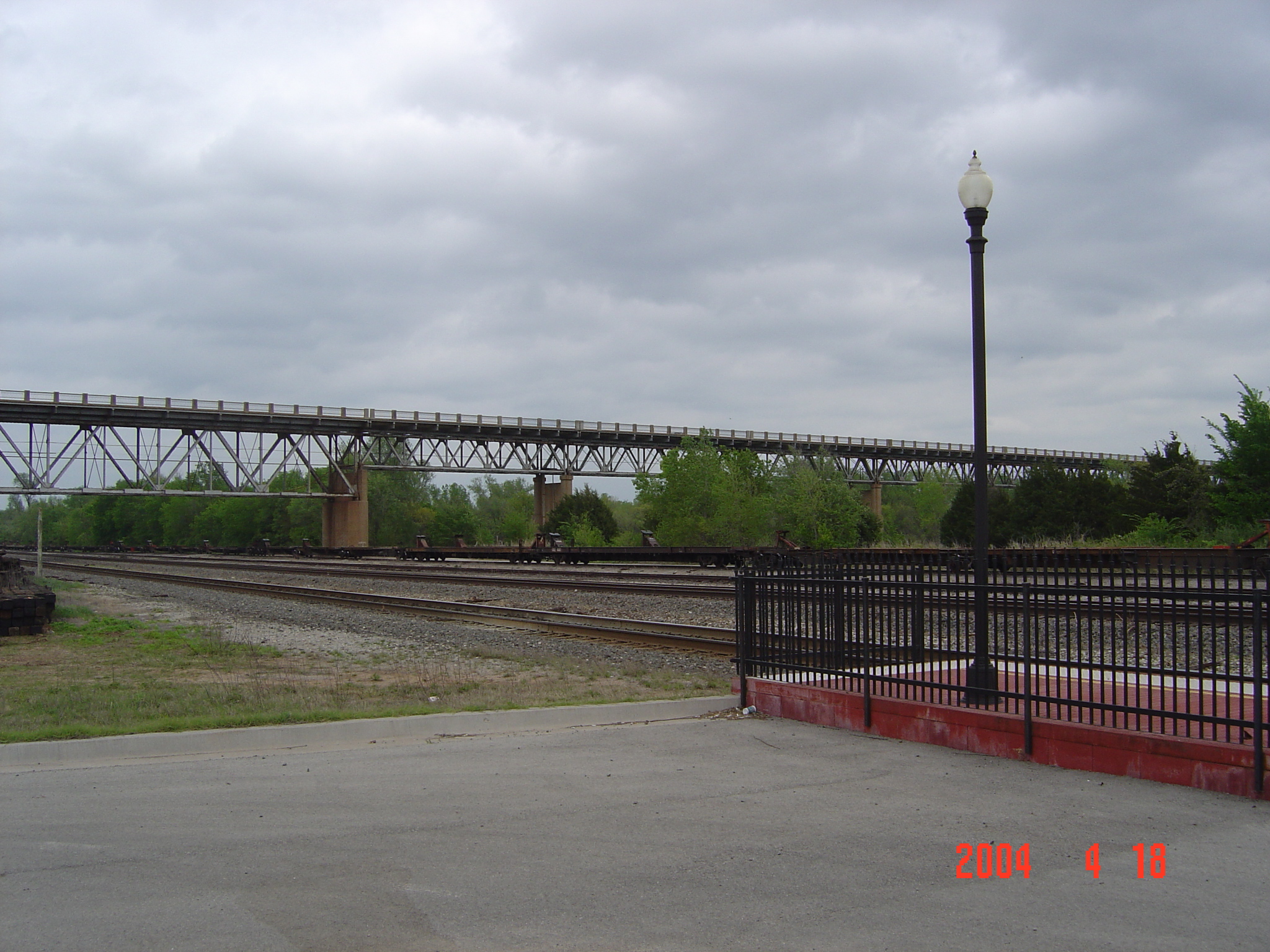
- James C. Nance Memorial Bridge
Infobox_Bridge
bridge_name=James C. Nance Memorial Bridge
caption=The Nance Bridge as seen from the Purcell train station.
official_name=
carries=2 lanes of
crosses=Canadian River
locale=Purcell-Lexington, Oklahoma
maint=Oklahoma Department of Transportation
id=06593
design=Deck truss
mainspan=
length=convert|1110.1|m|ftNational Bridge Inventory, [http://nationalbridges.com/nbi_record.php?StateCode=40&struct=065930000000000] ]
width=
clearance=
below=
traffic=
open= 1938
closed=
toll=
map_cue=
map_
map_text=
map_width=
coordinates=The
James C. Nance Memorial Bridge is adeck truss bridge crossing theCanadian River between Purcell andLexington, Oklahoma . The bridge carries US-77 and State Highway 39 from McClain County to Cleveland County.The 1938 Construction of this bridge, one of the longest in the state, was instrumental in the development of Purcell as a retail and employment hub for the "Heart of Oklahoma" trade area comprised of Purcell, Lexington, Washington, Wayne,Payne, Slaughterville, Dibble, Cole, Wanette, Goldsby, Byars, Paoli and Rosedale.Fact|date=August 2008 Traffic using the bridge allows trade and commerce to freely flow in this retail trade area hub of southern McClain County, southern Cleveland County, Southern Pottawatomie County, and northern area of Garvin County, and eastern portion of Grady county.
The Nance bridge is 1,110.1 meters (3,642 ft) long, making it among the longest in the state.Kinsler, Wes. [http://okbridges.wkinsler.com/canadianbridge3.html U.S. 77 Across the Canadian River] . "Oklahoma Bridges". URL accessed
20 January 2008 .]The bridge was listed in the
National Register of Historic Places on2003-09-02 . [http://www.nr.nps.gov/iwisapi/explorer.dll?IWS_SCHEMA=NRIS1&IWS_LOGIN=1&IWS_REPORT=100000066] , enter "OK" and "McClain"]References
Oklahoma Highway DepartmentState of Oklahoma
Crossings navbox
structure = Crossings
place =Canadian River
bridge = James C. Nance Bridge
bridge signs =
upstream =McCall Bridge
upstream signs =
downstream =Wanette-Byars Bridge
downstream signs =
Wikimedia Foundation. 2010.
