- Terrace Bay, Ontario
Infobox Settlement
official_name = PAGENAME
nickname =
settlement_type =
motto =
imagesize =
image_caption =
flag_size =
image_
seal_size =
image_shield =
shield_size =
image_blank_emblem =
blank_emblem_type =
blank_emblem_size =
mapsize =
map_caption =
mapsize1 =
map_caption1 =
image_dot_
imagesize =
image_caption =
flag_size =
image_
seal_size =
image_shield =
shield_size =
image_blank_emblem =
blank_emblem_type =
blank_emblem_size =
mapsize =
map_caption =
mapsize1 =
map_caption1 =
image_dot_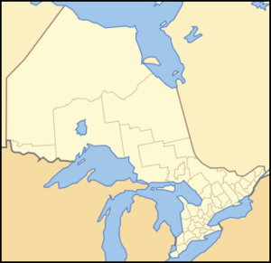
dot_mapsize = 250px
dot_map_caption = Location of PAGENAME
dot_x = 88 |dot_y = 130
pushpin_
pushpin_label_position =
pushpin_map_caption =
pushpin_mapsize =
subdivision_type = Country
subdivision_name =Canada flagicon|Canada
subdivision_type1 = Province
subdivision_name1 =Ontario flagicon|Ontario
subdivision_type2 = Region
subdivision_name2 =Northwestern Ontario
subdivision_type3 = District
subdivision_name3 = Thunder Bay District
government_footnotes =
government_type =
leader_title =
leader_name =
leader_title1 =
leader_name1 =
established_title =
established_date =
area_magnitude =
unit_pref =
area_footnotes =
area_total_km2 =
area_land_km2 =
area_water_km2 =
area_total_sq_mi =
area_land_sq_mi =
area_water_sq_mi =
area_water_percent =
population_as_of = 2006
population_footnotes =
population_note = 1,625
population_total =
population_density_km2 =
population_density_sq_mi =
timezone = EST
utc_offset = -5
timezone_DST = EDT
utc_offset_DST = -4
latd= |latm= |lats= |latNS=
longd= |longm= |longs= |longEW=
elevation_footnotes =
elevation_m =
elevation_ft =
postal_code_type = Postal code span
postal_code = P0T
area_code = 807
website =
footnotes =Terrace Bay is a township in
Thunder Bay District in northernOntario located on the north shore ofLake Superior east of Thunder Bay.The town of Terrace Bay was established when a pulp mill was established here in 1947 by the Longlac Pulp & Paper Company, later Kimberly-Clark Forest Products. The
hydroelectric power for the town came from a diversion of the waters of theKenogami River into theAguasabon River system, also known as the Longlac diversion. Terrace Bay became a municipal township in 1959.An airport (
IATA Airport Code YTJ) and a regional hospital are located in Terrace Bay. It is situated on the southern branch of theTrans-Canada Highway , Highway 17, and on theCanadian Pacific Railway .Terrace Bay offers three elementary schools, a fully equipped high school, and a local library.There's a Senior's centre, Golf Course, Ski Hill and well marked Hiking Trails. An outdoor Pool, Curling rink, and Skating Arena are part of the town's Recreation Centre. The Slate Islands, now a provincial park, are located in Lake Superior within Terrace Bay.
The town's name came from a series of terraces formed as the water level in Lake Superior lowered following the latest
ice age .The town's motto is "The Gem of the North Shore"
According to the
Canada 2006 Census :
*Population: 1,625
*% Change (2001 -2006 ): -16.7
*Dwellings: 838
*Area (km²): 151.24 km²
*Density (persons per km²): 10.8The 2008 Population is estimated at 1,900 people by MPAC.
External links
* [http://www.terracebay.ca Terrace Bay's Website]
* [http://www.terracebay.ca/tourism Terrace Bay Tourism Information]
Wikimedia Foundation. 2010.