- Connecticut Route 114
-
Route 114

Route information Maintained by ConnDOT Length: 7.92 mi[1] (12.75 km) Existed: 1932 – present Major junctions South end:  US 1 in Orange
North end:  Route 63 in Woodbridge
Highway system Routes in Connecticut
Special Service Roads • State Roads←  Route 113
Route 115  →
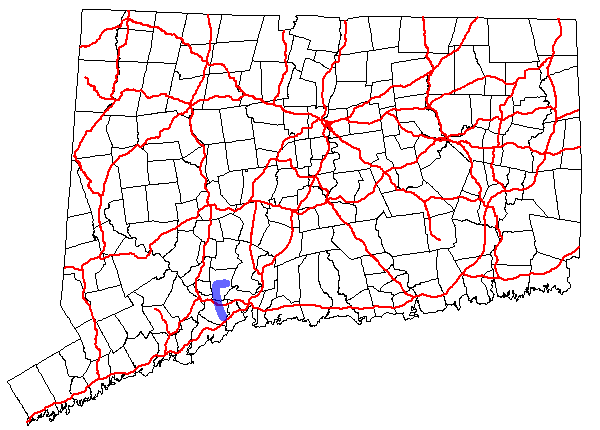
→Route 114 is a Connecticut state highway in the western suburbs of New Haven, running from Orange to Woodbridge.
Contents
Route description
Route 114 begins as Racebrook Road at an intersection with US 1 in Orange and heads north. It intersects with Route 34 in northern Orange 2.3 miles (3.7 km) from the south end and continues northward into the town of Woodbridge. In Woodbridge, it passes over the Wilbur Cross Parkway without a junction, then intersects with Route 243 1.1 miles (1.8 km) later and with Route 313 another 1.4 miles (2.3 km) after that. As Route 114 approaches Woodbridge center, it shifts to Center Road making a sharp right turn then crossing the Wepawaug River. Route 114 continues east for another 1.6 miles (2.6 km) before ending at an intersection with Route 63.[1]
History
Route 114 was established as part of the 1932 state highway renumbering. It originally ran in a "C" pattern within the town of Woodbridge, connecting at both ends with Route 63 (then Route 67) and serving Woodbridge center. The original route used modern Route 114 from its north end until the intersection with Route 243. Then it proceeded east along Route 243 (Ansonia Road/Fountain Street) until it met Route 63 again in the Westville neighborhood of New Haven. In 1951, the southern segment of Route 114 was relocated and extended south to its current terminus at Route 1 using former SR 442. The old alignment became an unsigned state-maintained road (part of reconfigured SR 552).[2]
Junction list
Town Road names Junction Milepost Orange
(3.17 miles)[1]Racebrook Road US 10.00  Route 34
2.34 Woodbridge
(4.75 miles)Racebrook Road,
Center Road Route 243
4.43  Route 313
5.83 Route 637.92 References
Coordinates: 41°18′30″N 73°01′11″W / 41.308245°N 73.0196°W
Categories:- State highways in Connecticut
- Transportation in New Haven County, Connecticut

Wikimedia Foundation. 2010.