- Gmina Mykanów
-
Gmina Mykanów
Mykanów Commune— Gmina — 
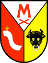
Coat of armsCoordinates (Mykanów): 50°55′N 19°11′E / 50.917°N 19.183°ECoordinates: 50°55′N 19°11′E / 50.917°N 19.183°E Country  Poland
Voivodeship Silesian County Częstochowa County Seat Mykanów Area – Total 140.64 km2 (54.3 sq mi) Population (2006) – Total 13,822 – Density 98.3/km2 (254.5/sq mi) Website http://www.mykanow.pl Gmina Mykanów is a rural gmina (administrative district) in Częstochowa County, Silesian Voivodeship, in southern Poland. Its seat is the village of Mykanów, which lies approximately 14 kilometres (9 mi) north of Częstochowa and 76 km (47 mi) north of the regional capital Katowice.
The gmina covers an area of 140.64 square kilometres (54.3 sq mi), and as of 2006 its total population is 13,822.
Villages
Gmina Mykanów contains the villages and settlements of Adamów, Antoniów, Borowno, Borowno-Kolonia, Cykarzew Północny, Cykarzew Północny-Stacja, Czarny Las, Dudki, Florków, Grabowa, Grabówka, Jamno, Kokawa, Kolonia Wierzchowisko, Kuźnica Kiedrzyńska, Kuźnica Lechowa, Lemańsk, Łochynia, Lubojenka, Lubojna, Mykanów, Nowa Rybna, Nowy Broniszew, Nowy Kocin, Osiny, Pasieka, Przedkocin, Radostków, Radostków-Kolonia, Rusinów, Rybna, Stary Broniszew, Stary Cykarzew, Stary Cykarzew POM, Stary Kocin, Topolów, Tylin, Wierzchowisko, Wola Hankowska and Wola Kiedrzyńska.
Neighbouring gminas
Gmina Mykanów is bordered by the city of Częstochowa and by the gminas of Kłobuck, Kłomnice, Kruszyna, Miedźno, Nowa Brzeźnica and Rędziny.
References

Other villages Adamów • Antoniów • Borowno • Borowno-Kolonia • Cykarzew Północny • Cykarzew Północny-Stacja • Czarny Las • Dudki • Florków • Grabowa • Grabówka • Jamno • Kokawa • Kolonia Wierzchowisko • Kuźnica Kiedrzyńska • Kuźnica Lechowa • Lemańsk • Łochynia • Lubojenka • Lubojna • Nowa Rybna • Nowy Broniszew • Nowy Kocin • Osiny • Pasieka • Przedkocin • Radostków • Radostków-Kolonia • Rusinów • Rybna • Stary Broniszew • Stary Cykarzew • Stary Cykarzew POM • Stary Kocin • Topolów • Tylin • Wierzchowisko • Wola Hankowska • Wola KiedrzyńskaUrban-rural gminas 
Rural gminas Gmina Dąbrowa Zielona • Gmina Janów • Gmina Kamienica Polska • Gmina Kłomnice • Gmina Konopiska • Gmina Kruszyna • Gmina Lelów • Gmina Mstów • Gmina Mykanów • Gmina Olsztyn • Gmina Poczesna • Gmina Przyrów • Gmina Rędziny • Gmina StarczaSeat (not part of the county) Categories:- Gminas in Silesian Voivodeship
- Częstochowa County
Wikimedia Foundation. 2010.
