- Limanköy, Çayeli
Infobox Settlement
settlement_type = Town
subdivision_type = Country
subdivision_name = TUR
timezone=EET
utc_offset=+2
map_caption =Location of PAGENAME within Turkey.
timezone_DST=EEST
utc_offset_DST=+3official_name = Limanköy,
Çayeli 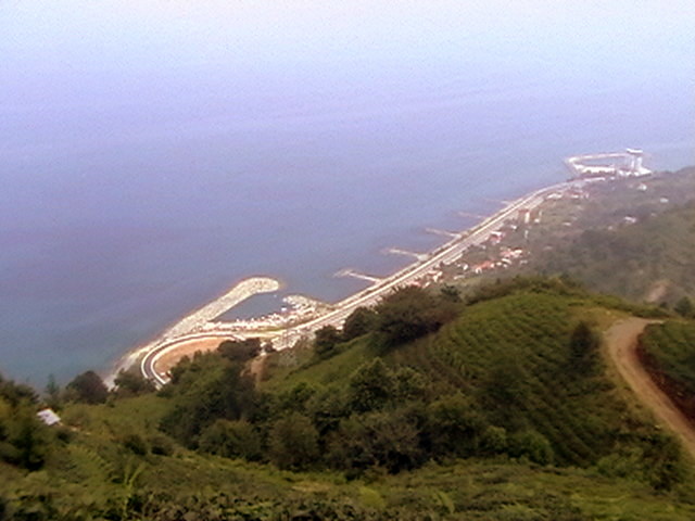
image_caption =
image_blank_emblem =
blank_emblem_type =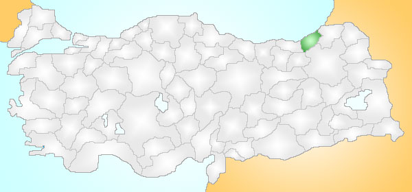
subdivision_type1=Region
subdivision_name1 = Black Sea
subdivision_type2=Province
subdivision_name2 = Rize| population_total = Not
population_as_of = 2000
population_density_km2 =
area_total_km2 = 4
latd = 41
latm = 04
latNS = N
longd = 40
longm = 40
longEW = E
postal_code_type=Postal code
postal_code = 53
area_code = (0090)+ 464 532
blank_info = 53|blank_name=Licence plate
website = http://www.limankoy.netLimankoy District is a town and a district of
Çayeli on theBlack Sea coast of easternTurkey , 6 km west of the city ofÇayeli . There is Limanköy in the east of Büyük Caferpaşa, in the south of Demirhisar and Akpınar.There are a lot ofbeach s. There is a harbour and there are three boathouses. "Çay" means "tea " in Turkish and a large percentage ofTurkey 's tea is indeed grown in this lush green district.Etymology
Limanköy District was formerly known as Artotir.
Geography
Çayeli consists of a narrow coastal strip and a large section of the Black Sea Mountain range which rises steeply and runs parallel to the coast. The Rize mountain section of these mountains reach up to 2,000m here. The local
economy is mainly dependent on tea-growing, along with some sweetcorn, which before tea was planted in the 1940s was the major crop here. The town and the cultivated area are all on the coastal strip, while the mountain hinterland is sparsely populated. Indeed the steepness of these hills is legendary, and celebrated in song; the lateBarış Manço used to sing a version of the local ballad "Çayelunden Öteye Ciderum Yali Yali", which tells of a man so much in love that he was even prepared to haul his household over the mountains of Çayeli.However for anyone who does venture up here the countryside is unspoilt forest and the views from these steep mountainsides are incredible; therefore Çayeli is now attracting visitors on trekking holidays.
The local cuisine includes a dish of large, light-coloured baked beans
Çayeli fasülyesi .The people are conservative, and the municipality is controlled by the
Islamist -leaningAdalet ve Kalkınma Partisi .History
Mapavri was long occupied by the
Laz community, and was part of theRoman Empire and then theEmpire of Trebizond until was brought within theOttoman Empire byMehmet II in 1461, although this coast has always been vulnerable to invaders from across the nearbyCaucasus .In the recent past Çayeli was an impoverished remote region that saw successive generations migrate away to jobs in Turkey's larger cities or abroad. This emigration slowed when tea was planted here in the 1940s.
External links
* [http://www.limankoy.net the Web site]
* [http://www.limankoy.net/liman/Html/mahallemiz.htm the Limanköy Information]
* [http://www.cnnturk.com/Haberim/?CID=508&SID=27&type=i CNN News(1)]
* [http://www.cnnturk.com/Haberim/?CID=500&SID=19&type=i CNN News(2)]
Wikimedia Foundation. 2010.