Gmina Mucharz

Gmina Mucharz
Gmina Mucharz
Mucharz Commune
—  Gmina  —

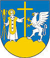
Coat of arms
Coordinates (Mucharz): 49°49′N 19°33′E / 49.817°N 19.55°E / 49.817; 19.55Coordinates: 49°49′N 19°33′E / 49.817°N 19.55°E / 49.817; 19.55
Country  Poland
Voivodeship Lesser Poland
County Wadowice
Seat Mucharz
Area
 – Total 37.32 km2 (14.4 sq mi)
Population (2006)
 – Total 3,878
 – Density 103.9/km2 (269.1/sq mi)
Website http://www.mucharz.pl

Gmina Mucharz is a rural gmina (administrative district) in Wadowice County, Lesser Poland Voivodeship, in southern Poland. Its seat is the village of Mucharz, which lies approximately 9 kilometres (6 mi) south-east of Wadowice and 39 km (24 mi) south-west of the regional capital Kraków.

The gmina covers an area of 37.32 square kilometres (14.4 sq mi), and as of 2006 its total population is 3,878.

Villages

Gmina Mucharz contains the villages and settlements of Jamnik, Jaszczurowa, Koziniec, Mucharz, Skawce, Świnna Poręba and Zagórze.

Neighbouring gminas

Gmina Mucharz is bordered by the gminas of Stryszów, Wadowice and Zembrzyce.

References


Wikimedia Foundation. 2010.

Игры ⚽ Поможем написать курсовую

Look at other dictionaries:

  • Mucharz —   Village   …   Wikipedia

  • Gmina Wadowice — Infobox Settlement name = Gmina Wadowice other name = Wadowice Commune settlement type = Gmina total type = Total image shield = subdivision type = Country subdivision name = POL subdivision type1 = Voivodeship subdivision name1 = Lesser Poland… …   Wikipedia

  • Gmina Stryszów — Infobox Settlement name = Gmina Stryszów other name = Stryszów Commune settlement type = Gmina total type = Total image shield = subdivision type = Country subdivision name = POL subdivision type1 = Voivodeship subdivision name1 = Lesser Poland… …   Wikipedia

  • Gmina Zembrzyce — Infobox Settlement name = Gmina Zembrzyce other name = Zembrzyce Commune settlement type = Gmina total type = Total image shield = subdivision type = Country subdivision name = POL subdivision type1 = Voivodeship subdivision name1 = Lesser Poland …   Wikipedia

  • List of Polish gminas/M — *Gmina Maciejowice (rural, Garwolin County, Masovian Voivodeship, 172.67 km², 7,287) *Gmina Magnuszew (rural, Kozienice County, Masovian Voivodeship, 140.92 km², 6,595) *Gmina Majdan Królewski (rural, Kolbuszowa County, Subcarpathian Voivodeship …   Wikipedia

  • Гмины Малопольского воеводства —     …   Википедия

  • Гмина Мухаж — Gmina Mucharz Герб Файл:Mucharzherb.JPG Страна:  Польша Повят:  Вадовицкий повят Глава:  Вацлав Вондольны Площадь:  37,32 км² Население:  3839 чел …   Википедия

  • Jamnik, Lesser Poland Voivodeship — Infobox Settlement name = Jamnik settlement type = Village total type = image shield = subdivision type = Country subdivision name = POL subdivision type1 = Voivodeship subdivision name1 = Lesser Poland subdivision type2 = County subdivision… …   Wikipedia

  • Jaszczurowa, Lesser Poland Voivodeship — Infobox Settlement name = Jaszczurowa settlement type = Village total type = image shield = subdivision type = Country subdivision name = POL subdivision type1 = Voivodeship subdivision name1 = Lesser Poland subdivision type2 = County subdivision …   Wikipedia

  • Koziniec, Lesser Poland Voivodeship — Infobox Settlement name = Koziniec settlement type = Village total type = image shield = subdivision type = Country subdivision name = POL subdivision type1 = Voivodeship subdivision name1 = Lesser Poland subdivision type2 = County subdivision… …   Wikipedia

Share the article and excerpts

Direct link
Do a right-click on the link above
and select “Copy Link”