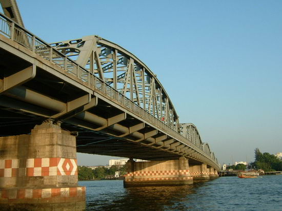
Krung Thon-Brücke — Die Krung Thon Brücke (Thai สะพานกรุงธน) ist eine Brücke über den Fluss Chao Phraya. Sie verbindet die beiden Bezirke (Khet) Dusit und Bang Phlat in Bangkok, der Hauptstadt von Thailand. Die Bauarbeiten begannen am … Deutsch Wikipedia
Rama VIII Bridge — Infobox Bridge bridge name=Rama VIII Bridge caption= official name= carries= 4 lanes of roadway, pedestrians crosses=Chao Phraya River locale= maint= id= design=Cable stayed bridge mainspan=300 m length=2.45 km width= height= load= clearance=… … Wikipedia
Rama VI Bridge — Infobox Bridge bridge name = Rama VI Bridge caption = View from east bank official name = Saphan Phra Ram Hok carries = 2 Railway tracks, pedestrians crosses = Chao Phraya river locale = Bangkok, Thailand maint = id = design = 5 span through… … Wikipedia
Chao Phraya Express Boat — The Chao Phraya Express Boat is a transportation service in Thailand that operates on the Chao Phraya River. It provides riverine express transportation between stops in the capital city of Bangkok and to Nonthaburi, the province immediately to… … Wikipedia
List of bridges — The list of bridges is a link page for any bridges that are notable enough to have an article, or that are likely to have an article in the future.Afghanistan*Afghanistan–Uzbekistan Friendship Bridge *Tajik Afghan Friendship… … Wikipedia
MRT (Bangkok) — Mass Rapid Transit (MRT) Info Owner Mass Rapid Transit Authority of Thailand Locale … Wikipedia
Local Line — RouteThe service runs between Nonthaburi and Wat Rat Singkhon districts in Bangkok. At Sathorn pier in Sathon districts is an interchange, where passengers may change boats or change their transportation to ferry, longtail boat, skytrain and… … Wikipedia
Orange Flag Line — RouteThe service runs between Nonthaburi and Rat Burana districts in Bangkok. At Sathorn pier in Sathon districts is an interchange, where passengers may change boats or change their transportation to ferry, longtail boat, skytrain and… … Wikipedia
Bangkok Metro Orange Line — The Orange MRT line is a planned mass rapid transit line to be built in Bangkok, Thailand.The line will run mostly underground. There are 17 stations planned on this 24 km long line, 14 stations will be underground. The Orange Line is aimed to… … Wikipedia
Royal River Hotel Bangkok (Bangkok) — Royal River Hotel Bangkok country: Thailand, city: Bangkok (Riverside) Royal River Hotel Bangkok Location Located on the eastern bank of the Chao Phraya River, the Royal River Hotel is a luxury on the western, next to Krung Thon Bridge in the… … International hotels

