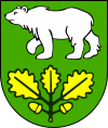
- Gmina Chełm
-
Gmina Chełm
Chełm Commune— Gmina — 
Coat of armsCoordinates (Pokrówka): 51°6′N 23°27′E / 51.1°N 23.45°ECoordinates: 51°6′N 23°27′E / 51.1°N 23.45°E Country  Poland
Voivodeship Lublin County Chełm County Seat Pokrówka Area – Total 221.82 km2 (85.6 sq mi) Population (2006) – Total 12,602 – Density 56.8/km2 (147.1/sq mi) Website http://www.gmina.chelm.pl/ Gmina Chełm is a rural gmina (administrative district) in Chełm County, Lublin Voivodeship, in eastern Poland. Its seat is the village of Pokrówka, which lies approximately 7 kilometres (4 mi) south-west of Chełm and 64 km (40 mi) east of the regional capital Lublin.
The gmina covers an area of 221.82 square kilometres (85.6 sq mi), and as of 2006 its total population is 12,602.
The gmina contains part of the protected area called Chełm Landscape Park.
Villages
Gmina Chełm contains the villages and settlements of Antonin, Depułtycze Królewskie, Depułtycze Królewskie-Kolonia, Henrysin, Horodyszcze, Horodyszcze-Kolonia, Janów, Józefin, Koza-Gotówka, Krzywice, Krzywice-Kolonia, Nowe Depułtycze, Nowiny, Nowosiółki, Nowosiółki-Kolonia, Ochoża-Kolonia, Okszów, Okszów-Kolonia, Parypse, Podgórze, Pokrówka, Rożdżałów, Rożdżałów-Kolonia, Rudka, Srebrzyszcze, Stańków, Stare Depułtycze, Staw, Stołpie, Strupin Duży, Strupin Łanowy, Strupin Mały, Tytusin, Uher, Weremowice, Wojniaki, Wólka Czułczycka, Zagroda, Zarzecze, Zawadówka, Żółtańce and Żółtańce-Kolonia.
Neighbouring gminas
Gmina Chełm is bordered by the city of Chełm and by the gminas of Dorohusk, Kamień, Leśniowice, Rejowiec, Ruda-Huta, Sawin, Siedliszcze, Siennica Różana and Wierzbica.
References

Other villages Antonin • Depułtycze Królewskie • Depułtycze Królewskie-Kolonia • Henrysin • Horodyszcze • Horodyszcze-Kolonia • Janów • Józefin • Koza-Gotówka • Krzywice • Krzywice-Kolonia • Nowe Depułtycze • Nowiny • Nowosiółki • Nowosiółki-Kolonia • Ochoża-Kolonia • Okszów • Okszów-Kolonia • Parypse • Podgórze • Rożdżałów • Rożdżałów-Kolonia • Rudka • Srebrzyszcze • Stańków • Stare Depułtycze • Staw • Stołpie • Strupin Duży • Strupin Łanowy • Strupin Mały • Tytusin • Uher • Weremowice • Wojniaki • Wólka Czułczycka • Zagroda • Zarzecze • Zawadówka • Żółtańce • Żółtańce-KoloniaUrban gmina 
Rural gminas Gmina Białopole • Gmina Chełm • Gmina Dorohusk • Gmina Dubienka • Gmina Kamień • Gmina Leśniowice • Gmina Rejowiec • Gmina Rejowiec Fabryczny • Gmina Ruda-Huta • Gmina Sawin • Gmina Siedliszcze • Gmina Wierzbica • Gmina Wojsławice • Gmina ŻmudźSeat (not part of the county) Categories:- Gminas in Lublin Voivodeship
- Chełm County
Wikimedia Foundation. 2010.
