- Gmina Osielsko
-
Gmina Osielsko
Osielsko Commune— Gmina — 
Flag
Coat of armsLocation within the county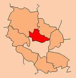
Coordinates (Osielsko): 53°11′N 18°4′E / 53.183°N 18.067°ECoordinates: 53°11′N 18°4′E / 53.183°N 18.067°E Country  Poland
Voivodeship Kuyavian-Pomeranian County Bydgoszcz County Seat Osielsko Area – Total 102.89 km2 (39.7 sq mi) Population (2006) – Total 8,917 – Density 86.7/km2 (224.5/sq mi) Website http://www.osielsko.pl/ Gmina Osielsko is a rural gmina (administrative district) in Bydgoszcz County, Kuyavian-Pomeranian Voivodeship, in north-central Poland. Its seat is the village of Osielsko, which lies approximately 9 kilometres (6 mi) north-east of Bydgoszcz.
The gmina covers an area of 102.89 square kilometres (39.7 sq mi), and as of 2006 its total population is 8,917.
Villages
Gmina Osielsko contains the villages and settlements of Bożenkowo, Czarnówczyn, Jagodowo, Jarużyn, Jarużyn-Kolonia, Maksymilianowo, Myślęcinek, Niemcz, Niwy, Osielsko, Strzelce Leśne, Wilcze and Żołędowo.
Neighbouring gminas
Gmina Osielsko is bordered by the city of Bydgoszcz and by the gminas of Dobrcz, Koronowo and Sicienko.
References

Other villages Bożenkowo • Czarnówczyn • Jagodowo • Jarużyn • Jarużyn-Kolonia • Maksymilianowo • Myślęcinek • Niemcz • Niwy • Strzelce Leśne • Wilcze • ŻołędowoUrban-rural gminas 
Rural gminas Gmina Białe Błota • Gmina Dąbrowa Chełmińska • Gmina Dobrcz • Gmina Nowa Wieś Wielka • Gmina Osielsko • Gmina SicienkoSeat Categories:- Gminas in Kuyavian-Pomeranian Voivodeship
- Bydgoszcz County


Wikimedia Foundation. 2010.