- Redings Mill, Missouri
Infobox Settlement
official_name = Redings Mill, Missouri
settlement_type = Village
nickname =
motto =
imagesize =
image_caption =
image_
imagesize =
image_caption =
image_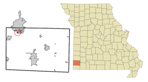
mapsize = 250px
map_caption = Location of Redings Mill, Missouri
mapsize1 =
map_caption1 =subdivision_type = Country
subdivision_name =United States
subdivision_type1 = State
subdivision_name1 =Missouri
subdivision_type2 = County
subdivision_name2 = Newton
government_footnotes =
government_type =
leader_title =
leader_name =
leader_title1 =
leader_name1 =
established_title =
established_date =unit_pref = Imperial
area_footnotes =area_magnitude =
area_total_km2 = 0.5
area_land_km2 = 0.5
area_water_km2 = 0.0
area_total_sq_mi = 0.2
area_land_sq_mi = 0.2
area_water_sq_mi = 0.0population_as_of = 2000
population_footnotes =
population_total = 159
population_density_km2 = 298.5
population_density_sq_mi = 773.1timezone = Central (CST)
utc_offset = -6
timezone_DST = CDT
utc_offset_DST = -5
elevation_footnotes =
elevation_m = 321
elevation_ft = 1053
latd = 37 |latm = 1 |lats = 9 |latNS = N
longd = 94 |longm = 31 |longs = 1 |longEW = Wpostal_code_type =
postal_code =
area_code =
blank_name = FIPS code
blank_info = 29-60986GR|2
blank1_name = GNIS feature ID
blank1_info = 0729953GR|3
website =
footnotes =Redings Mill is a
village in Newton County,Missouri ,United States . The population was 159 at the 2000 census.History
Redings Mill was named for
millwright John S. Reding (1816-1892). He built the first mill in Newton County prior to the Confederate War. cite web |title=A Directory of Towns, Villages, and Hamlets Past and Present of Newton County, Missouri |first=Arthur Paul |last=Moser |work=TheLibrary.org |url=http://thelibrary.org/lochist/moser/newtonpl.html |date= |accessdate=2007-09-03]Geography
Redings Mill is located at coor dms|37|1|9|N|94|31|1|W|city (37.019111, -94.516906)GR|1.
According to the
United States Census Bureau , the village has a total area of 0.2square mile s (0.5km² ), all of it land.Demographics
As of the
census GR|2 of 2000, there were 159 people, 69 households, and 44 families residing in the village. Thepopulation density was 773.1 people per square mile (292.3/km²). There were 76 housing units at an average density of 369.5/sq mi (139.7/km²). The racial makeup of the village was 91.19% White, 5.03% Native American, 0.63% Pacific Islander, and 3.14% from two or more races. Hispanic or Latino of any race were 1.89% of the population.There were 69 households out of which 31.9% had children under the age of 18 living with them, 52.2% were married couples living together, 13.0% had a female householder with no husband present, and 34.8% were non-families. 29.0% of all households were made up of individuals and 8.7% had someone living alone who was 65 years of age or older. The average household size was 2.30 and the average family size was 2.91.
In the village the population was spread out with 23.3% under the age of 18, 6.9% from 18 to 24, 27.0% from 25 to 44, 32.1% from 45 to 64, and 10.7% who were 65 years of age or older. The median age was 41 years. For every 100 females there were 87.1 males. For every 100 females age 18 and over, there were 82.1 males.
The median income for a household in the village was $35,938, and the median income for a family was $45,313. Males had a median income of $30,417 versus $27,500 for females. The
per capita income for the village was $18,629. None of the families and 4.6% of the population were living below thepoverty line .References
External links
Wikimedia Foundation. 2010.