- Guide Rock, Nebraska
Infobox Settlement
official_name = Guide Rock, Nebraska
settlement_type = Village
nickname =
motto =
imagesize =
image_caption =
image_
imagesize =
image_caption =
image_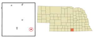
mapsize = 250px
map_caption = Location of Guide Rock, Nebraska
mapsize1 =
map_caption1 =subdivision_type = Country
subdivision_name =United States
subdivision_type1 = State
subdivision_name1 =Nebraska
subdivision_type2 = County
subdivision_name2 = Webster
government_footnotes =
government_type =
leader_title =
leader_name =
leader_title1 =
leader_name1 =
established_title =
established_date =unit_pref = Imperial
area_footnotes =area_magnitude =
area_total_km2 = 1.3
area_land_km2 = 1.3
area_water_km2 = 0.0
area_total_sq_mi = 0.5
area_land_sq_mi = 0.5
area_water_sq_mi = 0.0population_as_of = 2000
population_footnotes =
population_total = 245
population_density_km2 = 187.5
population_density_sq_mi = 485.7timezone = Central (CST)
utc_offset = -6
timezone_DST = CDT
utc_offset_DST = -5
elevation_footnotes =
elevation_m = 508
elevation_ft = 1667
latd = 40 |latm = 4 |lats = 23 |latNS = N
longd = 98 |longm = 19 |longs = 51 |longEW = Wpostal_code_type =
ZIP code
postal_code = 68942
area_code = 402
blank_name = FIPS code
blank_info = 31-20365GR|2
blank1_name = GNIS feature ID
blank1_info = 0829718GR|3
website =
footnotes =Guide Rock is a village in Webster County,
Nebraska ,United States . The population was 245 at the 2000 census. The town was the first settlement in Webster County, with the first white settlers arriving in 1870. The town was named after a rocky bluff on the opposite bank of theRepublican River . A historical marker near the village marks the former site of a largePawnee village.Geography
Guide Rock is located at coor dms|40|4|23|N|98|19|51|W|city (40.073032, -98.330931)GR|1.
According to the
United States Census Bureau , the village has a total area of 0.5square mile s (1.3km² ), all of it land.Demographics
As of the
census GR|2 of 2000, there were 245 people, 133 households, and 69 families residing in the village. Thepopulation density was 485.7 people per square mile (189.2/km²). There were 162 housing units at an average density of 321.2/sq mi (125.1/km²). The racial makeup of the village was 98.78% White, and 1.22% from two or more races.There were 133 households out of which 15.0% had children under the age of 18 living with them, 42.1% were married couples living together, 8.3% had a female householder with no husband present, and 47.4% were non-families. 43.6% of all households were made up of individuals and 18.0% had someone living alone who was 65 years of age or older. The average household size was 1.84 and the average family size was 2.51.
In the village the population was spread out with 15.1% under the age of 18, 7.3% from 18 to 24, 24.9% from 25 to 44, 26.5% from 45 to 64, and 26.1% who were 65 years of age or older. The median age was 47 years. For every 100 females there were 97.6 males. For every 100 females age 18 and over, there were 98.1 males.
The median income for a household in the village was $20,250, and the median income for a family was $26,500. Males had a median income of $22,250 versus $18,750 for females. The
per capita income for the village was $18,981. About 13.2% of families and 17.8% of the population were below thepoverty line , including 17.0% of those under the age of eighteen and 3.8% of those sixty five or over.References
External links
* [http://www.kancoll.org/books/andreas_ne/webster/webster-p3.html history of Guide Rock]
Wikimedia Foundation. 2010.