- Chillianwala
-
Chellianwala 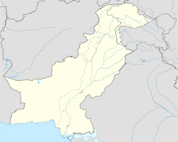
 Chellianwala
Coordinates: 32°23′N 73°22′E / 32.39°N 73.36°E Country  Pakistan
Province Punjab Government – Imran Sharif Area – Total 15 km2 (5.8 sq mi) Elevation 218 m (715 ft) Population – Total 15,000 Time zone PST (UTC+5) Calling code 0546-589, 0546-590 File:Monument of the Battle of Chellianwala (Cross).jpgThe monument of the Battle of Chellianwala is positioned near the graveyards to honor the fallen soldiersChellianwala is a town and union council of Mandi Bahauddin District in the Punjab province of Pakistan.[1] It is located at 32°39'0N 73°36'0E at an altitude of 218 metres (718 feet) and lies to the north-east of the district capital Mandi Bahauddin.[2] It is famous for being the location of the Battle of Chellianwala that took place in 1849 between the forces of the Sikh Khalsa army and the [[British Army ]].
The most notable thing in the centre of the village is two graveyards which are both deeply respected by the citizens of Chellianwala, a few lakh rupees have been donated by provincial government with the efforts of ex-chairman Chellianwala CH Nasir Ahmed son of CH Ghulam Ahmad, and efforts are still being put in to highlight its historical importance and military significance, this has so far been a success.
History
Chellianwala is one of the largest villages in Pakistan. Before 1992, it was part of District Gujrat, but now a part of Mandi Bahauddin. Chellianwala is culturaly very rich. It has its own traditions and values, which are very different from other villages in the area. The Battle of Chellianwala is what the village is most known for .
References
Coordinates: 32°39′0″N 73°36′0″E / 32.65°N 73.6°E
Categories:- Union councils of Mandi Bahauddin District
- Populated places in Mandi Bahauddin District
- Punjab, Pakistan geography stubs

Wikimedia Foundation. 2010.