- Bethel, Missouri
Infobox Settlement
official_name = Bethel, Missouri
settlement_type = Village
nickname =
motto =
imagesize =
image_caption =
image_
imagesize =
image_caption =
image_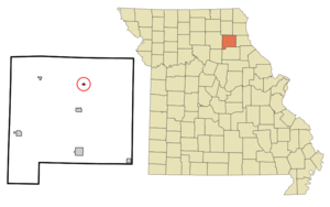
mapsize = 250px
map_caption = Location of Bethel, Missouri
mapsize1 =
map_caption1 =subdivision_type = Country
subdivision_name =United States
subdivision_type1 = State
subdivision_name1 =Missouri
subdivision_type2 = County
subdivision_name2 = Shelby
government_footnotes =
government_type =
leader_title =
leader_name =
leader_title1 =
leader_name1 =
established_title =
established_date =unit_pref = Imperial
area_footnotes =area_magnitude =
area_total_km2 = 0.4
area_land_km2 = 0.4
area_water_km2 = 0.0
area_total_sq_mi = 0.1
area_land_sq_mi = 0.1
area_water_sq_mi = 0.0population_as_of = 2000
population_footnotes =
population_total = 121
population_density_km2 = 330.7
population_density_sq_mi = 856.5timezone = Central (CST)
utc_offset = -6
timezone_DST = CDT
utc_offset_DST = -5
elevation_footnotes =
elevation_m = 218
elevation_ft = 715
latd = 39 |latm = 52 |lats = 38 |latNS = N
longd = 92 |longm = 1 |longs = 28 |longEW = Wpostal_code_type =
ZIP code
postal_code = 63434
area_code = 660
blank_name = FIPS code
blank_info = 29-05104GR|2
blank1_name = GNIS feature ID
blank1_info = 0714027GR|3
website =
footnotes =Bethel is a village in Shelby County,
Missouri ,United States . The population was 121 at the 2000 census.History
Bethel was founded in 1844 by Dr
William Keil (1811 - 1877), aPrussia n-born preacher who had been a member of theMethodist church. By 1850, Bethel had a population of 650. However, the construction of theHannibal & St. Joseph Railroad threatened histheocracy . In 1855, he led his followers westward over theOregon Trail , to eventually settleAurora, Oregon .Geography
Bethel is located at coor dms|39|52|38|N|92|1|28|W|city (39.877205, -92.024433)GR|1.
According to the
United States Census Bureau , the village has a total area of 0.1square mile s (0.4km² ), all of it land.Demographics
As of the
census GR|2 of 2000, there were 121 people, 56 households, and 31 families residing in the village. Thepopulation density was 856.5 people per square mile (333.7/km²). There were 77 housing units at an average density of 545.0/sq mi (212.4/km²). The racial makeup of the village was 98.35% White, and 1.65% from two or more races.There were 56 households out of which 26.8% had children under the age of 18 living with them, 44.6% were married couples living together, 10.7% had a female householder with no husband present, and 44.6% were non-families. 42.9% of all households were made up of individuals and 17.9% had someone living alone who was 65 years of age or older. The average household size was 2.16 and the average family size was 3.03.
In the village the population was spread out with 24.0% under the age of 18, 10.7% from 18 to 24, 24.0% from 25 to 44, 25.6% from 45 to 64, and 15.7% who were 65 years of age or older. The median age was 40 years. For every 100 females there were 112.3 males. For every 100 females age 18 and over, there were 80.4 males.
The median income for a household in the village was $22,083, and the median income for a family was $53,750. Males had a median income of $22,292 versus $21,000 for females. The
per capita income for the village was $13,958. There were no families and 6.8% of the population living below thepoverty line , including no under eighteens and 42.9% of those over 64.References
External links
Wikimedia Foundation. 2010.