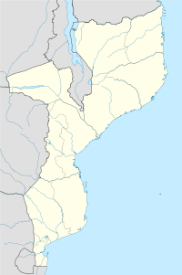
Marromeu — es una población de la provincia de Sofala, Mozambique, en la orilla derecha del río Zambeze (18°16′S 35°53′E / 18.267, 35.883). Da nombre al Parque Nacional Marromeu … Wikipedia Español
Marromeu — es una población de la provincia de Sofala, Mozambique, en la orilla derecha del río Zambeze (). Da nombre al Parque Nacional Marromeu. La Agencia Multilateral para Garantías de Inversión (MIGA), dependiente del Banco Mundial, subencionó un… … Enciclopedia Universal
Marromeu District — is a district of Sofala Province in Mozambique. The principal town is Marromeu. Further reading District profile (PDF) … Wikipedia
Marromeu (distrito) — 18°17′S 35°56′E / 18.283, 35.933 Marromeu es una villa y también uno de los doce distritos que forman la provincia de Sofala en el centro este de Mozambique, región costera en el … Wikipedia Español
Francisco Dique Sousa — was in many respects the organizer of The Church of Jesus Christ of Latter day Saints (LDS Church) in Mozambique. Sousa s son in law, Chico Mapenda, had joined the LDS Church while studying in the German Democratic Republic. In 1990, when Germany … Wikipedia
Transport in Mozambique — Railways total: 3,123 km narrow gauge: 2,983 km 1.067 m gauge; narrow gauge: 140 km 0.762 m gauge (2005)* The railways do not all interconnect. Railway links to adjacent countries * Malawi expected to be operative by 2009 * South Africa under… … Wikipedia
Zambezi — Infobox River river name = Zambezi caption = The Zambezi and its river basin origin = Near Mwinilunga, Zambia mouth = Indian Ocean basin countries = Zambia, DR Congo, Angola, Namibia, Botswana, Zimbabwe, Mozambique, Malawi, Tanzania length =… … Wikipedia
List of conservation areas of Mozambique — Below is a list of conservation areas in Mozambique. Contents 1 Transfrontier Parks 2 Transfrontier Conservation Areas 3 National Parks 4 Reserves … Wikipedia
Railway stations in Mozambique — include:These problems were solved but the biggest headache of all remains CDN has failed to rehabilitate the branch line from Cuamba to Lichinga, capital of the northernmost province of Niassa, and there is still no regular train service to… … Wikipedia
Mozambique — /moh zam beek , zeuhm /, n. 1. Formerly, Portuguese East Africa. a republic in SE Africa: formerly an overseas province of Portugal; gained independence in 1975. 18,165,476; 297,731 sq. mi. (771,123 sq. km). Cap.: Maputo. 2. a seaport on an… … Universalium
 Mozambique
