- Florida State Parks in Alachua County
Alachua County, Florida is home to six state parks. Two of them are also
National Natural Landmark s, one is a historic district, one is aNational Historic Landmark , and one is aRail trail . Unless otherwise noted, all of the parks adhere to theFlorida State Parks schedule; FLparkhrsDevil's Millhopper Geological State Park
Infobox_protected_area | name = Devil's Millhopper Geological State Park
iucn_category = V
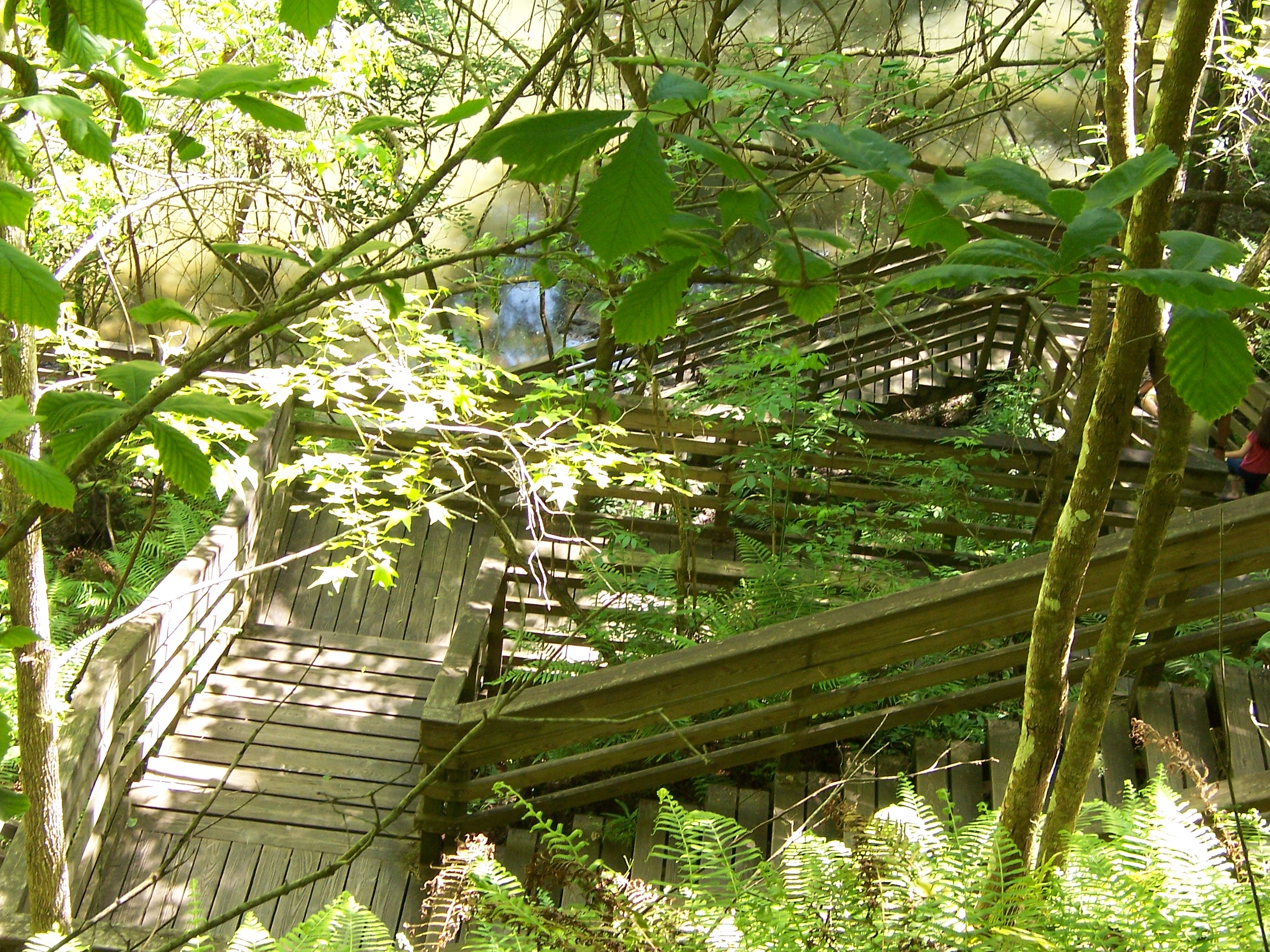
caption = Boardwalk leading down to the sinkhole's observation deck
locator_x =
locator_y =
location =Alachua County, Florida , USA
nearest_city =Gainesville, Florida
lat_degrees = 29
lat_minutes = 42
lat_seconds = 25
lat_direction = N
long_degrees = 82
long_minutes = 23
long_seconds = 42
long_direction = W
area = 67 acres
established =
visitation_num =
visitation_year =
governing_body =Florida Department of Environmental Protection Devil's Millhopper Geological State Park is a Florida State Park located two miles northwest ofGainesville, Florida , USA, off County Road 232, northwest of theUniversity of Florida . It is the only geological park in the state ofFlorida , is aNational Natural Landmark , and is maintained by the Florida State Parks system, a division of the FloridaDepartment of Environmental Protection . The park is near theSan Felasco Hammock Preserve State Park .Geology
The cutaway,
limestone sides of thesinkhole provide an easily visible geological record of the area. Twelve springs, some more visible than others, feed the pond at the bottom of the sinkhole. In the summer, the bottom of sinkhole is dramatically cooler than the air at the surface, due to springs that trickle 70-degree water in small waterfalls.Ecology
Even though the park is only 67 acres (271,000 m²), three distinct ecological environments exist in the park, based on exposure to sun, fire, and water. In the
sandhill environment, the sandy soil and regular fires result inpine trees being the predominant vegetation. The moist soils of the hammocks support broadleaf trees and more low vegetation, while theswamp areas only support flora and fauna adapted to year-around wet conditions.History
The 117 foot (36 m) deep, 500 foot (152 m) across
sinkhole got its name from its similar appearance to thehopper of a mill, along with the bones found at the bottom, suggesting animals entered it on the way to meeting thedevil . The site was purchased by the state in 1974, and a set of 232 wooden steps, along with boardwalks and an observation deck at the bottom were completed in 1976.Dudley Farm Historic State Park
Infobox_protected_area | name = Dudley Farm
iucn_category = V
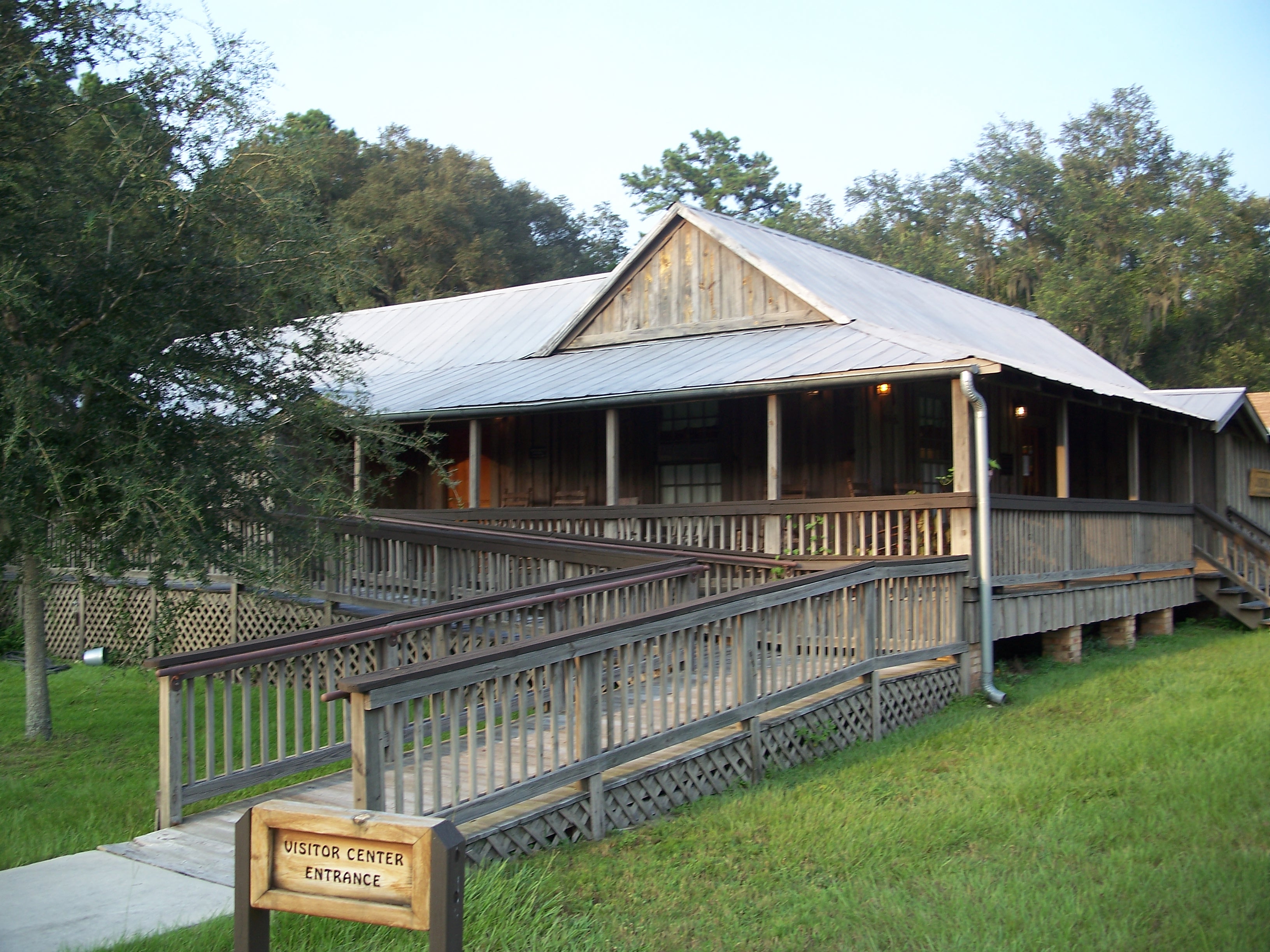
caption = Dudley Farm visitor center
location = Alachua County,Florida , USA
nearest_city = Newberry
lat_degrees = 29
lat_minutes = 39
lat_seconds = 15
lat_direction = N
long_degrees = 82
long_minutes = 32
long_seconds = 37
long_direction = W
area = 2,598 acres
established =October 4 ,2002
visitation_num =
visitation_year =
governing_body =Florida Department of Environmental Protection The Dudley Farm (also known as Dudley Farm State Historic Site) is a U.S. historic district located in Newberry,Florida . It was added to the U.S.National Register of Historic Places onOctober 4 ,2002 . The address is 18730 West Newberry Road. It encompasses approximately 2,598 acres, and contains 21 historic buildings and 13 structures.The site is a working farm, showing agricultural development in Florida from the late nineteenth through the early twentieth centuries.
Gainesville-Hawthorne State Trail
Infobox_protected_area | name = Gainesville-Hawthorne State Trail
iucn_category = V

caption =
locator_x = 228
locator_y = 149
location =Alachua County, Florida , USA
nearest_city =Gainesville, Florida
lat_degrees = 29
lat_minutes = 35
lat_seconds = 28
lat_direction = N
long_degrees = 82
long_minutes = 11
long_seconds = 21
long_direction = W
area = 16 mile length
established =
visitation_num =
visitation_year =
governing_body =Florida Department of Environmental Protection Gainesville-Hawthorne State Trail is a
rail trail inFlorida .It is protected as a 16 mile long Florida State Park and runs from the City of Gainesville's
Boulware Springs Water Works to the town of Hawthorne. It passes through the Paynes Prairie Preserve State Park and theLochloosa Wildlife Management Area along a formerSeaboard Coast Line rail line.Recreational activities
Activities include
hiking ,running ,cycling ,rollerblading , and horseback riding. A grassy equestrian pathway is available except east of the Lochloosa trailhead.Hours
The Boulware Springs trailhead is open from 8 a.m. to 6 p.m. November through April and from 8 a.m. to 8 p.m. May through October. The Paynes Prairie portion of the trail is open from 8 a.m. until sunset, 365 days a year.
Payne's Prairie Preserve State Park
Infobox_protected_area | name = Paynes Prairie Preserve State Park
iucn_category = V
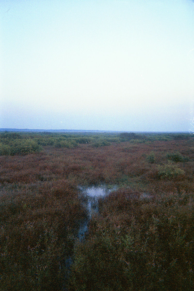
caption = Looking north from the Prairie observation tower
locator_x =
locator_y =
location =Alachua County, Florida , USA
nearest_city =Gainesville, Florida
lat_degrees = 29
lat_minutes = 34
lat_seconds = 01
lat_direction = N
long_degrees = 82
long_minutes = 22
long_seconds = 52
long_direction = W
area = 21,000 acres (85 km²)
established = 1971
visitation_num =
visitation_year =
governing_body =Florida Department of Environmental Protection Paynes Prairie is a Florida State Park, encompassing a 21,000 acre (85 km²)savanna south of Gainesville,Florida , in Micanopy. It is also a U.S.National Natural Landmark . It is crossed by both I-75 and U.S. 441 (which has a scenic outlook ramp).History
The prairie became the stronghold of the Alachua band of the
Seminole tribe under chief Ahaya the Cowkeeper in the 18th century. It is named for the Cowkeeper's eldest surviving son, Payne.There have been times when the prairie's drainage become so blocked that it flooded, causing the formation of a
lake . The most recent such occurrence was in 1871, and lasted until 1886. During this period,steamboat s were a frequent sight on what was called Alachua Lake.Fauna
Over 270 species of birds can be seen in the park as well as
alligator s andbison . The bison were reintroduced to the park fromOklahoma in the mid 1970s. As a part of the park service goal of restoring Florida's natural resources to pre-European settler conditions, the bison were reintroduced because they once roamed this area until the early 1800s. It is rare to see them, but the best place to look for them is along the Cone's Dike trail.Recreational activities
The park contains exhibits and an audio-visual program at the
visitor center that explains the area's natural and cultural history. A 50-foot-highobservation tower near the visitor center provides a panoramic view of the preserve. Eight different trails provide opportunities forhiking ,horseback riding , andbicycling . Ranger-led activities are offered on weekends, November through April. Fishing onLake Wauburg is allowed and a boat ramp provides access forcanoe s and boats with electric motors. Full-facility campsites are available for overnight visitors.The park is a 'gateway site' for the
Great Florida Birding Trail .Gallery
Marjorie Kinnan Rawlings Historic State Park
Infobox_nrhp
name = Marjorie Kinnan Rawlings House
nrhp_type = nhl-fl
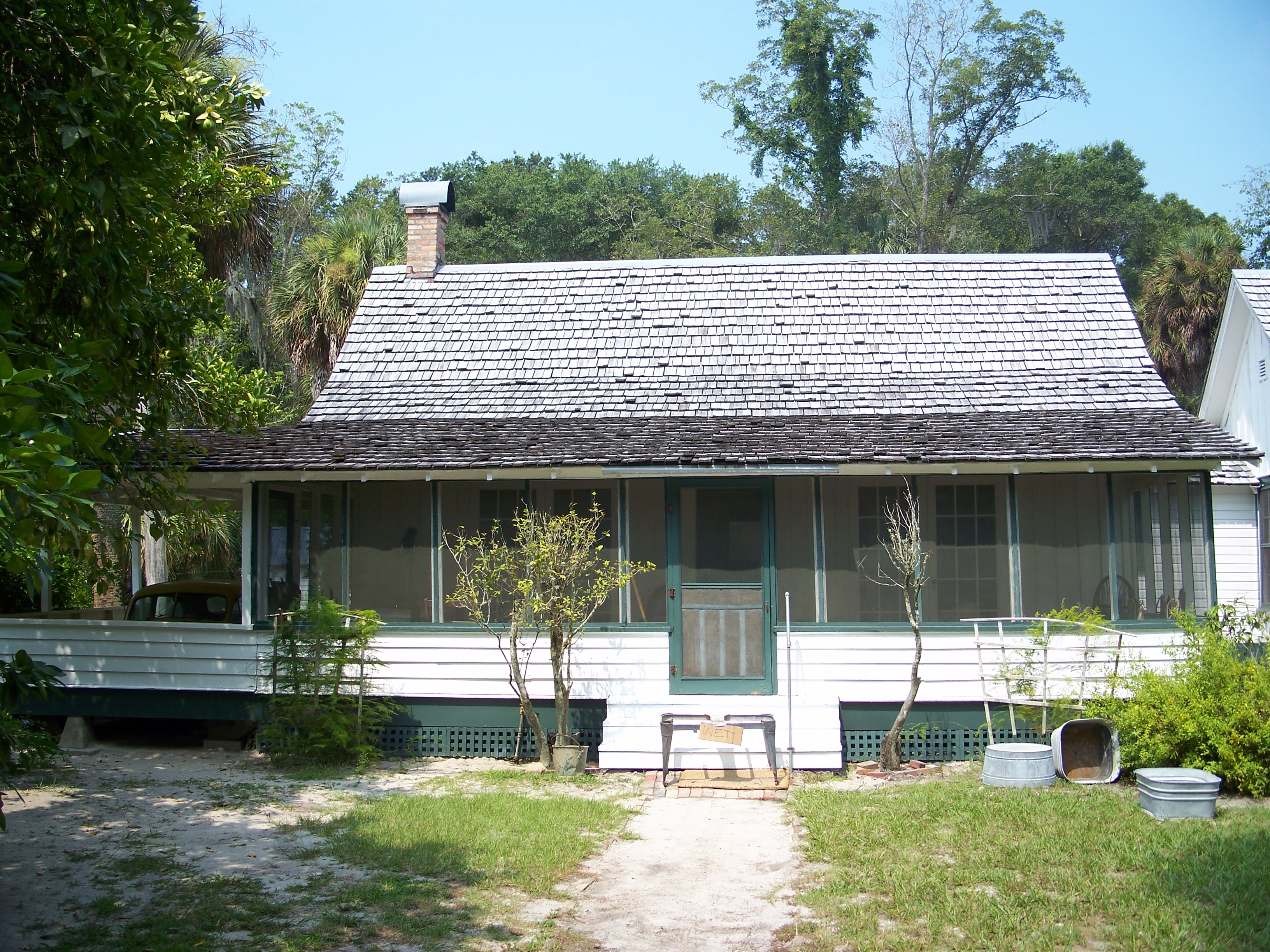
caption = View of the Kinnan Rawlings home
location = Cross Creek,Alachua County, Florida
lat_degrees =
lat_minutes =
lat_seconds =
lat_direction =
long_degrees =
long_minutes =
long_seconds =
long_direction =
built = circa 1890cite web|url=http://www.flheritage.com/services/sites/fht/record_t.cfm?ID=14&type=c&index=1|title=Marjorie Kinnan Rawlings House|date=2007-09-22|work=Florida Heritage Tourism Interactive Catalog|publisher=Florida's Office of Cultural and Historical Programs]
designated =September 20 ,2006 [http://tps.cr.nps.gov/nhl/detail.cfm?ResourceId=-1531508324&ResourceType=Building Marjorie Kinnan Rawlings House and Farm Yard] at [http://tps.cr.nps.gov/nhl National Historic Landmarks Program] ]
added =September 29 ,1970
refnum = 70000176cite web|url=http://www.nationalregisterofhistoricplaces.com/FL/Alachua/state.html|title=National Register of Historical Places - Florida (FL), Alachua County|date=2007-09-22|work=National Register of Historic Places|publisher=National Park Service]
governing_body =Florida Department of Environmental Protection Marjorie Kinnan Rawlings Historic State Park is a Florida State Park and historic site located on the former homestead ofFlorida authorMarjorie Kinnan Rawlings . It is located inCross Creek, Florida , between Ocala and Gainesville. The address is 18700 South County Road 325.The homestead is listed on the
National Register of Historic Places , added onSeptember 29 ,1970 . The house and farm yard were designated aNational Historic Landmark onSeptember 27 ,2006 .Activities include
hiking and hourly tours Thursday through Sunday, at 10 a.m. 11 a.m. and from 1 p.m. to 4 p.m., except in August and September. Amenities include two short hiking trails and park employees that bring 1930s ruralFlorida to life with period clothing and stories.an Felasco Hammock Preserve State Park
Infobox_protected_area | name = San Felasco Hammock Preserve State Park
iucn_category = V
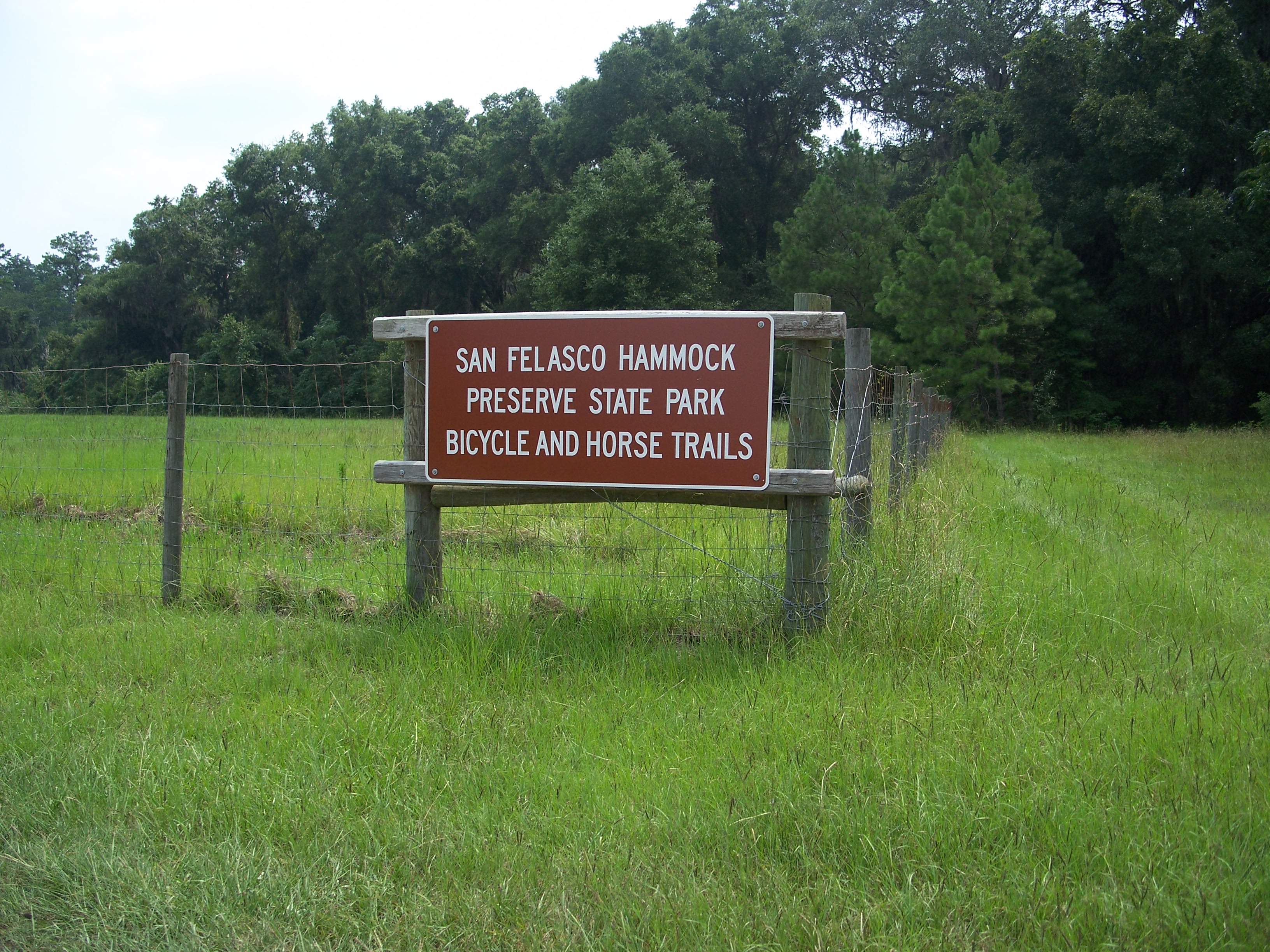
caption = Entrance to San Felasco Hammock State Park
locator_x =
locator_y =
location =Alachua County, Florida , USA
nearest_city =Alachua, Florida
lat_degrees = 29
lat_minutes = 43
lat_seconds = 44
lat_direction = N
long_degrees = 82
long_minutes = 26
long_seconds = 31
long_direction = W
area =
established =
visitation_num =
visitation_year =
governing_body = FloridaDepartment of Environmental Protection San Felasco Hammock Preserve State Park is a Florida State Park in
Alachua County, Florida . It is located northwest ofGainesville, Florida on Millhopper Road and off U.S. 441, just south of the town of Alachua.Fauna
Among the wildlife of the park are
bobcat s,white-tailed deer , grayfox es,turkey s, and many species ofsongbird s.Recreational activities
Activities include
hiking ,biking ,horseback riding and nature viewing.Amenities include 20 miles of single-track bike trails,
horse trail s, andnature trail s.References
External links
* [http://www.floridastateparks.org/devilsmillhopper/ParkSummary.cfm Devil's Millhopper State Geological Site] at [http://www.floridastateparks.org Florida State Parks]
* [http://www.nationalregisterofhistoricplaces.com/FL/Alachua/state.html Alachua County listings] at [http://www.nationalregisterofhistoricplaces.com National Register of Historic Places]
* [http://www.floridastateparks.org/dudleyfarm/default.cfm Dudley Farm Historic State Park] at [http://www.floridastateparks.org Florida State Parks]
* [http://www.floridastateparks.org/gainesville-hawthorne Gainesville-Hawthorne State Trail] at [http://www.floridastateparks.org Florida State Parks]
* [http://www.floridastateparks.org/paynesprairie/default.cfm Paynes Prairie Preserve State Park] at [http://www.floridastateparks.org Florida State Parks]
* [http://historic.alachua.fl.us/infosys/historic_survey.php Alachua County Historic Structures] at [http://historic.alachua.fl.us Alachua County Historic Resources]
* [http://www.floridastateparks.org/marjoriekinnanrawlings/default.cfm Marjorie Kinnan Rawlings Historic State Park] at [http://www.floridastateparks.org Florida State Parks]
* [http://www.floridastateparks.org/sanfelascohammock/default.cfm San Felasco Hammock Preserve State Park] at [http://www.floridastateparks.org Florida State Parks]Further reading
* [http://www.pineapplepress.com Book - Paynes Prairie: A History and Guide. By Lars Andersen]
Wikimedia Foundation. 2010.