- Mtito Andei
-
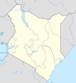
Mtito Andei Location in Kenya
Placement on map is approximateCoordinates: 02°41′24″S 38°41′24″E / 2.69°S 38.69°E Country  Kenya
KenyaProvince Eastern Province District Makueni District Government - Mayor Elevation 2,398 ft (731 m) Population (2010 Estimate) - Total 4,760 Mtito Andei is a town in Kenya.
Contents
Location
The town is located in Makueni District, Eastern Province, in the country's southeastern part on the map, close to the International border with the Republic of Tanzania. Its location lies approximately 290 kilometres (180 mi), by road, southeast of Nairobi, the capital of Kenya and the largest city in that country.[1] The geographic coodinates of Mtito Andei are:2° 41' 24.00"S, 38° 10' 12.00"E (Latitude:-2.69000; Longitude:38.17000).
Overview
Mtito Andei is a small town on the Mombasa to Nairobi Railway and Highway. Itt lies at the western edge of Tsavo National Park and two entrance gaates into the park are located in the town. The town is administered by Mtito Andei Town Council. It also serves as tthe county headquarters for Mtito Anddei County, in which the town is located.
Population
According to the 1999 Kenya National Census, Mtito Andei's urban population was counted at 4,304 (1999 Census).[2] In 2010, the population of the town was estimated at about 4,760.[3]
Transport
Mtito Andei lies on the main line of Kenya Railways, between Mombasa and Nairobi. The town is also served by Mtito Andei Airport. The main thoroughfare going through town is the Mombasa-Nairobi Road (A109). Going south the road continues on to Tsavo and then to Voi and eventually to Mombasa. Going north, the road goes through Kibwezi and Sultan Hamud, before entering Nairobi (See Google Map). The town is also served by Mtito Andei Airport.
Points of interest
The points of interest located in Mtito Andei or close to its borders include the following:
- The offices of Mtito Andei Toewn Council
- The headquarters of Mtito Andei County
- The Nairobi-Mombasa Road - The road passes through the middle of town in a norrthwest to southeast direction
- The Mombasa-Nairobi Railway Line - The railway runs pararell to the Road
- Mtito Andei Central Market
- The Mtito Andei Post Office
- Tsavo National Park - The town lies just outside the park. Two gates to the national parrk are located in Mtito Andei; one to the south and another to the northeast of town.
- Mtito Andei Airport
External links
See also
References
- ^ Estimated Road Distance Between Nairobi And Mtito Andei With Map
- ^ Kenya National Bureau of Statistics: Population of Local Authorities
- ^ Estimated Population In 2010
Categories:- Makueni District
- Coast Province
- Populated places in the Eastern Province of Kenya
- Tsavo National Park
Wikimedia Foundation. 2010.

