- Herculaneum, Missouri
Infobox Settlement
official_name = Herculaneum, Missouri
settlement_type =City
nickname =
motto =
imagesize =
image_caption =
image_
imagesize =
image_caption =
image_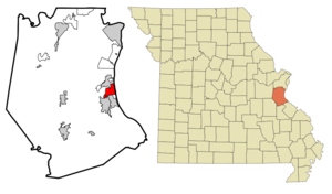
mapsize = 250x200px
map_caption = Location of Herculaneum, Missouri
mapsize1 =
map_caption1 =subdivision_type = Country
subdivision_name =United States
subdivision_type1 = State
subdivision_name1 =Missouri
subdivision_type2 = County
subdivision_name2 = Jefferson
government_footnotes =
government_type =
leader_title =
leader_name =
leader_title1 =
leader_name1 =
established_title =
established_date =unit_pref = Imperial
area_footnotes =area_magnitude =
area_total_km2 = 9.0
area_land_km2 = 8.9
area_water_km2 = 0.1
area_total_sq_mi = 3.5
area_land_sq_mi = 3.4
area_water_sq_mi = 0.0population_as_of = 2000
population_footnotes =
population_total = 2805
population_density_km2 = 315.0
population_density_sq_mi = 815.8timezone = Central (CST)
utc_offset = -6
timezone_DST = CDT
utc_offset_DST = -5
elevation_footnotes =
elevation_m = 135
elevation_ft = 443
latd = 38 |latm = 15 |lats = 33 |latNS = N
longd = 90 |longm = 23 |longs = 16 |longEW = Wpostal_code_type =
ZIP code
postal_code = 63048
area_code = 636
blank_name = FIPS code
blank_info = 29-31708GR|2
blank1_name = GNIS feature ID
blank1_info = 0719395GR|3
website =
footnotes =Herculaneum is a city in Jefferson County,
Missouri ,United States . The population was 2,805 at the 2000 census. The city is currently celebrating its bicentennial. Festivals among other events are being held throughout the year in order to celebrate.Geography
Herculaneum is located at coor dms|38|15|33|N|90|23|16|W|city (38.259247, -90.387790)GR|1.
According to the
United States Census Bureau , the city has a total area of 3.5square mile s (9.0km² ), of which, 3.4 square miles (8.9 km²) of it is land and 0.1 square miles (0.1 km²) of it (1.44%) is water.Origin of name
Herculaneum was laid out by
Moses Austin in 1808, and named after the ancient Roman town ofHerculaneum , destroyed by the eruption ofMt. Vesuvius . Austin is said to have chosen the name because the limestone ledges overlooking theMississippi River resembled a Romanamphitheatre . Lead smelting is still the major industry in this town.Demographics
As of the
census GR|2 of 2000, there were 2,805 people, 1,028 households, and 736 families residing in the city. Thepopulation density was 815.8 people per square mile (314.8/km²). There were 1,078 housing units at an average density of 313.5/sq mi (121.0/km²). The racial makeup of the city was 96.65% White, 2.60% African American, 0.18% Asian, 0.04% from other races, and 0.53% from two or more races. Hispanic or Latino of any race were 0.64% of the population.There were 1,028 households out of which 31.8% had children under the age of 18 living with them, 58.0% were married couples living together, 8.9% had a female householder with no husband present, and 28.4% were non-families. 25.1% of all households were made up of individuals and 15.6% had someone living alone who was 65 years of age or older. The average household size was 2.52 and the average family size was 2.99.
In the city the population was spread out with 22.6% under the age of 18, 7.2% from 18 to 24, 27.2% from 25 to 44, 21.1% from 45 to 64, and 21.8% who were 65 years of age or older. The median age was 40 years. For every 100 females there were 88.0 males. For every 100 females age 18 and over, there were 84.1 males.
The median income for a household in the city was $40,365, and the median income for a family was $50,615. Males had a median income of $33,603 versus $25,581 for females. The
per capita income for the city was $18,613. About 2.4% of families and 5.7% of the population were below thepoverty line , including 3.0% of those under age 18 and 14.3% of those age 65 or over.Toxic metal contamination of the environment
There has been a lead
smelter operated in the town for over 100 years. The smelter, currently owned by theDoe Run Company is the largest lead smelter in the United States. Testing by the United States Environmental Protection Agency (EPA) and the Missouri Hazardous Waste Program has revealed elevated levels of lead,arsenic ,cadmium and other metals associated with smelting in the air, soil, and groundwater in Herculaneum. [http://www.epa.gov/region7/news_events/factsheets/fs_herculaneum_lead_smelter_site_herculaneum_mo.pdf] . The United StatesFish and Wildlife Service found high levels of lead in fish, mice, frogs, and birds tested near Herculaneum. [http://www.epa.gov/region7/cleanup/superfund/final_doe_run_aoc_sow.pdf] Many of the birds tested were found to suffer from lead poisoning. Almost half of the children living in Herculaneum who were tested in 2001 near the smelter had high levels of lead in their blood, and a fourth of those under 6 years old had lead poisoning. [http://query.nytimes.com/gst/fullpage.html?res=9B0CE2D91231F93BA15751C0A9649C8B63&n=Top%2fReference%2fTimes%20Topics%2fSubjects%2fL%2fLead] Lead is a toxic metal andlead poisoning has been linked tolearning disabilities , behavioral problems,anemia ,kidney disorders, decreased intelligence, and central nervous system damage.The Doe Run Company has purchased more than 130 houses as a result of toxic metal contamination in Herculaneum. It has also removed contaminated soil from the yards of at least 430 homes in the town. Due to toxic metal contamination, the company tore some down some houses and left others vacant. [http://www.motherjones.com/news/feature/2006/11/lead_astray.html] The Columbia Tribune reports that the town is "characterized by empty homes and vacated neighborhoods as a result of these buy outs, and the Saint Louis Post Dispatch has described the town as a "ghost town." [http://www.columbiatribune.com/2007/Feb/20070219News008.asp] Although the town has long been recognized as an environmental disaster area, lead continues to be emitted at high levels and testing of the soil for lead contamination has shown an upward trend at least as recently as November of 2006. [http://www.epa.gov/region7/cleanup/superfund/herculaneum_pbtrend_thru_nov2006.pdf] .
The New York Times reported in 2002 that there are clusters of brain cancer and multiple sclerosis in Herculaneum. The paper did not identify the cause of these disease clusters, although many people in the town believe these diseases were caused by exposure to
toxic waste , including lead and other metals.Education
Christ the Vine Lutheran School, opened in 2003, is nationally accredited and part of the
Lutheran Church - Missouri Synod education system.In fiction
* In the Broadway musical "
A Chorus Line ", Ritchie Walters was born in Herculaneum, Missouri.References
External links
Wikimedia Foundation. 2010.