- Calhoun City, Mississippi
Infobox Settlement
official_name = Calhoun City, Mississippi
settlement_type =Town
nickname =
motto =
imagesize =
image_caption =
image_
imagesize =
image_caption =
image_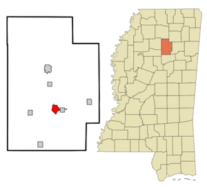
mapsize = 250px
map_caption = Location of Calhoun City, Mississippi
mapsize1 =
map_caption1 =subdivision_type = Country
subdivision_name =United States
subdivision_type1 = State
subdivision_name1 =Mississippi
subdivision_type2 = County
subdivision_name2 = Calhoun
government_footnotes =
government_type =
leader_title =
leader_name =
leader_title1 =
leader_name1 =
established_title =
established_date =unit_pref = Imperial
area_footnotes =area_magnitude =
area_total_km2 = 6.2
area_land_km2 = 6.1
area_water_km2 = 0.1
area_total_sq_mi = 2.4
area_land_sq_mi = 2.4
area_water_sq_mi = 0.0population_as_of = 2000
population_footnotes =
population_total = 1872
population_density_km2 = 304.7
population_density_sq_mi = 789.1timezone = Central (CST)
utc_offset = -6
timezone_DST = CDT
utc_offset_DST = -5
elevation_footnotes =
elevation_m = 86
elevation_ft = 282
latd = 33 |latm = 51 |lats = 25 |latNS = N
longd = 89 |longm = 18 |longs = 48 |longEW = Wpostal_code_type =
ZIP code s
postal_code = 38916, 38955
area_code = 662
blank_name = FIPS code
blank_info = 28-10580
blank1_name = GNIS feature ID
blank1_info = 0667920
website =
footnotes =Calhoun City is a town in Calhoun County,
Mississippi ,United States . The population was 1,872 at the 2000 census.Geography
Calhoun City is located at coor dms|33|51|25|N|89|18|48|W|city (33.856865, -89.313342)GR|1.
According to the
United States Census Bureau , the town has a total area of 2.4square mile s (6.2km² ), of which, 2.4 square miles (6.1 km²) of it is land and 0.04 square miles (0.1 km²) of it (1.25%) is water.Demographics
As of the
census GR|2 of 2000, there were 1,872 people, 736 households, and 530 families residing in the town. Thepopulation density was 789.1 people per square mile (305.0/km²). There were 827 housing units at an average density of 348.6/sq mi (134.7/km²). The racial makeup of the town was 66.72% White, 32.00% African American, 0.11% Native American, 0.05% Asian, 0.16% from other races, and 0.96% from two or more races. Hispanic or Latino of any race were 0.69% of the population.There were 736 households out of which 34.5% had children under the age of 18 living with them, 44.3% were married couples living together, 23.6% had a female householder with no husband present, and 27.9% were non-families. 26.4% of all households were made up of individuals and 15.6% had someone living alone who was 65 years of age or older. The average household size was 2.38 and the average family size was 2.84.
In the town the population was spread out with 25.1% under the age of 18, 8.1% from 18 to 24, 23.2% from 25 to 44, 21.6% from 45 to 64, and 22.0% who were 65 years of age or older. The median age was 39 years. For every 100 females there were 73.0 males. For every 100 females age 18 and over, there were 66.4 males.
The median income for a household in the town was $23,983, and the median income for a family was $28,047. Males had a median income of $27,917 versus $20,292 for females. The
per capita income for the town was $14,294. About 23.2% of families and 25.2% of the population were below thepoverty line , including 41.1% of those under age 18 and 16.9% of those age 65 or over.Education
The Town of Calhoun City is served by the Calhoun County School District.
Famous people
* [http://www.acecannon.com/ "Mr. Sax" Ace Cannon]
*Dave Parker , formerMajor League Baseball player.References
External links
Wikimedia Foundation. 2010.