- Cernăuţi County
-
Judeţul Cernăuţi — County (Judeţ) — 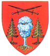
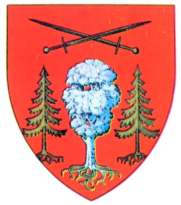
Coat of arms
Country  Rumania
Historic region Bucovina Capital city (Reşedinţă de judeţ) Cernăuţi Established 1925 (according to the Law No. 25/14 June 1925) Ceased to exist Administrative and Constitutional Reform in 1938 Government – Type Prefect Area – Land 1,771 km2 (683.8 sq mi) Population – Total 395,097 (1,930 Census) Time zone EET (UTC+2) – Summer (DST) EEST (UTC+3) Cernăuţi was a county (judeţ) of Romania, in Bukovina, with the capital city at Cernăuţi.
Contents
Neighbours
Neighbours of the county were Stanislawow Voivodship of Poland to the north and west, countries of Storojineţ and Dorohoi to the south and Hotin to the east. The county was created after the Union of Bukovina with Romania at the end of World War I.
Administration
The county consisted of 4 plăṣi (districts): Cozmin (with the seat at Cernăuţi), Nistru (with the seat at Zastavna), Prut (with the seat at Sadagura) and Şipeniţ (with the seat at Cozmeni).
Coat of arms
The Coat of Arms featured 3 trees, one of which was white, under 2 crossed swords.
Population
According to the Romanian census of 1930 the population of Cernăuţi County was 305,097 , of which 48.9% were ethnic Ukrainians, 21.8% ethnic Romanians, 13.1% Jews, 12.5% ethnic Germans and 4.6% Poles. Classified by religion: 78.1% were Orthodox Christian, 9.1% Jewish, 9.1% Roman Catholic, 1.9% Greek Catholic.
Urbanization
In 1930 the urban population of Cernăuţi County which included 29.1% Jews, 25.9% Romanians, 23.3% Germans, 11.3% Ukrainians, 8.8% Romanians, 7.5% Poles and 1.6% Russians by ethnicity.
After 1938
After the 1938 Administrative and Constitutional Reform, this county was merged with counties of Hotin, Suceava, Storojineţ, Dorohoi, Rădăuţi and Câmpulung to form Ţinutul Suceava.
External links
- (Romanian) Cernăuţi County at memoria.ro
- Alba
- Arad
- Argeş
- Bacău
- Baia
- Bălţi
- Bihor
- Botoşani
- Braşov
- Brăila
- Buzău
- Cahul
- Caliacra
- Câmpulung
- Caraş
- Cernăuţi
- Cetatea Albă
- Ciuc
- Cluj
- Constanţa
- Covurlui
- Dâmboviţa
- Dolj
- Dorohoi
- Durostor
- Făgăraş
- Fălciu
- Gorj
- Hotin
- Hunedoara
- Ialomiţa
- Iaşi
- Ilfov
- Ismail
- Lăpuşna
- Maramureş
- Mehedinţi
- Mureş
- Muscel
- Năsăud
- Neamţ
- Odorhei
- Olt
- Orhei
- Prahova
- Putna
- Rădăuţi
- Râmnicu Sărat
- Roman
- Romanaţi
- Satu Mare
- Sălaj
- Severin
- Sibiu
- Someş
- Soroca
- Storojineţ
- Suceava
- Târnava-Mare
- Târnava-Mică
- Tecuci
- Teleorman
- Tighina
- Timiş-Torontal
- Trei Scaune
- Tulcea
- Turda
- Tutova
- Vaslui
- Vâlcea
- Vlaşca
 Categories:
- Bukovina
- Former counties of Romania

Wikimedia Foundation. 2010.