Vihorlat Protected Landscape Area

Vihorlat Protected Landscape Area

Infobox_protected_area
name = Vihorlat Protected Landscape Area
"CHKO Vihorlat"
iucn_category = V


caption =
location = Eastern Slovakia
lat_degrees = 48
lat_minutes = 55
lat_seconds =
lat_direction = N
long_degrees = 22
long_minutes = 10
long_seconds =
long_direction = E
area = 174.85 km² (67.5 mi²)
established = 28 December 1973
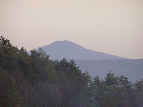
governing_body = "Správa CHKO Vihorlat" (Vihorlat PLA administration) in Michalovce

Vihorlat Protected Landscape Area ( _sk. Chránená krajinná oblasť Vihorlat) is one of the 14 protected landscape areas in Slovakia. The Landscape Area is situated in the middle part of the Vihorlatské vrchy mountains, in eastern Slovakia. It is situated in the Humenné, Sobrance and Snina districts.

History

The park was created on 28 December 1973 and the law creating it was amended on 19 April 1999.

Geography, geology and biology

The area of the Vihorlat Mountains is of volcanic origin. Beech, oak, ash, maple, and fir trees are most common in Vihorlat. The area contains about 2,000 species of invertebrates and 100 species of birds. Notable species include Eurasian Lynx, Wildcat, Gray Wolf, Otter, Black Stork, Ural Owl, Lesser Spotted Eagle, and Eurasian Eagle-Owl. [cite web | publisher = Štátna ochrana prírody SR | url = http://www.sopsr.sk/index.php?lang=en&page=posobnost&id=25& | title = "Správa CHKO Vihorlat" (in Slovak) | date = no date | accessdate = May 24 | accessyear = 2007] A curiosity in the park is the Morské oko (literally Sea Eye) lake.

References

External links

* [http://www.slovakia.travel/entitaview.aspx?l=2&ami=108035&smi=108035&llt=1&idp=2329 Vihorlat PLA] at [http://www.slovakia.travel/intropage.aspx?l=2&ami=0&smi=0&p=99 Slovakia.travel]
* [http://www.sopsr.sk/index.php?page=posobnost&id=25 Vihorlat PLA at The Slovak State Nature Conservancy]


Wikimedia Foundation. 2010.

Игры ⚽ Поможем написать курсовую

Look at other dictionaries:

  • Dunajské luhy Protected Landscape Area — CHKO Dunajské luhy IUCN Category V (Protected Landscape/Seascape) Floodplains and forests near Bratislava s b …   Wikipedia

  • Biele Karpaty Protected Landscape Area — White Carpathians Protected Landscape Area CHKO Biele Karpaty IUCN Category V (Protected Landscape/Seascape) Červenokamenské bradlo cliff near the village of …   Wikipedia

  • Cerová vrchovina Protected Landscape Area — CHKO Cerová vrchovina IUCN Category V (Protected Landscape/Seascape) …   Wikipedia

  • Protected areas in Slovakia — Protected areas of Slovakia are areas that need protection because of their environmental, historical or cultural value to the nation. Protected areas in Slovakia are managed by institutions and organizations governed by the Ministry of the… …   Wikipedia

  • Vihorlat Mountains — ( sk. Vihorlatské vrchy; ua. Vyhorliat ) or colloquially Vihorlat is a volcanic mountain range in eastern Slovakia and western Ukraine. A part of the range is listed as a World Heritage Site. Vihorlat Mountains in SlovakiaThe Slovak part is 55 km …   Wikipedia

  • Morské oko (Slovakia) — Morské oko Location Vihorlat Mountains Coordinates …   Wikipedia

  • Malá Fatra National Park — Národný park Malá Fatra IUCN Category II (National Park) Veľký Rozsutec (1,610 m) …   Wikipedia

  • Poloniny National Park — A typical polonina meadow …   Wikipedia

  • Low Tatras National Park — Low Tatra National Park Národný park Nízke Tatry IUCN Category II (National Park) Dereše peak …   Wikipedia

  • Muránska planina National Park — Národný park Muránska planina IUCN Category II (National Park) Cigánka Mountain (935 m AMSL), north of the vi …   Wikipedia

Share the article and excerpts

Direct link
Do a right-click on the link above
and select “Copy Link”